Maps of Hertfordshire
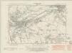
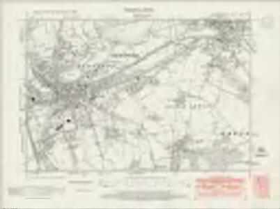
Hertfordshire XXIX.SE - OS Six-Inch Map
1 : 10560 Topographic maps Ordnance Survey Ordnance Survey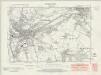
Hertfordshire XXIX.SE - OS Six-Inch Map
1 : 10560 Topographic maps Ordnance Survey Ordnance Survey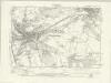
Hertfordshire XXIX.SE - OS Six-Inch Map
1 : 10560 Topographic maps Ordnance Survey Ordnance Survey
Hertfordshire XXIX.SE - OS Six-Inch Map
1 : 10560 Topographic maps Ordnance Survey Ordnance Survey
Hertfordshire XXIX.16 (includes: Brickendon Liberty; Great Amwell; Hertford; Little Amwell; Stanstead St Margaret; Ware Urban) - 25 Inch Map
1 : 2500 Topographic maps Ordnance Survey Ordnance Survey
Hertfordshire XXIX.16 (includes: Brickendon Liberty; Great Amwell; Hertford; Little Amwell; Stanstead St Margaret; Ware Urban) - 25 Inch Map
1 : 2500 Topographic maps Ordnance Survey Ordnance Survey
Hertfordshire XXIX.15 (includes: Bayford; Brickendon Liberty; Hertford) - 25 Inch Map
1 : 2500 Topographic maps Ordnance Survey Ordnance Survey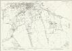
Hertfordshire XXIX.15 (includes: Bayford; Brickendon Liberty; Hertford) - 25 Inch Map
1 : 2500 Topographic maps Ordnance Survey Ordnance Survey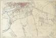
Hertfordshire XXIX.15 (includes: Bayford; Brickendon Liberty; Hertford) - 25 Inch Map
1 : 2500 Topographic maps Ordnance Survey Ordnance Survey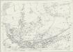
Hertfordshire XXIX.11 (includes: Hertford; Ware Rural) - 25 Inch Map
1 : 2500 Topographic maps Ordnance Survey Ordnance Survey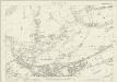
Hertfordshire XXIX.11 (includes: Hertford; Ware Rural) - 25 Inch Map
1 : 2500 Topographic maps Ordnance Survey Ordnance Survey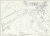
Hertfordshire XXIX.12 (includes: Great Amwell; Hertford; Ware Rural; Ware Urban) - 25 Inch Map
1 : 2500 Topographic maps Ordnance Survey Ordnance Survey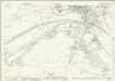
Hertfordshire XXIX.12 (includes: Great Amwell; Hertford; Ware Rural; Ware Urban) - 25 Inch Map
1 : 2500 Topographic maps Ordnance Survey Ordnance Survey
Hertfordshire XXIX.12 (includes: Great Amwell; Hertford; Ware Rural; Ware Urban) - 25 Inch Map
1 : 2500 Topographic maps Ordnance Survey Ordnance Survey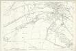
Hertfordshire XXIX.12 (includes: Great Amwell; Hertford; Ware Rural; Ware Urban) - 25 Inch Map
1 : 2500 Topographic maps Ordnance Survey Ordnance Survey
A plan of Hartford
1 Karte : Kupferdruck ; 41 x 57 cm Andrews; Wren; Dury; Cheever publish'd according to act of parliament and sold by A. Dury in Dukes court St. Martin's lane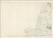
Hertfordshire XXIX - OS Six-Inch Map
1 : 10560 Topographic maps Ordnance Survey Ordnance Survey
TL31 - OS 1:25,000 Provisional Series Map
1 : 25000 Topographic maps Ordnance Survey Ordnance Survey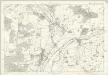
Essex XL - OS Six-Inch Map
1 : 10560 Topographic maps Ordnance Survey Ordnance Survey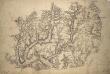
Ware 2
1 : 31680 .Much consideration is given in this map to the detailed representation of trees., Woodland could provide either hindrance or cover for a regiment on the move., Trees are drawn with small vertical stems and a shadow at the base., Planted avenues are depicted in this fashion at Ware Park, above Hartford, and Eastwich Hall, at the bottom of the map., A pattern of open dotting depicts the untilled agricultural land dominating the valleys of the Rivers Rib and Ash.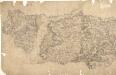
Epping
Pencil lines radiating from trigonometrical stations cover this drawing. They show the angles used for measuring distances and plotting topographical features. To the left of the map on Chestnut Common, the word 'flag' denotes the site of such a station. Hoddesden Park Wood and surrounding woodland are shown by individual trees with a line at the base, indicating shadow. This laborious technique was often replaced by a more generalised, stippled representation of treetops. The Lee River, running from Standstead at the top of this drawing, branches to form a canal leading down to the Powder Mills, which manufactured Gun Powder for shipping to London. Locks on the canal are shown in red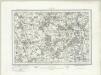
Hertford (Outline) - OS One-Inch Revised New Series
1 : 63360 Topographic maps Ordnance Survey Ordnance Survey
Hertford (Hills) - OS One-Inch Revised New Series
1 : 63360 Topographic maps Ordnance Survey Ordnance Survey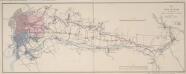
Map of the New River from its Source near the Town of Ware to London
Map of the course of the New River, a man made water course which has supplied London with fresh water from Hertfordshire since 1613. Commissioned by the House of Commons, the map features title and scale bar at top right and key to colour at bottom right. Telford, Thomas
Hatfield
1 : 31680 This map is not drawn with north at the top. Potters Bar appears at the bottom left, almost on a level with Hertford at the bottom right. The remains of the Old Royal Palace of Hatfield are shown near the centre of the map. This was the home of Elizabeth I (1533-1603) prior to her accession to the throne. Also featured is Hatfield, the house built in 1611 by the first Earl of Salisbury, Robert Cecil (1563-1612). A poorhouse is marked just outside the town. Hyett, William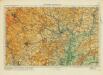
Hertford& St Albans
Ordnance Survey
London passenger transport map
Ordnance Survey
Ordnance Survey of England and Wales (Sheet 7), South Wales
Ordnance Survey, Great Britain
London N.W. - OS One-Inch Map
1 : 63360 Topographic maps Ordnance Survey Ordnance Survey