Maps of Babergh
Suffolk LXIII.SE - OS Six-Inch Map
1 : 10560 Topographic maps Ordnance Survey Ordnance Survey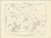
Suffolk LXIII.SE - OS Six-Inch Map
1 : 10560 Topographic maps Ordnance Survey Ordnance Survey
Suffolk LXIII.SE - OS Six-Inch Map
1 : 10560 Topographic maps Ordnance Survey Ordnance Survey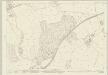
Suffolk LXIII.16 (includes: Acton; Alpheton; Lavenham; Long Melford) - 25 Inch Map
1 : 2500 Topographic maps Ordnance Survey Ordnance Survey
Suffolk LXIII.16 (includes: Acton; Alpheton; Lavenham; Long Melford) - 25 Inch Map
1 : 2500 Topographic maps Ordnance Survey Ordnance Survey
Suffolk LXIII.15 (includes: Alpheton; Long Melford; Stanstead) - 25 Inch Map
1 : 2500 Topographic maps Ordnance Survey Ordnance Survey
Suffolk LXIII.15 (includes: Alpheton; Long Melford; Stanstead) - 25 Inch Map
1 : 2500 Topographic maps Ordnance Survey Ordnance Survey
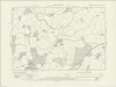
Suffolk LXIII.12 (includes: Alpheton; Lavenham; Long Melford) - 25 Inch Map
1 : 2500 Topographic maps Ordnance Survey Ordnance Survey
Suffolk LXIII.12 (includes: Alpheton; Lavenham; Long Melford) - 25 Inch Map
1 : 2500 Topographic maps Ordnance Survey Ordnance Survey
Suffolk LXIII.12 (includes: Alpheton; Lavenham; Long Melford) - 25 Inch Map
1 : 2500 Topographic maps Ordnance Survey Ordnance Survey
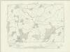
Suffolk LXIII.11 (includes: Alpheton; Long Melford; Shimpling; Stanstead) - 25 Inch Map
1 : 2500 Topographic maps Ordnance Survey Ordnance Survey
Suffolk LXIII.11 (includes: Alpheton; Long Melford; Shimpling; Stanstead) - 25 Inch Map
1 : 2500 Topographic maps Ordnance Survey Ordnance Survey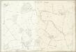
Suffolk LXIII.11 (includes: Alpheton; Long Melford; Shimpling; Stanstead) - 25 Inch Map
1 : 2500 Topographic maps Ordnance Survey Ordnance Survey
TL84 - OS 1:25,000 Provisional Series Map
1 : 25000 Topographic maps Ordnance Survey Ordnance Survey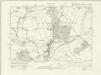
Essex nV.SW - OS Six-Inch Map
1 : 10560 Topographic maps Ordnance Survey Ordnance Survey
Essex (New Series 1913-) n V.9 (includes: Glemsford; Long Melford) - 25 Inch Map
1 : 2500 Topographic maps Ordnance Survey Ordnance Survey
Bury St. Edmunds
1 : 31680 .Built in 1795 to display the paintings and silverware of the fourth Earl of Bristol, Ickworth House is depicted near the top left of the map along the road leading south-west to Haverhill. The abbey of Bury St Edmunds is indicated by a cross. The abbey, built shortly after the Norman Conquest of 1066, housed a thriving monastic community until its dissolution in 1539. A prison and windmills are noted outside Bury St Edmunds. Metcalf, Edward B.
Sudbury
1 : 31680 This plan traces the border between Essex and Suffolk along the course of the River Stour and the River Brett valley, running through Hadleigh. Verron, Charles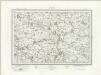
Sudbury (Outline) - OS One-Inch Revised New Series
1 : 63360 Topographic maps Ordnance Survey Ordnance Survey
Sudbury (Hills) - OS One-Inch Revised New Series
1 : 63360 Topographic maps Ordnance Survey Ordnance Survey
Colchester - OS One-Inch Map
1 : 63360 Topographic maps Ordnance Survey Ordnance Survey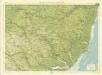
Suffolk, Sheet 20 - Bartholomew's "Half Inch to the Mile Maps" of England & Wales
1 : 126720 Topographic maps Bartholomew, John George John Bartholomew & Co
Chart of the mouth of the River Thames, c1540
This map, showing parts of Kent and Sussex, comes from a 16th-century portfolio of coastal charts and drawings It incorporates miniature copies of town plans that are now lost including what are probably the earliest plans of Canterbury, Rochester and Sandwich The mapmaker was Sir Richard Cavendish With its emphasis on sandbanks and beaches, the map was evidently intended for navigation and defence purposes The decorative quality of the map suggests it was meant for the eyes of the king, Henry VIII North is to the left of the map and East to the top, making the map appear on its side to modern eyes Cavendish, Sir Richard
Suffolcia vernacula Suffolke
1 Karte : Kupferdruck ; 36 x 47 cm Valck; Schenk penes Gerardum Valk et Petrum Schenk
Svffolcia, vernacule Svffolke
1 Karte : Kupferdruck ; 37 x 48 cm Blaeu Joan Blaeu
Essex, actually surveyed, with the several Roads
Lamb, Francis, Morgan, William, & Ogilby, John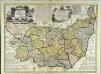
An accurate map of the county of Suffolk
1 Karte : Kupferdruck ; 50 x 69 cm Bowen; Hinton sold by I. Hinton at the Kings Arms in St. Pauls Church Yard
Comitatis Cantabrigiensis, vernacule Cambridge Shire
1 : 210000 Amstelodami : apud Joannem Janssonium
Essex f. 10
This map of Essex is taken from a work entitled ""A CHOROGRAPHICALL description of the several Shires and Islands of Middlesex, Essex, Surrey, Sussex, Hamshire, Weighte, Garnesey and Jersey, performed by the travel and view of John Norden, 1595."" The map forms part of an omnibus volume of Norden's intended series of county guides, the Speculum Britanniae, which was never completed. It is dedicated to Elizabeth I, in whose reign the use of maps became more common. Under Elizabeth’s patronage the first, mostly accurate and detailed image of Britain was recorded by Christopher Saxton in his atlas of 1579. The volume that this map is from was meant for presentation to the Queen in the hope of securing her financial support for the project. This map of Essex is derived from Saxton’s work, in that relief is shown pictorially by small hill symbols, woodland and parks are shown by small trees, the later with a fence surrounding and surrounding counties are left blank. The main difference however between this and the Saxton maps is that this includes the road network and indicates the homes of the leading aristocracy and gentry. Roads are shown in beige, clearly linking the settlements, which are shown pictorially and highlighted with a red dot. London appears in the lower left corner. This development is significant as it shows the progression from a presentation of the county, to a means to practically navigate it. As a further tool in this endeavour the map is squared off with an Alpha numeric border. The depiction of roads and the orientation grid are derived from German prototypes. The Elizabethan coat of arms, appears to the left and sea monsters and ships provide decoration. Norden, John