Maps of Little Wratting
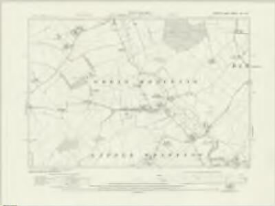
Suffolk LXI.SE - OS Six-Inch Map
1 : 10560 Topographic maps Ordnance Survey Ordnance Survey
Suffolk LXI.SE - OS Six-Inch Map
1 : 10560 Topographic maps Ordnance Survey Ordnance Survey
Suffolk LXI.SE - OS Six-Inch Map
1 : 10560 Topographic maps Ordnance Survey Ordnance Survey
Suffolk LXI.SE - OS Six-Inch Map
1 : 10560 Topographic maps Ordnance Survey Ordnance Survey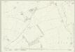
Suffolk LXI.11 (includes: Great Thurlow; Great Wratting; Little Thurlow; Withersfield) - 25 Inch Map
1 : 2500 Topographic maps Ordnance Survey Ordnance Survey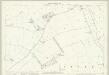
Suffolk LXI.11 (includes: Great Thurlow; Great Wratting; Little Thurlow; Withersfield) - 25 Inch Map
1 : 2500 Topographic maps Ordnance Survey Ordnance Survey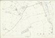
Suffolk LXI.11 (includes: Great Thurlow; Great Wratting; Little Thurlow; Withersfield) - 25 Inch Map
1 : 2500 Topographic maps Ordnance Survey Ordnance Survey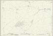
Suffolk LXI.15 (includes: Great Wratting; Haverhill; Little Wratting; Withersfield) - 25 Inch Map
1 : 2500 Topographic maps Ordnance Survey Ordnance Survey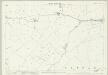
Suffolk LXI.15 (includes: Great Wratting; Haverhill; Little Wratting; Withersfield) - 25 Inch Map
1 : 2500 Topographic maps Ordnance Survey Ordnance Survey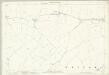
Suffolk LXI.15 (includes: Great Wratting; Haverhill; Little Wratting; Withersfield) - 25 Inch Map
1 : 2500 Topographic maps Ordnance Survey Ordnance Survey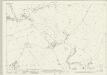
Suffolk LXI.16 (includes: Barnardiston; Great Wratting; Kedington; Little Wratting) - 25 Inch Map
1 : 2500 Topographic maps Ordnance Survey Ordnance Survey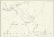
Suffolk LXI.16 (includes: Barnardiston; Great Wratting; Kedington; Little Wratting) - 25 Inch Map
1 : 2500 Topographic maps Ordnance Survey Ordnance Survey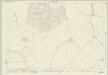
Suffolk LXI.12 (includes: Barnardiston; Great Thurlow; Great Wratting) - 25 Inch Map
1 : 2500 Topographic maps Ordnance Survey Ordnance Survey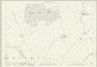
Suffolk LXI.12 (includes: Barnardiston; Great Thurlow; Great Wratting) - 25 Inch Map
1 : 2500 Topographic maps Ordnance Survey Ordnance Survey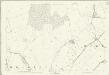
Suffolk LXI.12 (includes: Barnardiston; Great Thurlow; Great Wratting) - 25 Inch Map
1 : 2500 Topographic maps Ordnance Survey Ordnance Survey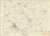
Essex nIII - OS Six-Inch Map
1 : 10560 Topographic maps Ordnance Survey Ordnance Survey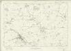
Essex nIII - OS Six-Inch Map
1 : 10560 Topographic maps Ordnance Survey Ordnance Survey
TL64 - OS 1:25,000 Provisional Series Map
1 : 25000 Topographic maps Ordnance Survey Ordnance Survey
Newmarket 3
1 : 31680 .Even before horse racing became one of Newmarket's attractions under James I, Chevely Park at the top of this plan was famous for horse breeding., When this map was drawn, the Duke of Rutland had just taken possession of the park where he continued the equestrain tradition begun by kings Athelstan and Canute., Other notable landmarks include: Denham Hall towards the top right, with the layout of the gardens shown in detail; the site of,the eponymous,temple near Temple Wood towards the bottom; and the ruins of a chapel at Brinkley, to the left of centre. Metcalf, Edward B.
Boxstead
1 : 31680 The draughtsman used Balsham Steeple and West Wickham Steeple at the top left of this plan as triangulation points. From these positions, he made angular observations with a theodolite to measure the height of the land and to plot individual topographical features. Pencil rays radiating from these two points,record the measurement process. Verron Charles
Saffron Walden - OS One-Inch Map
1 : 63360 Topographic maps Ordnance Survey Ordnance Survey
Colchester - OS One-Inch Map
1 : 63360 Topographic maps Ordnance Survey Ordnance Survey
Cary's Improved Map of England and Wales
Cary, George, & Cary, John London : G. & J. Cary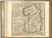

Cantabrigiensis comitatvs
1 Karte : Kupferdruck ; 41 x 51 cm Blaeu Joan Blaeu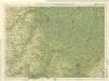
Cambridge, Huntingdon, Sheet 19 - Bartholomew's "Half Inch to the Mile Maps" of England & Wales
1 : 126720 Topographic maps Bartholomew, John George John Bartholomew & Co
Comitatis Cantabrigiensis; vernacule Cambridge Shire
1 Karte : Kupferdruck ; 40 x 50 cm Valck; Schenk venditant Gerardus Valk et Petrus Schenk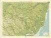
Suffolk, Sheet 20 - Bartholomew's "Half Inch to the Mile Maps" of England & Wales
1 : 126720 Topographic maps Bartholomew, John George John Bartholomew & Co
Cambridgeshire
1 : 390000 Hall, Sidney Chapmann & Hall