Maps of Stansfield
Suffolk LIII.SE - OS Six-Inch Map
1 : 10560 Topographic maps Ordnance Survey Ordnance Survey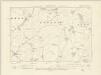
Suffolk LIII.SE - OS Six-Inch Map
1 : 10560 Topographic maps Ordnance Survey Ordnance Survey
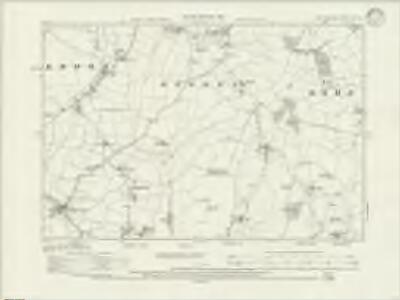
Suffolk LIII.SE - OS Six-Inch Map
1 : 10560 Topographic maps Ordnance Survey Ordnance Survey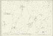
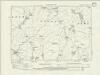
Suffolk LIII.16 (includes: Brockley; Depden; Hawkedon; Rede; Stansfield; Wickhambrook) - 25 Inch Map
1 : 2500 Topographic maps Ordnance Survey Ordnance Survey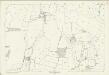
Suffolk LIII.16 (includes: Brockley; Depden; Hawkedon; Rede; Stansfield; Wickhambrook) - 25 Inch Map
1 : 2500 Topographic maps Ordnance Survey Ordnance Survey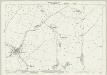
Suffolk LIII.15 (includes: Denston; Depden; Stansfield; Wickhambrook) - 25 Inch Map
1 : 2500 Topographic maps Ordnance Survey Ordnance Survey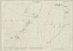
Suffolk LIII.11 (includes: Depden; Wickhambrook) - 25 Inch Map
1 : 2500 Topographic maps Ordnance Survey Ordnance Survey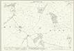
Suffolk LIII.12 (includes: Depden; Rede; Stansfield) - 25 Inch Map
1 : 2500 Topographic maps Ordnance Survey Ordnance Survey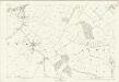
Suffolk LIII.12 (includes: Depden; Rede; Stansfield) - 25 Inch Map
1 : 2500 Topographic maps Ordnance Survey Ordnance Survey
TL75 - OS 1:25,000 Provisional Series Map
1 : 25000 Topographic maps Ordnance Survey Ordnance Survey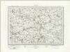
Sudbury (Outline) - OS One-Inch Revised New Series
1 : 63360 Topographic maps Ordnance Survey Ordnance Survey
Sudbury (Hills) - OS One-Inch Revised New Series
1 : 63360 Topographic maps Ordnance Survey Ordnance Survey
Bury St Edmunds - OS One-Inch Map
1 : 63360 Topographic maps Ordnance Survey Ordnance Survey
Colchester - OS One-Inch Map
1 : 63360 Topographic maps Ordnance Survey Ordnance Survey
Cary's Improved Map of England and Wales
Cary, George, & Cary, John London : G. & J. Cary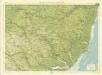
Suffolk, Sheet 20 - Bartholomew's "Half Inch to the Mile Maps" of England & Wales
1 : 126720 Topographic maps Bartholomew, John George John Bartholomew & Co
Cambridgeshire
1 : 390000 Hall, Sidney Chapmann & Hall
A general Plot and description of the Fennes and surounded grounds in the sixe Counties of Norfolke, Suffolke, Cambridge [...] [Karte], in: Novus atlas absolutissimus, Bd. 7, S. 306.
1 Karte aus Atlas Janssonius Offizin
Regiones Inundatae In finibus Comitatus Norfolciae, Suffolciae, Cantabrigiae, Huntingtoniae[,] Northamtoniae, et Lincolniae [Karte], in: Theatrum orbis terrarum, sive, Atlas novus, Bd. 4, S. 301.
1 Karte aus Atlas Blaeu, Joan Blaeu, Willem Janszoon
Regiones Inundatae In finibus Comitatus Norfolciae, Suffolciae, Cantabrigiae, Huntingtoniae Northamtoniae, et Lincolniae [Karte], in: Le théâtre du monde, ou, Nouvel atlas contenant les chartes et descriptions de tous les païs de la terre, Bd. 4, S. 265.
1 Karte aus Atlas Blaeu, Willem Janszoon und Blaeu, Joan Blaeu, Willem Janszoon
CANTABRIGIENSIS | COMITATVS; | CAMBRIDGE SHIRE.
[Amsterdam : Joan Blaeu]
Suffolcia vernacula Suffolke
1 Karte : Kupferdruck ; 36 x 47 cm Valck; Schenk penes Gerardum Valk et Petrum Schenk
Svffolcia, vernacule Svffolke
1 Karte : Kupferdruck ; 37 x 48 cm Blaeu Joan Blaeu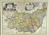
An accurate map of the county of Suffolk
1 Karte : Kupferdruck ; 50 x 69 cm Bowen; Hinton sold by I. Hinton at the Kings Arms in St. Pauls Church Yard
Comitatis Cantabrigiensis, vernacule Cambridge Shire
1 : 210000 Amstelodami : apud Joannem Janssonium
Sheets 35-36. (Cary's England, Wales, and Scotland).
1 : 360000 Cary, John, ca. 1754-1835
The Fens
This is a map of the fenlands dating from around 1603. It is thought to be the model for Hondius's "A generall plotte of the Fennes" published in Amsterdam in 1632 and is signed Ro. Cotton. The map shows the area in some detail, generalised representations of churches represent small settlements. Larger towns such as Cambridge and Bury St Edmunds' are shown in more detail with individualised red roofed buildings. The sands or the washes are indicated by dotted lines and a beacon is marked on the sands. A notable feature of the drawing is the proliferation of windmills as the wind from the sea can move inland unhindered by hills.
SVFFOLCIA. | Vernacule | SVFFOLKE.
[Amsterdam : Joan Blaeu]
Suffolcia vernacule Suffolke
1 : 240000 Joannes Janssonius excudit. [Amstelodami] : [apud Joannem Janssonium]