Maps of St Edmundsbury
Norfolk CVIII.NE - OS Six-Inch Map
1 : 10560 Topographic maps Ordnance Survey Ordnance Survey
Norfolk CVIII.NE - OS Six-Inch Map
1 : 10560 Topographic maps Ordnance Survey Ordnance Survey
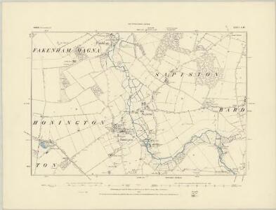
Suffolk XXII.NE - OS Six-Inch Map
1 : 10560 Topographic maps Ordnance Survey Ordnance Survey
Suffolk XXII.8 (includes: Barnham; Euston; Fakenham Magna) - 25 Inch Map
1 : 2500 Topographic maps Ordnance Survey Ordnance Survey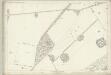
Suffolk XXII.8 (includes: Barnham; Euston; Fakenham Magna) - 25 Inch Map
1 : 2500 Topographic maps Ordnance Survey Ordnance Survey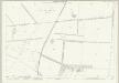
Suffolk XXII.7 (includes: Barnham) - 25 Inch Map
1 : 2500 Topographic maps Ordnance Survey Ordnance Survey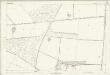
Suffolk XXII.7 (includes: Barnham) - 25 Inch Map
1 : 2500 Topographic maps Ordnance Survey Ordnance Survey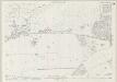
Norfolk CVIII.4 (includes: Barnham; Brettenham; Euston) - 25 Inch Map
1 : 2500 Topographic maps Ordnance Survey Ordnance Survey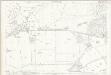
Norfolk CVIII.4 (includes: Barnham; Brettenham; Euston) - 25 Inch Map
1 : 2500 Topographic maps Ordnance Survey Ordnance Survey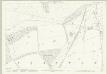
Suffolk XXII.3 (includes: Barnham) - 25 Inch Map
1 : 2500 Topographic maps Ordnance Survey Ordnance Survey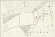
Suffolk XXII.3 (includes: Barnham) - 25 Inch Map
1 : 2500 Topographic maps Ordnance Survey Ordnance Survey
TL87 - OS 1:25,000 Provisional Series Map
1 : 25000 Topographic maps Ordnance Survey Ordnance Survey
Thetford (Hills) - OS One-Inch Revised New Series
1 : 63360 Topographic maps Ordnance Survey Ordnance Survey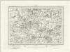
Thetford (Outline) - OS One-Inch Revised New Series
1 : 63360 Topographic maps Ordnance Survey Ordnance Survey
Bury St Edmunds
The landscape here still reflected its medieval character in the early nineteeth century, as is seen through the dominance of named common fields, heaths and warrens. Eldon Field, Downham Warren, and Cutford Heath are just a few of the large labelled tracts of land appearing on this map. Stanley, William.
Feltwell St. Nicholas
1 : 31680 The pecked red line following the course of the Little Ouse marks the county boundary of Norfolk and Cambridgeshire. Drawn on the left of the sheet, along the Ouse Valley, is a patchwork of arable land divided by straight water-filled dykes, typical features of the fens landscape. This elaborate system of drains and river diversions was designed in the 17th century by a Dutch engineer called Vermuyden. It made possible the conversion of pasture to arable land in this region. Yeakell, Thomas
Bury St Edmunds - OS One-Inch Map
1 : 63360 Topographic maps Ordnance Survey Ordnance Survey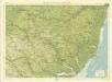
Suffolk, Sheet 20 - Bartholomew's "Half Inch to the Mile Maps" of England & Wales
1 : 126720 Topographic maps Bartholomew, John George John Bartholomew & Co
Suffolcia vernacula Suffolke
1 Karte : Kupferdruck ; 36 x 47 cm Valck; Schenk penes Gerardum Valk et Petrum Schenk
Svffolcia, vernacule Svffolke
1 Karte : Kupferdruck ; 37 x 48 cm Blaeu Joan Blaeu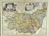
An accurate map of the county of Suffolk
1 Karte : Kupferdruck ; 50 x 69 cm Bowen; Hinton sold by I. Hinton at the Kings Arms in St. Pauls Church Yard
Comitatis Cantabrigiensis, vernacule Cambridge Shire
1 : 210000 Amstelodami : apud Joannem Janssonium
Sheets 35-36. (Cary's England, Wales, and Scotland).
1 : 360000 Cary, John, ca. 1754-1835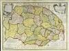
An accurate map of the county of Norfolk
1 Karte : Kupferdruck ; 52 x 70 cm Bowen; Hinton sold by I. Hinton at the Kings Arms in St. Pauls Church yard
Nortfolcia; vernacule Norfolke
1 Karte : Kupferdruck ; 36 x 47 cm Valck; Schenk penes Gerardum Valk et Petrum Schenk
Nortfolcia
1 Karte : Kupferdruck ; 37 x 48 cm Blaeu Joan Blaeu
The Fens
This is a map of the fenlands dating from around 1603. It is thought to be the model for Hondius's "A generall plotte of the Fennes" published in Amsterdam in 1632 and is signed Ro. Cotton. The map shows the area in some detail, generalised representations of churches represent small settlements. Larger towns such as Cambridge and Bury St Edmunds' are shown in more detail with individualised red roofed buildings. The sands or the washes are indicated by dotted lines and a beacon is marked on the sands. A notable feature of the drawing is the proliferation of windmills as the wind from the sea can move inland unhindered by hills.
SVFFOLCIA. | Vernacule | SVFFOLKE.
[Amsterdam : Joan Blaeu]
Suffolcia vernacule Suffolke
1 : 240000 Joannes Janssonius excudit. [Amstelodami] : [apud Joannem Janssonium]