Maps of Daventry
Northamptonshire XXIII.SE - OS Six-Inch Map
1 : 10560 Topographic maps Ordnance Survey Ordnance Survey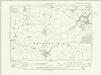
Northamptonshire XXIII.SE - OS Six-Inch Map
1 : 10560 Topographic maps Ordnance Survey Ordnance Survey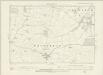
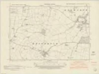
Northamptonshire XXIII.SE - OS Six-Inch Map
1 : 10560 Topographic maps Ordnance Survey Ordnance Survey
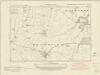
Northamptonshire XXIII.SE - OS Six-Inch Map
1 : 10560 Topographic maps Ordnance Survey Ordnance Survey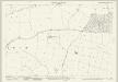
Northamptonshire XXIII.16 (includes: Haselbech; Kelmarsh; Maidwell) - 25 Inch Map
1 : 2500 Topographic maps Ordnance Survey Ordnance Survey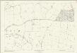
Northamptonshire XXIII.16 (includes: Haselbech; Kelmarsh; Maidwell) - 25 Inch Map
1 : 2500 Topographic maps Ordnance Survey Ordnance Survey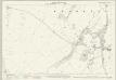
Northamptonshire XXIII.12 (includes: Clipston; Haselbech; Kelmarsh) - 25 Inch Map
1 : 2500 Topographic maps Ordnance Survey Ordnance Survey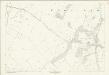
Northamptonshire XXIII.12 (includes: Clipston; Haselbech; Kelmarsh) - 25 Inch Map
1 : 2500 Topographic maps Ordnance Survey Ordnance Survey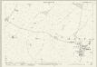
Northamptonshire XXIII.15 (includes: Haselbech; Naseby) - 25 Inch Map
1 : 2500 Topographic maps Ordnance Survey Ordnance Survey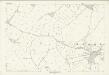
Northamptonshire XXIII.15 (includes: Haselbech; Naseby) - 25 Inch Map
1 : 2500 Topographic maps Ordnance Survey Ordnance Survey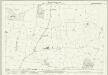
Northamptonshire XXIII.11 (includes: Clipston; Haselbech; Kelmarsh; Naseby) - 25 Inch Map
1 : 2500 Topographic maps Ordnance Survey Ordnance Survey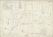
Northamptonshire XXIII.11 (includes: Clipston; Haselbech; Kelmarsh; Naseby) - 25 Inch Map
1 : 2500 Topographic maps Ordnance Survey Ordnance Survey
SP77 - OS 1:25,000 Provisional Series Map
1 : 25000 Topographic maps Ordnance Survey Ordnance Survey
Welford
1 : 31680 This drawing depicts the boundary of Leicestershire and Northamptonshire. The county border is indicated at top left by a pecked line following the course of the River Avon. Relative relief is depicted by brushwork interlining ('hachuring') and ink wash. A section of the Watling Street is shown at bottom left. This Roman road ran from London to Wroxeter in Wales, via St. Albans and Leicester (where it intersected the Fosse Way, the Roman road from Exeter to Lincoln). Triangulation points and pencil rays used to plot the survey of the region are clearly visible at the top of the sheet. Stevens, Henry
Market Harborough (Hills) - OS One-Inch Revised New Series
1 : 63360 Topographic maps Ordnance Survey Ordnance Survey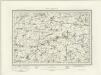
Market Harborough (Outline) - OS One-Inch Revised New Series
1 : 63360 Topographic maps Ordnance Survey Ordnance Survey
Northampton
1 : 31680 This drawing covers part of the Nene Valley as the river meanders through farmland and the industries of Northamptonshire. Mills are depicted throughout the area, especially along the river's course. The staples of Northamptonshire's industry at the beginning of the 19th century were wool, lace, silk and shoemaking. With no indigenous coal supply, local industrialists relied principally upon natural resources for industrial processing, particularly wind and water. Hyett, William
Northampton - OS One-Inch Map
1 : 63360 Topographic maps Ordnance Survey Ordnance Survey
Leicestrensis comitatvs
1 Karte : Kupferdruck ; 37 x 48 cm Blaeu Joan Blaeu
Leicestrensis Comitatus cum Rutlandiae vulgo Leicester & Rutland Shire
1 : 160000 Amstelodami : ex. Joannes Janssonius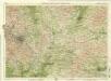
Birmingham, Leicester, Sheet 18 - Bartholomew's "Half Inch to the Mile Maps" of England & Wales
1 : 126720 Topographic maps Bartholomew, John George John Bartholomew & Co
An accurate map of the counties of Leicester and Rutland
1 Karte : Kupferdruck ; 52 x 68 cm Bowen; Tinney; Bowles; Sayer; Bowles; Bowles printed for I. Tinney at the Golden Lion and R. Sayer at the Golden Buck in Fleet street T. Bowles in St. Paul's Church yard and I. Bowles and son at the Black Horse in Cornhill
Leicestrensis comitatvs cum Rvtlandiæ vulgo Leicester [and] Rutland Shire
1 Karte : Kupferdruck ; 42 x 52 cm Valck; Schenk penes Gerardum Valk et Petrum Schenk
LEICESTRENSIS | COMITATVS. | LEICESTER SHIRE.
[Amsterdam : Joan Blaeu]
Leicestrensis Comitatus cum Rutlandiae. Vulgo Leicester & Rutland Shire. [Karte], in: Novus atlas absolutissimus, Bd. 7, S. 316.
1 Karte aus Atlas Janssonius Offizin
Leicestrensis Comitatus. Leicester Shire. [Karte], in: Le théâtre du monde, ou, Nouvel atlas contenant les chartes et descriptions de tous les païs de la terre, Bd. 4, S. 287.
1 Karte aus Atlas Blaeu, Willem Janszoon und Blaeu, Joan Blaeu, Willem Janszoon
An accurate map of Northampton Shire
1 Karte : Kupferdruck ; 68 x 51 cm Bowen; Hinton sold by I. Hinton at the Kings Arms in Newgate street
Comitatvs Northantonensis vernacule Northamton Shire
1 Karte : Kupferdruck ; 37 x 49 cm Valck; Schenk prostant in officina penes Gerardi Valk et Petri Schenk
Comitatvs Northantonensis; vernacule Northamton Shire
1 Karte : Kupferdruck ; 40 x 48 cm Blaeu Joan Blaeu