Maps of South Cambridgeshire
Cambridgeshire LIX.SW - OS Six-Inch Map
1 : 10560 Topographic maps Ordnance Survey Ordnance Survey
Cambridgeshire LIX.SW - OS Six-Inch Map
1 : 10560 Topographic maps Ordnance Survey Ordnance Survey
Essex II.SW - OS Six-Inch Map
1 : 10560 Topographic maps Ordnance Survey Ordnance Survey
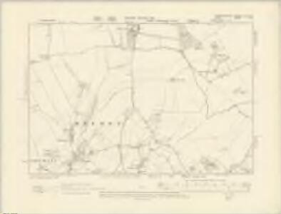
Cambridgeshire LIX.SW - OS Six-Inch Map
1 : 10560 Topographic maps Ordnance Survey Ordnance Survey
Cambridgeshire LIX.9 (includes: Chrishall; Duxford; Fowlmere; Great Chishill; Heydon) - 25 Inch Map
1 : 2500 Topographic maps Ordnance Survey Ordnance Survey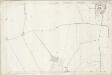
Essex (1st Ed/Rev 1862-96) II.9 (includes: Chrishall; Fowlmere; Heydon) - 25 Inch Map
1 : 2500 Topographic maps Ordnance Survey Ordnance Survey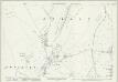
Cambridgeshire LIX.13 (includes: Chrishall; Great Chishill; Heydon) - 25 Inch Map
1 : 2500 Topographic maps Ordnance Survey Ordnance Survey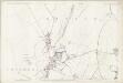
Essex (1st Ed/Rev 1862-96) II.13 (includes: Chrishall; Great Chishill; Heydon) - 25 Inch Map
1 : 2500 Topographic maps Ordnance Survey Ordnance Survey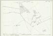
Cambridgeshire LIX.10 (includes: Chrishall; Duxford; Elmdon; Ickleton) - 25 Inch Map
1 : 2500 Topographic maps Ordnance Survey Ordnance Survey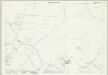
Cambridgeshire LIX.14 (includes: Chrishall; Elmdon; Ickleton) - 25 Inch Map
1 : 2500 Topographic maps Ordnance Survey Ordnance Survey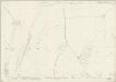
Essex (New Series 1913-) n VI.8 (includes: Chrishall; Heydon) - 25 Inch Map
1 : 2500 Topographic maps Ordnance Survey Ordnance Survey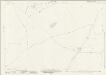
Essex (New Series 1913-) n VII.5 (includes: Chrishall; Elmdon; Ickleton) - 25 Inch Map
1 : 2500 Topographic maps Ordnance Survey Ordnance Survey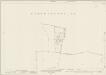
Essex (New Series 1913-) n VI.4 (includes: Chrishall; Duxford; Fowlmere; Heydon; Thriplow) - 25 Inch Map
1 : 2500 Topographic maps Ordnance Survey Ordnance Survey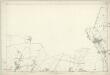
Essex II - OS Six-Inch Map
1 : 10560 Topographic maps Ordnance Survey Ordnance Survey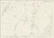
Essex (New Series 1913-) n VI.12 (includes: Chrishall; Heydon) - 25 Inch Map
1 : 2500 Topographic maps Ordnance Survey Ordnance Survey
Essex (New Series 1913-) n VII.1 (includes: Duxford; Ickleton) - 25 Inch Map
1 : 2500 Topographic maps Ordnance Survey Ordnance Survey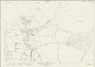
Essex (New Series 1913-) n VII.9 (includes: Elmdon; Wendon Lofts) - 25 Inch Map
1 : 2500 Topographic maps Ordnance Survey Ordnance Survey
TL44 - OS 1:25,000 Provisional Series Map
1 : 25000 Topographic maps Ordnance Survey Ordnance Survey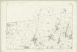
Hertfordshire V - OS Six-Inch Map
1 : 10560 Topographic maps Ordnance Survey Ordnance Survey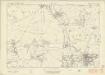
Essex nVII - OS Six-Inch Map
1 : 10560 Topographic maps Ordnance Survey Ordnance Survey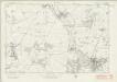
Essex nVII - OS Six-Inch Map
1 : 10560 Topographic maps Ordnance Survey Ordnance Survey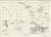
Essex nVII - OS Six-Inch Map
1 : 10560 Topographic maps Ordnance Survey Ordnance Survey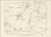
Hertfordshire V.SE - OS Six-Inch Map
1 : 10560 Topographic maps Ordnance Survey Ordnance Survey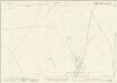
Hertfordshire V.10 & 11 (includes: Barkway; Barley; Great Chishill; Heydon; Little Chishill) - 25 Inch Map
1 : 2500 Topographic maps Ordnance Survey Ordnance Survey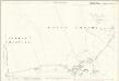
Hertfordshire V.11 (includes: Barley; Great Chishill; Heydon; Little Chishill) - 25 Inch Map
1 : 2500 Topographic maps Ordnance Survey Ordnance Survey
Anstey
1 : 31680 .This plan details the borders of Cambridgeshire, Essex and Hertfordshire. The close attention given to communication routes highlights the military emphasis of the Ordnance Survey. The River Cam is visible towards the right of the map, running from Ducksworth to Newport. Verron
Saffron Walden (Hills) - OS One-Inch Revised New Series
1 : 63360 Topographic maps Ordnance Survey Ordnance Survey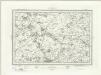
Saffron Walden (Outline) - OS One-Inch Revised New Series
1 : 63360 Topographic maps Ordnance Survey Ordnance Survey
Saffron Walden - OS One-Inch Map
1 : 63360 Topographic maps Ordnance Survey Ordnance Survey