Maps of Fenland
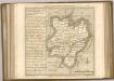
Cambridgeshire VI.SW - OS Six-Inch Map
1 : 10560 Topographic maps Ordnance Survey Ordnance Survey
Cambridgeshire VI.SW - OS Six-Inch Map
1 : 10560 Topographic maps Ordnance Survey Ordnance Survey
Cambridgeshire VI.SW - OS Six-Inch Map
1 : 10560 Topographic maps Ordnance Survey Ordnance Survey
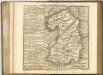
Lincolnshire CLIV.SW - OS Six-Inch Map
1 : 10560 Topographic maps Ordnance Survey Ordnance Survey
Lincolnshire CLIV.SW - OS Six-Inch Map
1 : 10560 Topographic maps Ordnance Survey Ordnance Survey
Lincolnshire CLIV.9 (includes: Sutton St Edmund; Thorney; Wisbech St Mary) - 25 Inch Map
1 : 2500 Topographic maps Ordnance Survey Ordnance Survey
Lincolnshire CLIV.9 (includes: Sutton St Edmund; Thorney; Wisbech St Mary) - 25 Inch Map
1 : 2500 Topographic maps Ordnance Survey Ordnance Survey
Cambridgeshire VI.9 (includes: Thorney) - 25 Inch Map
1 : 2500 Topographic maps Ordnance Survey Ordnance Survey
Cambridgeshire VI.9 (includes: Thorney) - 25 Inch Map
1 : 2500 Topographic maps Ordnance Survey Ordnance Survey
Cambridgeshire VI.13 (includes: Thorney) - 25 Inch Map
1 : 2500 Topographic maps Ordnance Survey Ordnance Survey
Cambridgeshire VI.13 (includes: Thorney) - 25 Inch Map
1 : 2500 Topographic maps Ordnance Survey Ordnance Survey
Cambridgeshire VI.14 (includes: Thorney; Wisbech St Mary) - 25 Inch Map
1 : 2500 Topographic maps Ordnance Survey Ordnance Survey
Cambridgeshire VI.10 (includes: Parson Drove; Sutton St Edmund; Thorney; Wisbech St Mary) - 25 Inch Map
1 : 2500 Topographic maps Ordnance Survey Ordnance Survey
Cambridgeshire VI.10 (includes: Parson Drove; Sutton St Edmund; Thorney; Wisbech St Mary) - 25 Inch Map
1 : 2500 Topographic maps Ordnance Survey Ordnance Survey
Lincolnshire CLIV.10 (includes: Parson Drove; Sutton St Edmund; Wisbech St Mary) - 25 Inch Map
1 : 2500 Topographic maps Ordnance Survey Ordnance Survey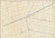
Lincolnshire CLIV.10 (includes: Parson Drove; Sutton St Edmund; Wisbech St Mary) - 25 Inch Map
1 : 2500 Topographic maps Ordnance Survey Ordnance Survey
TF30 - OS 1:25,000 Provisional Series Map
1 : 25000 Topographic maps Ordnance Survey Ordnance Survey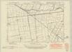
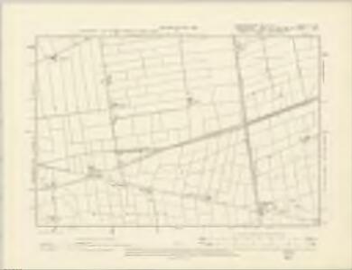
Lincolnshire CLIV.NW - OS Six-Inch Map
1 : 10560 Topographic maps Ordnance Survey Ordnance Survey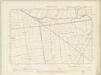
Lincolnshire CLIV.NW - OS Six-Inch Map
1 : 10560 Topographic maps Ordnance Survey Ordnance Survey
Lincolnshire CLIV.NW - OS Six-Inch Map
1 : 10560 Topographic maps Ordnance Survey Ordnance Survey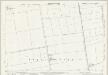
Lincolnshire CLIV.5 (includes: Sutton St Edmund; Thorney) - 25 Inch Map
1 : 2500 Topographic maps Ordnance Survey Ordnance Survey
Lincolnshire CLIV.6 (includes: Parson Drove; Sutton St Edmund) - 25 Inch Map
1 : 2500 Topographic maps Ordnance Survey Ordnance Survey
Peterborough (Hills) - OS One-Inch Revised New Series
1 : 63360 Topographic maps Ordnance Survey Ordnance Survey
Peterborough (Outline) - OS One-Inch Revised New Series
1 : 63360 Topographic maps Ordnance Survey Ordnance Survey
Spalding
1 : 31680 This drawing covers part of Lincolnshire, showing drains across the fens highlighted in blue. These date from the 17th century, when James I appointed Dutch engineer Cornelius Vermuyden to direct the drainage of the wetlands. Many local people opposed the scheme as the plan involved commonland on which they grazed cattle. As a result of Vermuyden's work, the fens changed radically in appearance, from an area of flooded marshes to one of extensively farmed agricultural land. In the middle of the sheet is a series of decoy ponds, built in the 17th and 18th centuries to lure wildlife. Yeakell, Thomas Jr.
Littleport
1 : 31680 This drawing covers part of the Cambridgeshire fenland, an area characterised by straight, water-filled dykes dividing arable land. The New Bedford River is shown running down the middle of the sheet, almost parallel to the original Old Bedford River, taking the waters of the Great Ouse to Denver Sluice, at top right of the plan. In the 17th century, the Dutch engineer, Cornelius Vermuyden was appointed by James I to direct the drainage of the wetlands. As a result of Vermuyden's work, the fens took on a very different appearance, changing from an area of flooded marshes to one of extensively farmed agricultural land. Yeakell, Thomas Jr.Draughtsman
Whittlesea
1 : 31680 This drawing covers the fens of Cambridgeshire, Huntingdonshire, Lincolnshire and Northamptonshire with the county borders indicated by a red dotted line. Characteristic fenland features such as dykes, canals and ancient cattle droves are clearly depicted on the plan. In the 17th century, the Dutch engineer Cornelius Vermuyden was appointed by James I to direct the drainage of the wetlands. As a result of Vermuyden's work, the fens took on a very different appearance, changing from an area of flooded marshes to one of extensively farmed agricultural land. Yeakell, T.
Spalding - OS One-Inch Map
1 : 63360 Topographic maps Ordnance Survey Ordnance Survey