Maps of Worcestershire
Herefordshire IX.SE - OS Six-Inch Map
1 : 10560 Topographic maps Ordnance Survey Ordnance Survey
Herefordshire IX.SE - OS Six-Inch Map
1 : 10560 Topographic maps Ordnance Survey Ordnance Survey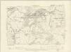
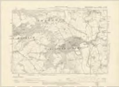
Worcestershire XX.SW - OS Six-Inch Map
1 : 10560 Topographic maps Ordnance Survey Ordnance Survey
Worcestershire XX.SW - OS Six-Inch Map
1 : 10560 Topographic maps Ordnance Survey Ordnance Survey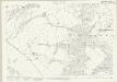
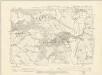
Worcestershire XX.9 (includes: Hanley; Stanford With Orleton; Upper Sapey) - 25 Inch Map
1 : 2500 Topographic maps Ordnance Survey Ordnance Survey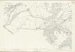
Worcestershire XX.9 (includes: Hanley; Stanford With Orleton; Upper Sapey) - 25 Inch Map
1 : 2500 Topographic maps Ordnance Survey Ordnance Survey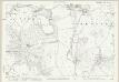
Herefordshire IX.16 (includes: Shelsley Kings; Stanford With Orleton; Stockton On Teme; Upper Sapey) - 25 Inch Map
1 : 2500 Topographic maps Ordnance Survey Ordnance Survey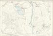
Herefordshire IX.16 (includes: Shelsley Kings; Stanford With Orleton; Stockton On Teme; Upper Sapey) - 25 Inch Map
1 : 2500 Topographic maps Ordnance Survey Ordnance Survey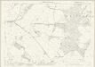
Herefordshire IX.15 (includes: Hanley; Stanford With Orleton; Upper Sapey) - 25 Inch Map
1 : 2500 Topographic maps Ordnance Survey Ordnance Survey
Herefordshire IX.15 (includes: Hanley; Stanford With Orleton; Upper Sapey) - 25 Inch Map
1 : 2500 Topographic maps Ordnance Survey Ordnance Survey
Worcestershire XX.10 (includes: Abberley; Shelsley Kings; Stanford With Orleton; Stockton on Teme) - 25 Inch Map
1 : 2500 Topographic maps Ordnance Survey Ordnance Survey
Worcestershire XX.10 (includes: Abberley; Shelsley Kings; Stanford With Orleton; Stockton on Teme) - 25 Inch Map
1 : 2500 Topographic maps Ordnance Survey Ordnance Survey
Worcestershire XX.5 (includes: Eastham; Hanley; Lindridge; Stanford With Orleton) - 25 Inch Map
1 : 2500 Topographic maps Ordnance Survey Ordnance Survey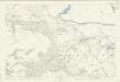
Worcestershire XX.5 (includes: Eastham; Hanley; Lindridge; Stanford With Orleton) - 25 Inch Map
1 : 2500 Topographic maps Ordnance Survey Ordnance Survey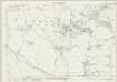
Worcestershire XX.6 (includes: Abberley; Lindridge; Pensax; Stanford With Orleton; Stockton on Teme) - 25 Inch Map
1 : 2500 Topographic maps Ordnance Survey Ordnance Survey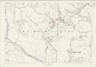
Worcestershire XX.6 (includes: Abberley; Lindridge; Pensax; Stanford With Orleton; Stockton on Teme) - 25 Inch Map
1 : 2500 Topographic maps Ordnance Survey Ordnance Survey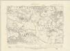
Worcestershire XX.NW - OS Six-Inch Map
1 : 10560 Topographic maps Ordnance Survey Ordnance Survey
Worcestershire XX.NW - OS Six-Inch Map
1 : 10560 Topographic maps Ordnance Survey Ordnance Survey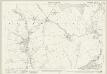
Worcestershire XX.13 (includes: Clifton upon Teme; Lower Sapey; Stanford With Orleton; Upper Sapey) - 25 Inch Map
1 : 2500 Topographic maps Ordnance Survey Ordnance Survey
Worcestershire XX.13 (includes: Clifton upon Teme; Lower Sapey; Stanford With Orleton; Upper Sapey) - 25 Inch Map
1 : 2500 Topographic maps Ordnance Survey Ordnance Survey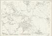
Worcestershire XX.14 (includes: Clifton upon Teme; Shelsley Beauchamp; Shelsley Kings; Shelsley Walsh; Stanford With Orleton; Upper Sapey) - 25 Inch Map
1 : 2500 Topographic maps Ordnance Survey Ordnance Survey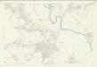
Worcestershire XX.14 (includes: Clifton upon Teme; Shelsley Beauchamp; Shelsley Kings; Shelsley Walsh; Stanford With Orleton; Upper Sapey) - 25 Inch Map
1 : 2500 Topographic maps Ordnance Survey Ordnance Survey
SO76 - OS 1:25,000 Provisional Series Map
1 : 25000 Topographic maps Ordnance Survey Ordnance Survey
SO66 - OS 1:25,000 Provisional Series Map
1 : 25000 Topographic maps Ordnance Survey Ordnance Survey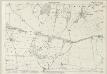
Worcestershire XIX.12 (includes: Eastham; Hanley; Upper Sapey; Wolferlow) - 25 Inch Map
1 : 2500 Topographic maps Ordnance Survey Ordnance Survey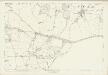
Worcestershire XIX.12 (includes: Eastham; Hanley; Upper Sapey; Wolferlow) - 25 Inch Map
1 : 2500 Topographic maps Ordnance Survey Ordnance Survey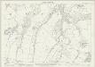
Worcestershire XIX.8 (includes: Eastham; Hanley) - 25 Inch Map
1 : 2500 Topographic maps Ordnance Survey Ordnance Survey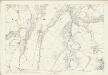
Worcestershire XIX.8 (includes: Eastham; Hanley) - 25 Inch Map
1 : 2500 Topographic maps Ordnance Survey Ordnance Survey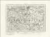
Droitwich (Outline) - OS One-Inch Revised New Series
1 : 63360 Topographic maps Ordnance Survey Ordnance Survey