Maps of Worcestershire
Herefordshire VIII.SE - OS Six-Inch Map
1 : 10560 Topographic maps Ordnance Survey Ordnance Survey
Herefordshire VIII.SE - OS Six-Inch Map
1 : 10560 Topographic maps Ordnance Survey Ordnance Survey
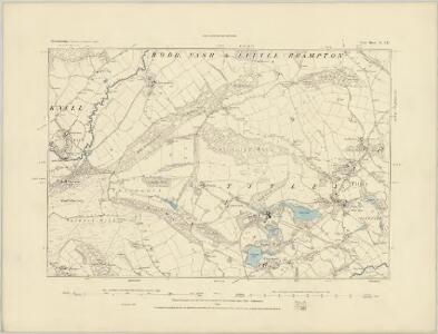
Worcestershire XIX.9 (includes: Bockleton; Laysters; Tenbury) - 25 Inch Map
1 : 2500 Topographic maps Ordnance Survey Ordnance Survey
Worcestershire XIX.9 (includes: Bockleton; Laysters; Tenbury) - 25 Inch Map
1 : 2500 Topographic maps Ordnance Survey Ordnance Survey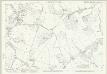
Herefordshire VIII.15 (includes: Bockleton; Laysters; Middleton On The Hill; Tenbury) - 25 Inch Map
1 : 2500 Topographic maps Ordnance Survey Ordnance Survey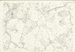
Herefordshire VIII.15 (includes: Bockleton; Laysters; Middleton On The Hill; Tenbury) - 25 Inch Map
1 : 2500 Topographic maps Ordnance Survey Ordnance Survey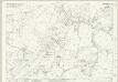
Worcestershire XIX.5 (includes: Tenbury) - 25 Inch Map
1 : 2500 Topographic maps Ordnance Survey Ordnance Survey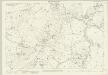
Worcestershire XIX.5 (includes: Tenbury) - 25 Inch Map
1 : 2500 Topographic maps Ordnance Survey Ordnance Survey
Worcestershire XIX.5 (includes: Tenbury) - 25 Inch Map
1 : 2500 Topographic maps Ordnance Survey Ordnance Survey
Worcestershire XIX.10 (includes: Kyre; Tenbury) - 25 Inch Map
1 : 2500 Topographic maps Ordnance Survey Ordnance Survey
Worcestershire XIX.10 (includes: Kyre; Tenbury) - 25 Inch Map
1 : 2500 Topographic maps Ordnance Survey Ordnance Survey
Worcestershire XIX.6 (includes: Rochford; Tenbury) - 25 Inch Map
1 : 2500 Topographic maps Ordnance Survey Ordnance Survey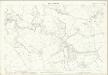
Worcestershire XIX.6 (includes: Rochford; Tenbury) - 25 Inch Map
1 : 2500 Topographic maps Ordnance Survey Ordnance Survey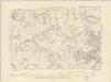
Worcestershire XIX.SW - OS Six-Inch Map
1 : 10560 Topographic maps Ordnance Survey Ordnance Survey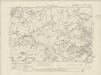
Worcestershire XIX.SW - OS Six-Inch Map
1 : 10560 Topographic maps Ordnance Survey Ordnance Survey
Worcestershire XIX.SW - OS Six-Inch Map
1 : 10560 Topographic maps Ordnance Survey Ordnance Survey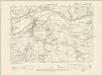
Worcestershire XIX.NW - OS Six-Inch Map
1 : 10560 Topographic maps Ordnance Survey Ordnance Survey
Worcestershire XIX.NW - OS Six-Inch Map
1 : 10560 Topographic maps Ordnance Survey Ordnance Survey
SO66 - OS 1:25,000 Provisional Series Map
1 : 25000 Topographic maps Ordnance Survey Ordnance Survey
SO56 - OS 1:25,000 Provisional Series Map
1 : 25000 Topographic maps Ordnance Survey Ordnance Survey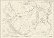
Worcestershire XVIII.12 (includes: Laysters; Little Hereford; Middleton on the Hill; Tenbury) - 25 Inch Map
1 : 2500 Topographic maps Ordnance Survey Ordnance Survey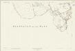
Worcestershire XVIII.12 (includes: Laysters; Little Hereford; Middleton on the Hill; Tenbury) - 25 Inch Map
1 : 2500 Topographic maps Ordnance Survey Ordnance Survey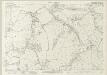
Worcestershire XVIII.8 (includes: Little Hereford; Tenbury) - 25 Inch Map
1 : 2500 Topographic maps Ordnance Survey Ordnance Survey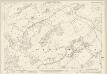
Worcestershire XIX.14 (includes: Bockleton; Kyre; Stoke Bliss; Tenbury) - 25 Inch Map
1 : 2500 Topographic maps Ordnance Survey Ordnance Survey
Worcestershire XIX.14 (includes: Bockleton; Kyre; Stoke Bliss; Tenbury) - 25 Inch Map
1 : 2500 Topographic maps Ordnance Survey Ordnance Survey
Worcestershire XIX.13 (includes: Bockleton; Kyre; Laysters; Tenbury) - 25 Inch Map
1 : 2500 Topographic maps Ordnance Survey Ordnance Survey
Worcestershire XIX.13 (includes: Bockleton; Kyre; Laysters; Tenbury) - 25 Inch Map
1 : 2500 Topographic maps Ordnance Survey Ordnance Survey
Ludlow (Hills) - OS One-Inch Revised New Series
1 : 63360 Topographic maps Ordnance Survey Ordnance Survey
Ludlow (Outline) - OS One-Inch Revised New Series
1 : 63360 Topographic maps Ordnance Survey Ordnance Survey