Maps of Ashford
Kent LV.NW - OS Six-Inch Map
1 : 10560 Topographic maps Ordnance Survey Ordnance Survey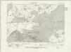
Kent LV.NW - OS Six-Inch Map
1 : 10560 Topographic maps Ordnance Survey Ordnance Survey
Kent LV.NW - OS Six-Inch Map
1 : 10560 Topographic maps Ordnance Survey Ordnance Survey
Kent LV.NW - OS Six-Inch Map
1 : 10560 Topographic maps Ordnance Survey Ordnance Survey
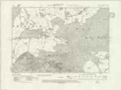
Kent LV.6 (includes: Boughton Aluph; Challock; Wye) - 25 Inch Map
1 : 2500 Topographic maps Ordnance Survey Ordnance Survey
Kent LV.6 (includes: Boughton Aluph; Challock; Wye) - 25 Inch Map
1 : 2500 Topographic maps Ordnance Survey Ordnance Survey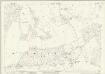
Kent LV.1 (includes: Challock; Wye) - 25 Inch Map
1 : 2500 Topographic maps Ordnance Survey Ordnance Survey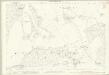
Kent LV.1 (includes: Challock; Wye) - 25 Inch Map
1 : 2500 Topographic maps Ordnance Survey Ordnance Survey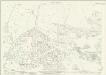
Kent LV.5 (includes: Challock) - 25 Inch Map
1 : 2500 Topographic maps Ordnance Survey Ordnance Survey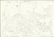
Kent LV.5 (includes: Challock) - 25 Inch Map
1 : 2500 Topographic maps Ordnance Survey Ordnance Survey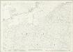
Kent LV.2 (includes: Molash; Wye) - 25 Inch Map
1 : 2500 Topographic maps Ordnance Survey Ordnance Survey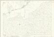
Kent LV.2 (includes: Molash; Wye) - 25 Inch Map
1 : 2500 Topographic maps Ordnance Survey Ordnance Survey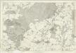
Kent LV - OS Six-Inch Map
1 : 10560 Topographic maps Ordnance Survey Ordnance Survey
Chilham, Kent 6
Drawing showing the area between Challock and Chilham in Kent. To plot the landscape of England, individual parts of the countryside were divided into triangular sections., Two black lines visible on this map represent sides of,one such,triangle., The drawing is covered in red lines., Radiating from fixed points, these indicate the positions from which the surveyor took angular measurements to plot the location of topographical features. Pink, George
TR05 - OS 1:25,000 Provisional Series Map
1 : 25000 Topographic maps Ordnance Survey Ordnance Survey
Eastling, Kent 6
Drawing showing the area around Eastling in Kent. This is an 'outline drawing'. It is uncoloured and has no representation of relative relief. Such drawings represented the halfway stage between the original protraction and the finished darwing. Increasingly sophisticated mapmaking techniques made this intermediate stage redundant by the 1830s. Red lines also feature heavily. Radiating from fixed points, these show the angular measurements taken with a theodolite to enable the surveryor to plot the location of topographical features. Black lines indicate the edges of the area intended to be copied up for the finished drawing. Pink, George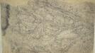
Challock, Kent
1 : 10560 This pencil and ink drawing is a very rough sketch or 'foul plan' of a rural section of the North Downs in Kent. It was drawn on 17 pieces of irregularly cut paper. The map was made in the field by the draughtsman to augment the angle and distance measurements noted in his field books. The detail recorded here was incorporated into the 'fair' drawing, which survives as OSD 109/110/111, serial 380. Pink, George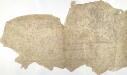
Chilham, Kent 17
This drawing comprises several sheets of paper joined together. Although roads and field boundaries are shown, much other detail is missing from the drawing and no indication of relief is indicated. Major settlements are named and individual buildings are delineated in red or black, indicating stone or wood structures. A pencil note in the bottom right corner records the publication date and status of the drawing as a proof.
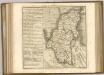
A topographical-map, of the county of Kent, 14
1 Blatt : 54 x 71 cm A. Dury, W. Herbert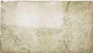
Charing, Kent(002OSD000000017U00375000)
The dominant feature of this drawing is the use of different shades of green to distinguish fields and woods. The draughtsman has depicted individual trees and recorded the position of clearings in Chilham Park. Such detail is testimony to the meticulousness of the Survey. The Stone Street Causeway, a Roman road, is shown to the left of the plan. Connecting Lympne to Canterbury, it is likely to have been the route taken by Henry II's men on their way to murder Archbishop Thomas Becket in Canterbury Cathedral on 29 December 1170.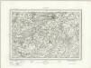
Canterbury (Outline) - OS One-Inch Revised New Series
1 : 63360 Topographic maps Ordnance Survey Ordnance Survey
Canterbury (Hills) - OS One-Inch Revised New Series
1 : 63360 Topographic maps Ordnance Survey Ordnance Survey
Partie de l'Angleterre
1 : 110000 Anglie jižní Fricx, Eugene Henry Harrewyn, Jacques chez Eugene Henry Fricx
Chatham and Maidstone - OS One-Inch Map
1 : 63360 Topographic maps Ordnance Survey Ordnance Survey
Hastings - OS One-Inch Map
1 : 63360 Topographic maps Ordnance Survey Ordnance Survey
East Kent - OS One-Inch Map
1 : 63360 Topographic maps Ordnance Survey Ordnance Survey
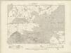
Kent, Sheet 31 - Bartholomew's "Half Inch to the Mile Maps" of England & Wales
1 : 126720 Topographic maps Bartholomew, John George John Bartholomew & Co
60. London. The World Atlas.
1 : 250000 USSR (Union of Soviet Socialist Republics).