Maps of Wiltshire
Wiltshire LXIII.NE - OS Six-Inch Map
1 : 10560 Topographic maps Ordnance Survey Ordnance Survey
Wiltshire LXIII.NE - OS Six-Inch Map
1 : 10560 Topographic maps Ordnance Survey Ordnance Survey
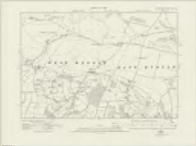
Wiltshire LXIII.3 (includes: Kingston Deverill; Mere; West Knoyle) - 25 Inch Map
1 : 2500 Topographic maps Ordnance Survey Ordnance Survey
Wiltshire LXIII.3 (includes: Kingston Deverill; Mere; West Knoyle) - 25 Inch Map
1 : 2500 Topographic maps Ordnance Survey Ordnance Survey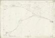
Wiltshire LXIII.3 (includes: Kingston Deverill; Mere; West Knoyle) - 25 Inch Map
1 : 2500 Topographic maps Ordnance Survey Ordnance Survey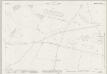
Wiltshire LXIII.4 (includes: East Knoyle; Kingston Deverill; West Knoyle) - 25 Inch Map
1 : 2500 Topographic maps Ordnance Survey Ordnance Survey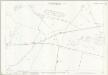
Wiltshire LXIII.4 (includes: East Knoyle; Kingston Deverill; West Knoyle) - 25 Inch Map
1 : 2500 Topographic maps Ordnance Survey Ordnance Survey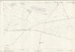
Wiltshire LXIII.4 (includes: East Knoyle; Kingston Deverill; West Knoyle) - 25 Inch Map
1 : 2500 Topographic maps Ordnance Survey Ordnance Survey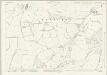
Wiltshire LXIII.7 (includes: East Knoyle; Mere; West Knoyle) - 25 Inch Map
1 : 2500 Topographic maps Ordnance Survey Ordnance Survey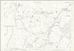
Wiltshire LXIII.7 (includes: East Knoyle; Mere; West Knoyle) - 25 Inch Map
1 : 2500 Topographic maps Ordnance Survey Ordnance Survey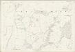
Wiltshire LXIII.7 (includes: East Knoyle; Mere; West Knoyle) - 25 Inch Map
1 : 2500 Topographic maps Ordnance Survey Ordnance Survey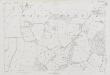
Wiltshire LXIII.7 (includes: East Knoyle; Mere; West Knoyle) - 25 Inch Map
1 : 2500 Topographic maps Ordnance Survey Ordnance Survey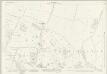
Wiltshire LXIII.8 (includes: East Knoyle; West Knoyle) - 25 Inch Map
1 : 2500 Topographic maps Ordnance Survey Ordnance Survey
Wiltshire LXIII.8 (includes: East Knoyle; West Knoyle) - 25 Inch Map
1 : 2500 Topographic maps Ordnance Survey Ordnance Survey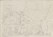
Wiltshire LXIII.8 (includes: East Knoyle; West Knoyle) - 25 Inch Map
1 : 2500 Topographic maps Ordnance Survey Ordnance Survey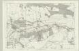
Wiltshire LXIII - OS Six-Inch Map
1 : 10560 Topographic maps Ordnance Survey Ordnance Survey
ST83 - OS 1:25,000 Provisional Series Map
1 : 25000 Topographic maps Ordnance Survey Ordnance Survey
Dorset II.SW - OS Six-Inch Map
1 : 10560 Topographic maps Ordnance Survey Ordnance Survey
Dorset II.SW - OS Six-Inch Map
1 : 10560 Topographic maps Ordnance Survey Ordnance Survey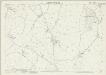
Dorset II.9 (includes: Gillingham; Mere; West Knoyle) - 25 Inch Map
1 : 2500 Topographic maps Ordnance Survey Ordnance Survey
Dorset II.9 (includes: Gillingham; Mere; West Knoyle) - 25 Inch Map
1 : 2500 Topographic maps Ordnance Survey Ordnance Survey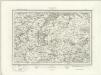
Wincanton (Outline) - OS One-Inch Revised New Series
1 : 63360 Topographic maps Ordnance Survey Ordnance Survey
Wincanton (Hills) - OS One-Inch Revised New Series
1 : 63360 Topographic maps Ordnance Survey Ordnance Survey
Shaftesbury
1 : 31680 This drawing covers the counties of Dorset, Somerset and Wiltshire, with their boundaries marked by pecked red lines. Relief is indicated by shading and interlining, giving an impression of the undulations of the land. Although the recording of archaeological sites did not become obligatory until 1816, the remains of Whitesheet Castle appear at the top centre of the drawing. Pencil lines can be seen at the edge of the drawing near Pimperne. This was an observation or measuring point for the survey.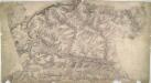
Warminster
1 : 31680 Although this drawing was surveyed six years before the obligatory inclusion of archaeological sites on drawings, several are featured. The most famous of these is Stonehenge, to the right of the drawing. Ancient camps, earthworks, castles and grave mounds ('tumuli') pepper the area, indicated by concentric shapes and a title in neat script. Their inclusion reveals the meticulous nature of the survey. To the right of the drawing, opposite Wishford, a trigonometrical station is indicated by a dot within a circle (annotated 'Col. Mudge's station' - Major-General William Mudge was Superintendent of the Ordnance Survey). This station denotes a point from which angular measurements were taken. In the right hand margin of the drawing a point titled "End of Base" marks the end of the Salisbury Plain baseline: an important measurement allowing for the triangulation of the area. Crocker, Edmund
Frome - OS One-Inch Map
1 : 63360 Topographic maps Ordnance Survey Ordnance Survey
Cary's Improved Map of England and Wales
Cary, George, & Cary, John London : G. & J. Cary
An improved map of Wilt Shire
1 Karte : Kupferdruck ; 52 x 68 cm Bowen; Tinney sold by I. Tinney at the Golden Lion in Fleet street
Wiltonia sive comitatvs Wiltoniensis; anglis Wil Shire
1 Karte : Kupferdruck ; 40 x 48 cm Blaeu Joan Blaeu