Maps of Wiltshire
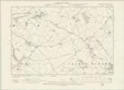
Wiltshire XXI.NE - OS Six-Inch Map
1 : 10560 Topographic maps Ordnance Survey Ordnance Survey
Wiltshire XXI.NE - OS Six-Inch Map
1 : 10560 Topographic maps Ordnance Survey Ordnance Survey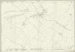
Wiltshire XXI.3 (includes: Lyneham; Tockenham) - 25 Inch Map
1 : 2500 Topographic maps Ordnance Survey Ordnance Survey
Wiltshire XXI.3 (includes: Lyneham; Tockenham) - 25 Inch Map
1 : 2500 Topographic maps Ordnance Survey Ordnance Survey
Wiltshire XXI.3 (includes: Lyneham; Tockenham) - 25 Inch Map
1 : 2500 Topographic maps Ordnance Survey Ordnance Survey
Wiltshire XXI.3 (includes: Lyneham; Tockenham) - 25 Inch Map
1 : 2500 Topographic maps Ordnance Survey Ordnance Survey
Wiltshire XXI.7 (includes: Clyffe Pypard; Hilmarton; Lyneham) - 25 Inch Map
1 : 2500 Topographic maps Ordnance Survey Ordnance Survey
Wiltshire XXI.7 (includes: Clyffe Pypard; Hilmarton; Lyneham) - 25 Inch Map
1 : 2500 Topographic maps Ordnance Survey Ordnance Survey
Wiltshire XXI.7 (includes: Clyffe Pypard; Hilmarton; Lyneham) - 25 Inch Map
1 : 2500 Topographic maps Ordnance Survey Ordnance Survey
Wiltshire XXI.7 (includes: Clyffe Pypard; Hilmarton; Lyneham) - 25 Inch Map
1 : 2500 Topographic maps Ordnance Survey Ordnance Survey
Wiltshire XXI.4 (includes: Broad Town; Clyffe Pypard; Lyneham; Tockenham; Wootton Bassett) - 25 Inch Map
1 : 2500 Topographic maps Ordnance Survey Ordnance Survey
Wiltshire XXI.4 (includes: Broad Town; Clyffe Pypard; Lyneham; Tockenham; Wootton Bassett) - 25 Inch Map
1 : 2500 Topographic maps Ordnance Survey Ordnance Survey
Wiltshire XXI.4 (includes: Broad Town; Clyffe Pypard; Lyneham; Tockenham; Wootton Bassett) - 25 Inch Map
1 : 2500 Topographic maps Ordnance Survey Ordnance Survey
Wiltshire XXI.4 (includes: Broad Town; Clyffe Pypard; Lyneham; Tockenham; Wootton Bassett) - 25 Inch Map
1 : 2500 Topographic maps Ordnance Survey Ordnance Survey
Wiltshire XXI.8 (includes: Clyffe Pypard; Lyneham) - 25 Inch Map
1 : 2500 Topographic maps Ordnance Survey Ordnance Survey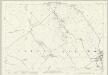
Wiltshire XXI.8 (includes: Clyffe Pypard; Lyneham) - 25 Inch Map
1 : 2500 Topographic maps Ordnance Survey Ordnance Survey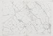
Wiltshire XXI.8 (includes: Clyffe Pypard; Lyneham) - 25 Inch Map
1 : 2500 Topographic maps Ordnance Survey Ordnance Survey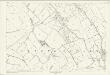
Wiltshire XXI.8 (includes: Clyffe Pypard; Lyneham) - 25 Inch Map
1 : 2500 Topographic maps Ordnance Survey Ordnance Survey
Wiltshire XXI - OS Six-Inch Map
1 : 10560 Topographic maps Ordnance Survey Ordnance Survey
SU07 - OS 1:25,000 Provisional Series Map
1 : 25000 Topographic maps Ordnance Survey Ordnance Survey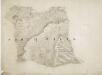
Broad Hinton and Avebury
This map features a stretch of the Wilts and Berks canal, before its route was appropriated for use by railway lines. Of the numerous ancient features on the map are the remains of the Druidical temple in Avesbury and the ancient encampments of Barbury castle and Byknoll (Bincknoll) castle. Crocker, E.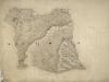
North Wilts
[E. Crocker]
Marlborough (Hills) - OS One-Inch Revised New Series
1 : 63360 Topographic maps Ordnance Survey Ordnance Survey
Marlborough (Outline) - OS One-Inch Revised New Series
1 : 63360 Topographic maps Ordnance Survey Ordnance Survey
Swindon - OS One-Inch Map
1 : 63360 Topographic maps Ordnance Survey Ordnance Survey
Cary's Improved Map of England and Wales
Cary, George, & Cary, John London : G. & J. Cary
An improved map of Wilt Shire
1 Karte : Kupferdruck ; 52 x 68 cm Bowen; Tinney sold by I. Tinney at the Golden Lion in Fleet street
Wiltonia sive comitatvs Wiltoniensis; anglis Wil Shire
1 Karte : Kupferdruck ; 40 x 48 cm Blaeu Joan Blaeu
Berkshire, Sheet 29 - Bartholomew's "Half Inch to the Mile Maps" of England & Wales
1 : 126720 Topographic maps Bartholomew, John George John Bartholomew & Co