Maps of Wiltshire
Wiltshire X.SW - OS Six-Inch Map
1 : 10560 Topographic maps Ordnance Survey Ordnance Survey
Wiltshire X.SW - OS Six-Inch Map
1 : 10560 Topographic maps Ordnance Survey Ordnance Survey
Wiltshire X.9 (includes: Braydon; Purton) - 25 Inch Map
1 : 2500 Topographic maps Ordnance Survey Ordnance Survey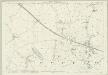
Wiltshire X.9 (includes: Braydon; Purton) - 25 Inch Map
1 : 2500 Topographic maps Ordnance Survey Ordnance Survey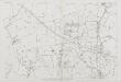
Wiltshire X.9 (includes: Braydon; Purton) - 25 Inch Map
1 : 2500 Topographic maps Ordnance Survey Ordnance Survey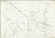
Wiltshire X.9 (includes: Braydon; Purton) - 25 Inch Map
1 : 2500 Topographic maps Ordnance Survey Ordnance Survey
Wiltshire X.13 (includes: Lydiard Millicent; Purton) - 25 Inch Map
1 : 2500 Topographic maps Ordnance Survey Ordnance Survey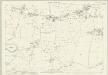
Wiltshire X.13 (includes: Lydiard Millicent; Purton) - 25 Inch Map
1 : 2500 Topographic maps Ordnance Survey Ordnance Survey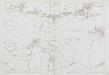
Wiltshire X.13 (includes: Lydiard Millicent; Purton) - 25 Inch Map
1 : 2500 Topographic maps Ordnance Survey Ordnance Survey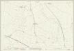
Wiltshire X.10 (includes: Blunsdon St Andrew; Haydon Wick; Purton) - 25 Inch Map
1 : 2500 Topographic maps Ordnance Survey Ordnance Survey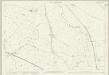
Wiltshire X.10 (includes: Blunsdon St Andrew; Haydon Wick; Purton) - 25 Inch Map
1 : 2500 Topographic maps Ordnance Survey Ordnance Survey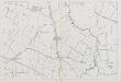
Wiltshire X.10 (includes: Blunsdon St Andrew; Haydon Wick; Purton) - 25 Inch Map
1 : 2500 Topographic maps Ordnance Survey Ordnance Survey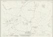
Wiltshire X.10 (includes: Blunsdon St Andrew; Haydon Wick; Purton) - 25 Inch Map
1 : 2500 Topographic maps Ordnance Survey Ordnance Survey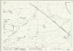
Wiltshire X.14 (includes: Haydon Wick; Lydiard Millicent; Purton) - 25 Inch Map
1 : 2500 Topographic maps Ordnance Survey Ordnance Survey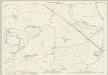
Wiltshire X.14 (includes: Haydon Wick; Lydiard Millicent; Purton) - 25 Inch Map
1 : 2500 Topographic maps Ordnance Survey Ordnance Survey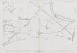
Wiltshire X.14 (includes: Haydon Wick; Lydiard Millicent; Purton) - 25 Inch Map
1 : 2500 Topographic maps Ordnance Survey Ordnance Survey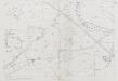
Wiltshire X.14 (includes: Haydon Wick; Lydiard Millicent; Purton) - 25 Inch Map
1 : 2500 Topographic maps Ordnance Survey Ordnance Survey
Wiltshire X - OS Six-Inch Map
1 : 10560 Topographic maps Ordnance Survey Ordnance Survey
Cricklade
1 : 31680 The drawing is framed by a formal border, confirming its status as complete. Black crosses, labelled Brinkworth and Purton, indicate points from which the surveyor took angular measurements. Bury Hill Camp and Ringsbury Camp, both iron-age hillforts, are indicated by soft interlining and loosely rendered concentric rings. Crocker, Edmund
SU08 - OS 1:25,000 Provisional Series Map
1 : 25000 Topographic maps Ordnance Survey Ordnance Survey
SU18 - OS 1:25,000 Provisional Series Map
1 : 25000 Topographic maps Ordnance Survey Ordnance Survey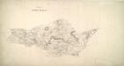
Lydiard
1 : 21120 This drawing covers part of Gloucester, the county boundary being indicated by a pecked red line. The drawing is delicately rendered with light pencil interlinings ('hachures') representing relief. Major communication routes are tinted yellow with their length noted at intervals of one mile. This indicates the serious military focus of the survey. In the margins of the drawing, several dots within circles annotated by place names mark the trigonometric stations from which the surveyor plotted the area's topography. A note in the bottom margin records the date of execution and the name draughtsman, recording him as a Royal Military Surveyor. Metcalf, Edward B.
Swindon (Hills) - OS One-Inch Revised New Series
1 : 63360 Topographic maps Ordnance Survey Ordnance Survey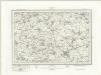
Swindon (Outline) - OS One-Inch Revised New Series
1 : 63360 Topographic maps Ordnance Survey Ordnance Survey
Swindon
1 : 31680 The author of this drawing, William Stanley, was listed as a 'first class' Military draughtsman and surveyor at the Tower of London Drawing Room. His elaborate hill shading technique for describing relief and the attention he pays to communications routes reinforce the military emphasis of these maps. Archaeological details are documented even though this did not become obligatory until 1816. The iron-age hillfort at Barbury Castle is described, along with numerous barrows and earthworks. Stanley, William
Swindon - OS One-Inch Map
1 : 63360 Topographic maps Ordnance Survey Ordnance Survey
Ordnance Survey of England. Sheet 256, North London
1 : 63360 Ordnance survey. GB Southampton : Ordnance Survey Office
Cary's Improved Map of England and Wales
Cary, George, & Cary, John London : G. & J. Cary
An improved map of Wilt Shire
1 Karte : Kupferdruck ; 52 x 68 cm Bowen; Tinney sold by I. Tinney at the Golden Lion in Fleet street