Maps of Somerset
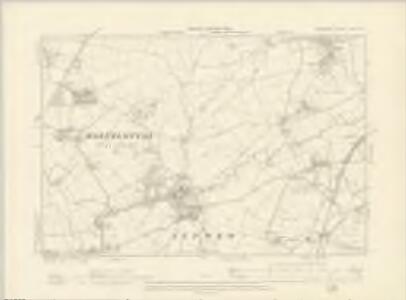
Somerset LXIV.NE - OS Six-Inch Map
1 : 10560 Topographic maps Ordnance Survey Ordnance Survey
Somerset LXIV.NE - OS Six-Inch Map
1 : 10560 Topographic maps Ordnance Survey Ordnance Survey
Somerset LXIV.NE - OS Six-Inch Map
1 : 10560 Topographic maps Ordnance Survey Ordnance Survey
Somerset LXIV.3 (includes: Ditcheat; East Pennard; Lydford; West Bradley) - 25 Inch Map
1 : 2500 Topographic maps Ordnance Survey Ordnance Survey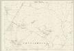
Somerset LXIV.3 (includes: Ditcheat; East Pennard; Lydford; West Bradley) - 25 Inch Map
1 : 2500 Topographic maps Ordnance Survey Ordnance Survey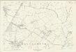
Somerset LXIV.3 (includes: Ditcheat; East Pennard; Lydford; West Bradley) - 25 Inch Map
1 : 2500 Topographic maps Ordnance Survey Ordnance Survey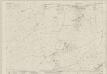
Somerset LXIV.4 (includes: Ansford; Castle Cary; Ditcheat; Lamyat) - 25 Inch Map
1 : 2500 Topographic maps Ordnance Survey Ordnance Survey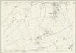
Somerset LXIV.4 (includes: Ansford; Castle Cary; Ditcheat; Lamyat) - 25 Inch Map
1 : 2500 Topographic maps Ordnance Survey Ordnance Survey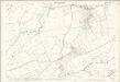
Somerset LXIV.4 (includes: Ansford; Castle Cary; Ditcheat; Lamyat) - 25 Inch Map
1 : 2500 Topographic maps Ordnance Survey Ordnance Survey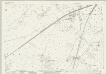
Somerset LXIV.8 (includes: Alford; Ansford; Castle Cary; Ditcheat) - 25 Inch Map
1 : 2500 Topographic maps Ordnance Survey Ordnance Survey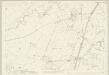
Somerset LXIV.8 (includes: Alford; Ansford; Castle Cary; Ditcheat) - 25 Inch Map
1 : 2500 Topographic maps Ordnance Survey Ordnance Survey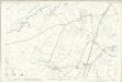
Somerset LXIV.8 (includes: Alford; Ansford; Castle Cary; Ditcheat) - 25 Inch Map
1 : 2500 Topographic maps Ordnance Survey Ordnance Survey
Somerset LXIV.7 (includes: Alford; Ditcheat; Lovington; Lydford; West Bradley) - 25 Inch Map
1 : 2500 Topographic maps Ordnance Survey Ordnance Survey
Somerset LXIV.7 (includes: Alford; Ditcheat; Lovington; Lydford; West Bradley) - 25 Inch Map
1 : 2500 Topographic maps Ordnance Survey Ordnance Survey
Somerset LXIV.7 (includes: Alford; Ditcheat; Lovington; Lydford; West Bradley) - 25 Inch Map
1 : 2500 Topographic maps Ordnance Survey Ordnance Survey
Somerset LXIV.7 (includes: Alford; Ditcheat; Lovington; Lydford; West Bradley) - 25 Inch Map
1 : 2500 Topographic maps Ordnance Survey Ordnance Survey
ST63 - OS 1:25,000 Provisional Series Map
1 : 25000 Topographic maps Ordnance Survey Ordnance Survey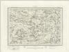
Glastonbury (Outline) - OS One-Inch Revised New Series
1 : 63360 Topographic maps Ordnance Survey Ordnance Survey
Glastonbury (Hills) - OS One-Inch Revised New Series
1 : 63360 Topographic maps Ordnance Survey Ordnance Survey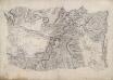
Wincanton
This drawing is rich in archaeological sites, the most notable being Cadbury Castle, which, according to legend, is the Camelot of Arthurian myth. It is marked by several concentric rings inside a band of dense shading, smudged at the top, indicating a steep mound. It was not until 1839-40 that contour lines were introduced into Ordnance Survey drawings, and so the two large blank areas on the map represent low fluvial tracts. Red pecked lines denote the boundaries between Dorset, Somerset and Wiltshire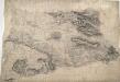
Glastonbury
Pencil orientation lines can be seen around the edges of this drawing. An arrow protruding from Wells indicates the link-point between this and another drawing. The flat lands of Burtle Heath and Kings Sedge Moor occupy half the drawing. Field boundaries and the manmade drainage system are recorded. Toll gates are marked 'TG' along the main turnpike road from Shepton Mallet to Somerton, which forms the edge of the drawing.
Dorset Shire, 2
2 Blätter : 109 x 53 cm s.n.
Frome - OS One-Inch Map
1 : 63360 Topographic maps Ordnance Survey Ordnance Survey
Weston-Super-Mare - OS One-Inch Map
1 : 63360 Topographic maps Ordnance Survey Ordnance Survey
Cary's Improved Map of England and Wales
Cary, George, & Cary, John London : G. & J. Cary
An improved map of the county of Somerset
1 Karte : Kupferdruck ; 51 x 68 cm Bowen; Hinton sold by I. Hinton at the Kings Arms in St. Pauls Church Yard
Somersettensis comitatvs
1 Karte : Kupferdruck ; 36 x 48 cm Valck; Schenk apud G. Valk et P. Schenk
Somersettensis comitatvs
1 Karte : Kupferdruck ; 37 x 48 cm Blaeu Joan Blaeu
Dorset, Sheet 34 - Bartholomew's "Half Inch to the Mile Maps" of England & Wales
1 : 126720 Topographic maps Bartholomew, John George John Bartholomew & Co