Maps of Somerset
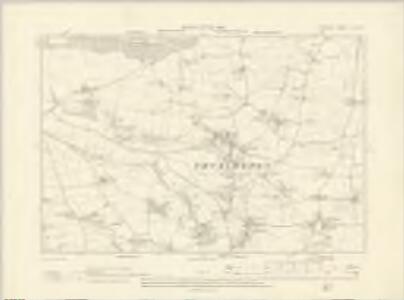
Somerset LXI.SW - OS Six-Inch Map
1 : 10560 Topographic maps Ordnance Survey Ordnance Survey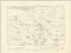
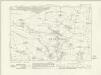
Somerset LXI.SW - OS Six-Inch Map
1 : 10560 Topographic maps Ordnance Survey Ordnance Survey
Somerset LXI.SW - OS Six-Inch Map
1 : 10560 Topographic maps Ordnance Survey Ordnance Survey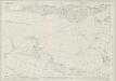
Somerset LXI.9 (includes: Broomfield; North Petherton; Thurloxton; West Monkton) - 25 Inch Map
1 : 2500 Topographic maps Ordnance Survey Ordnance Survey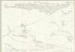
Somerset LXI.9 (includes: Broomfield; North Petherton; Thurloxton; West Monkton) - 25 Inch Map
1 : 2500 Topographic maps Ordnance Survey Ordnance Survey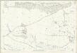
Somerset LXI.9 (includes: Broomfield; North Petherton; Thurloxton; West Monkton) - 25 Inch Map
1 : 2500 Topographic maps Ordnance Survey Ordnance Survey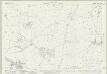
Somerset LXI.10 (includes: North Petherton; Thurloxton) - 25 Inch Map
1 : 2500 Topographic maps Ordnance Survey Ordnance Survey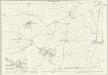
Somerset LXI.10 (includes: North Petherton; Thurloxton) - 25 Inch Map
1 : 2500 Topographic maps Ordnance Survey Ordnance Survey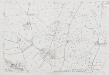
Somerset LXI.10 (includes: North Petherton; Thurloxton) - 25 Inch Map
1 : 2500 Topographic maps Ordnance Survey Ordnance Survey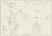
Somerset LXI.14 (includes: Creech St Michael; Durston; North Petherton; Thurloxton; West Monkton) - 25 Inch Map
1 : 2500 Topographic maps Ordnance Survey Ordnance Survey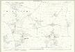
Somerset LXI.14 (includes: Creech St Michael; Durston; North Petherton; Thurloxton; West Monkton) - 25 Inch Map
1 : 2500 Topographic maps Ordnance Survey Ordnance Survey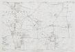
Somerset LXI.14 (includes: Creech St Michael; Durston; North Petherton; Thurloxton; West Monkton) - 25 Inch Map
1 : 2500 Topographic maps Ordnance Survey Ordnance Survey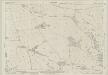
Somerset LXI.13 (includes: Creech St Michael; North Petherton; Thurloxton; West Monkton) - 25 Inch Map
1 : 2500 Topographic maps Ordnance Survey Ordnance Survey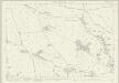
Somerset LXI.13 (includes: Creech St Michael; North Petherton; Thurloxton; West Monkton) - 25 Inch Map
1 : 2500 Topographic maps Ordnance Survey Ordnance Survey
Somerset LXI.13 (includes: Creech St Michael; North Petherton; Thurloxton; West Monkton) - 25 Inch Map
1 : 2500 Topographic maps Ordnance Survey Ordnance Survey
ST23 - OS 1:25,000 Provisional Series Map
1 : 25000 Topographic maps Ordnance Survey Ordnance Survey
Bridgewater
This drawing covers the coastal area of Burnham on Sea. A careful study has been made of the coastline, noting sand banks and low watermarks and a lighthouse at Burnham. Faint pencil lines radiate from a mark near Westonzoyland. This shows the point from which angular measurements were taken to plot topographical features. The drawing is unfinished, roads and settlements in the lower half being left unnamed. Attention given to the accurate delineation of the road network sets these maps apart from earlier county plans and is a further reflection of the serious military emphasis of the Survey as a whole.
Taunton (Hills) - OS One-Inch Revised New Series
1 : 63360 Topographic maps Ordnance Survey Ordnance Survey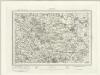
Taunton (Outline) - OS One-Inch Revised New Series
1 : 63360 Topographic maps Ordnance Survey Ordnance Survey
Taunton and Lyme Regis - OS One-Inch Map
1 : 63360 Topographic maps Ordnance Survey Ordnance Survey
Weston-Super-Mare - OS One-Inch Map
1 : 63360 Topographic maps Ordnance Survey Ordnance Survey
Cary's Improved Map of England and Wales
Cary, George, & Cary, John London : G. & J. Cary
Comitatus Dorcestria vulgo anglice Dorset Shire
1 : 170000 Amstelodami : apud Joannem Janssonium
An accurate map of Dorset Shire divided into hundreds
1 : 222000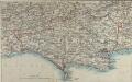
Map of Dorsetshire
This map comes from the Abbott's Illustrated Counties series of county guides: Dorsetshire, its history, antiquities, places of interest, etc a complete, concise and exhaustive story of Dorset from the earliest times to the present day' The Guide Printing & Publishing Co.
An improved map of the county of Somerset
1 Karte : Kupferdruck ; 51 x 68 cm Bowen; Hinton sold by I. Hinton at the Kings Arms in St. Pauls Church Yard
Somersettensis comitatvs
1 Karte : Kupferdruck ; 36 x 48 cm Valck; Schenk apud G. Valk et P. Schenk
Somersettensis comitatvs
1 Karte : Kupferdruck ; 37 x 48 cm Blaeu Joan Blaeu
Dorset, Sheet 34 - Bartholomew's "Half Inch to the Mile Maps" of England & Wales
1 : 126720 Topographic maps Bartholomew, John George John Bartholomew & Co