Maps of Devon
Somerset XLIV.NE - OS Six-Inch Map
1 : 10560 Topographic maps Ordnance Survey Ordnance Survey
Somerset XLIV.NE - OS Six-Inch Map
1 : 10560 Topographic maps Ordnance Survey Ordnance Survey
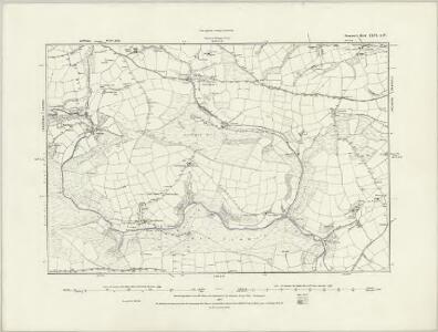
Somerset XLIV.7 (includes: Challcombe; Exmoor; High Bray) - 25 Inch Map
1 : 2500 Topographic maps Ordnance Survey Ordnance Survey
Somerset XLIV.7 (includes: Challcombe; Exmoor; High Bray) - 25 Inch Map
1 : 2500 Topographic maps Ordnance Survey Ordnance Survey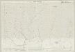
Somerset XLIV.3 (includes: Challcombe; Exmoor) - 25 Inch Map
1 : 2500 Topographic maps Ordnance Survey Ordnance Survey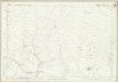
Somerset XLIV.3 (includes: Challcombe; Exmoor) - 25 Inch Map
1 : 2500 Topographic maps Ordnance Survey Ordnance Survey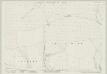
Somerset XLIV.4 (includes: Exmoor) - 25 Inch Map
1 : 2500 Topographic maps Ordnance Survey Ordnance Survey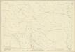
Somerset XLIV.4 (includes: Exmoor) - 25 Inch Map
1 : 2500 Topographic maps Ordnance Survey Ordnance Survey
Somerset XLIV.8 (includes: Exmoor) - 25 Inch Map
1 : 2500 Topographic maps Ordnance Survey Ordnance Survey
Somerset XLIV.8 (includes: Exmoor) - 25 Inch Map
1 : 2500 Topographic maps Ordnance Survey Ordnance Survey
Devon XI.1 (includes: Challcombe; Exmoor; High Bray) - 25 Inch Map
1 : 2500 Topographic maps Ordnance Survey Ordnance Survey
Devon XI.1 (includes: Challcombe; Exmoor; High Bray) - 25 Inch Map
1 : 2500 Topographic maps Ordnance Survey Ordnance Survey
Devonshire XI.NW - OS Six-Inch Map
1 : 10560 Topographic maps Ordnance Survey Ordnance Survey
Devonshire XI.NW - OS Six-Inch Map
1 : 10560 Topographic maps Ordnance Survey Ordnance Survey
Devonshire VII.SW - OS Six-Inch Map
1 : 10560 Topographic maps Ordnance Survey Ordnance Survey
Devonshire VII.SW - OS Six-Inch Map
1 : 10560 Topographic maps Ordnance Survey Ordnance Survey
Devon VII.13 (includes: Challcombe; Exmoor) - 25 Inch Map
1 : 2500 Topographic maps Ordnance Survey Ordnance Survey
Devon VII.13 (includes: Challcombe; Exmoor) - 25 Inch Map
1 : 2500 Topographic maps Ordnance Survey Ordnance Survey
SS74 & Parts of SS75 - OS 1:25,000 Provisional Series Map
1 : 25000 Topographic maps Ordnance Survey Ordnance Survey
SS73 - OS 1:25,000 Provisional Series Map
1 : 25000 Topographic maps Ordnance Survey Ordnance Survey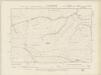
Devonshire VII.SE - OS Six-Inch Map
1 : 10560 Topographic maps Ordnance Survey Ordnance Survey
Devonshire VII.SE - OS Six-Inch Map
1 : 10560 Topographic maps Ordnance Survey Ordnance Survey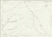
Devon XI.5 (includes: Challcombe; Exmoor; High Bray) - 25 Inch Map
1 : 2500 Topographic maps Ordnance Survey Ordnance Survey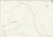
Devon XI.5 (includes: Challcombe; Exmoor; High Bray) - 25 Inch Map
1 : 2500 Topographic maps Ordnance Survey Ordnance Survey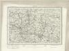
Barnstaple (Outline) - OS One-Inch Revised New Series
1 : 63360 Topographic maps Ordnance Survey Ordnance Survey
Barnstaple (Hills) - OS One-Inch Revised New Series
1 : 63360 Topographic maps Ordnance Survey Ordnance Survey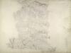
North Molton, Devon
Much of this drawing,is dominated by,the open land of the downs.,Relief is indicated by shading and brushwork interlining ('hachures') but there is no numerical,record of trigonometrical altitudes. Paths on the moor are distinguished from roads by their pecked lines; roads,through villages are indicated by parallel lines. Hewitt, John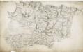
Barnstaple, Devon
The indication of land relief and attention to communication routes on this plan conform to the military and cartographic standards employed by the West Country survey. The south of England was the area most vulnerable to invasion, especially during the Napoleonic conflicts between 1793 and 1815. Accurate mapping of the Devonshire coastline was, therefore, of great military significance. Towards the left of the plan, the sand dunes of Braunton Burrows stretch southwards from the sea at Barnstaple Bay towards Appledore and Bideford.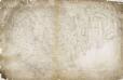
South Molton, Devon
This relief on this drawing,is indicated by dense interlining ('hachures'), with,the summits of hills left blank. The drawing has been made on three pieces of paper mounted as one sheet., Dirty, worn and creased, the manuscript is difficult to decipher. ,A pencil note at the base of the drawing reads "To survey from * to * as ...by...the Farms as named."