Maps of Stratford-on-Avon
Oxfordshire IV.SE - OS Six-Inch Map
1 : 10560 Topographic maps Ordnance Survey Ordnance Survey
Oxfordshire IV.SE - OS Six-Inch Map
1 : 10560 Topographic maps Ordnance Survey Ordnance Survey
Oxfordshire IV.SE - OS Six-Inch Map
1 : 10560 Topographic maps Ordnance Survey Ordnance Survey
Warwickshire LIV.SE - OS Six-Inch Map
1 : 10560 Topographic maps Ordnance Survey Ordnance Survey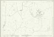
Warwickshire LIV.11 (includes: Brailes) - 25 Inch Map
1 : 2500 Topographic maps Ordnance Survey Ordnance Survey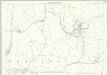
Warwickshire LIV.11 (includes: Brailes) - 25 Inch Map
1 : 2500 Topographic maps Ordnance Survey Ordnance Survey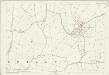
Warwickshire LIV.11 (includes: Brailes) - 25 Inch Map
1 : 2500 Topographic maps Ordnance Survey Ordnance Survey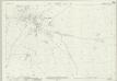
Warwickshire LIV.15 (includes: Brailes; Sutton Under Brailes) - 25 Inch Map
1 : 2500 Topographic maps Ordnance Survey Ordnance Survey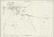
Warwickshire LIV.15 (includes: Brailes; Sutton Under Brailes) - 25 Inch Map
1 : 2500 Topographic maps Ordnance Survey Ordnance Survey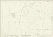
Oxfordshire IV.16 (includes: Brailes; Sibford Gower) - 25 Inch Map
1 : 2500 Topographic maps Ordnance Survey Ordnance Survey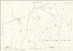
Oxfordshire IV.16 (includes: Brailes; Sibford Gower) - 25 Inch Map
1 : 2500 Topographic maps Ordnance Survey Ordnance Survey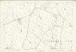
Oxfordshire IV.16 (includes: Brailes; Sibford Gower) - 25 Inch Map
1 : 2500 Topographic maps Ordnance Survey Ordnance Survey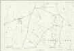
Warwickshire LIV.16 (includes: Brailes; Sibford Gower) - 25 Inch Map
1 : 2500 Topographic maps Ordnance Survey Ordnance Survey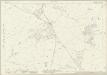
Oxfordshire IV.12 (includes: Brailes; Compton Wynyates; Epwell; Sibford Gower) - 25 Inch Map
1 : 2500 Topographic maps Ordnance Survey Ordnance Survey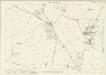
Oxfordshire IV.12 (includes: Brailes; Compton Wynyates; Epwell; Sibford Gower) - 25 Inch Map
1 : 2500 Topographic maps Ordnance Survey Ordnance Survey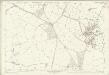
Oxfordshire IV.12 (includes: Brailes; Compton Wynyates; Epwell; Sibford Gower) - 25 Inch Map
1 : 2500 Topographic maps Ordnance Survey Ordnance Survey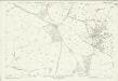
Warwickshire LIV.12 (includes: Brailes; Compton Wynyates; Epwell; Sibford Gower) - 25 Inch Map
1 : 2500 Topographic maps Ordnance Survey Ordnance Survey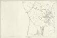
Oxfordshire IV.12 (includes: Brailes; Compton Wynyates; Epwell; Sibford Gower) - 25 Inch Map
1 : 2500 Topographic maps Ordnance Survey Ordnance Survey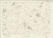
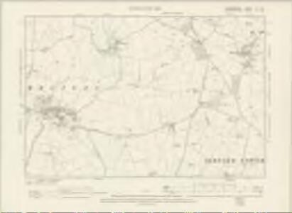
Oxfordshire IV - OS Six-Inch Map
1 : 10560 Topographic maps Ordnance Survey Ordnance Survey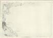
Oxfordshire IV - OS Six-Inch Map
1 : 10560 Topographic maps Ordnance Survey Ordnance Survey
SP33 - OS 1:25,000 Provisional Series Map
1 : 25000 Topographic maps Ordnance Survey Ordnance Survey
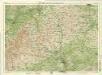
Shipston-on-Stour
1 : 31680 This area at the edge of the Cotswolds is dominated by enclosed farmland. Depicted at top left is the Fosse Way, the old Roman road running from Exeter to Lincoln, via Bath, Cirencester and Leicester (where it intersected the Watling Street from London).
Banbury - OS One-Inch Map
1 : 63360 Topographic maps Ordnance Survey Ordnance Survey
A new improved map of Oxfordshire
1 Karte : Kupferdruck ; 69 x 51 cm Kitchin; Hinton sold by J. Hinton at the Kings Arms in St. Pauls Church Yard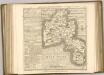
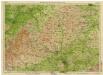
Oxford, Sheet 24 - Bartholomew's "Half Inch to the Mile Maps" of England & Wales
1 : 126720 Topographic maps Bartholomew, John George John Bartholomew & Co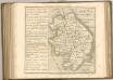
England & Wales [Bartholomew's "Half-inch to the mile" Map of]
J. Bartholomew
Oxonium comitatus vulgo Oxford Shire
1 Karte : Kupferdruck ; 36 x 47 cm Valck; Schenk apud Gerardum Valk et Petrum Schenk