Maps of Essex
Essex nXLVIII.SE - OS Six-Inch Map
1 : 10560 Topographic maps Ordnance Survey Ordnance Survey
Essex nXLVIII.SE - OS Six-Inch Map
1 : 10560 Topographic maps Ordnance Survey Ordnance Survey
Essex XLVIII.NW - OS Six-Inch Map
1 : 10560 Topographic maps Ordnance Survey Ordnance Survey
Essex (New Series 1913-) n XLVIII.16 (includes: St Osyth) - 25 Inch Map
1 : 2500 Topographic maps Ordnance Survey Ordnance Survey
Essex (New Series 1913-) n XLVIII.15 (includes: St Osyth) - 25 Inch Map
1 : 2500 Topographic maps Ordnance Survey Ordnance Survey
Essex (New Series 1913-) n XLVIII.12 (includes: St Osyth) - 25 Inch Map
1 : 2500 Topographic maps Ordnance Survey Ordnance Survey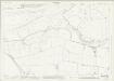
Essex (New Series 1913-) n XLVIII.11 (includes: Brightlingsea; St Osyth) - 25 Inch Map
1 : 2500 Topographic maps Ordnance Survey Ordnance Survey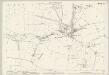
Essex (1st Ed/Rev 1862-96) XLVIII.1 (includes: St Osyth) - 25 Inch Map
1 : 2500 Topographic maps Ordnance Survey Ordnance Survey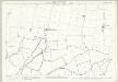
Essex (1st Ed/Rev 1862-96) XLVIII.5 (includes: St Osyth) - 25 Inch Map
1 : 2500 Topographic maps Ordnance Survey Ordnance Survey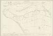
Essex (1st Ed/Rev 1862-96) XLVII.4 (includes: Brightlingsea; St Osyth) - 25 Inch Map
1 : 2500 Topographic maps Ordnance Survey Ordnance Survey
Essex (1st Ed/Rev 1862-96) XLVII.8 (includes: St Osyth) - 25 Inch Map
1 : 2500 Topographic maps Ordnance Survey Ordnance Survey
Essex XLVII.NE - OS Six-Inch Map
1 : 10560 Topographic maps Ordnance Survey Ordnance Survey
Essex (1st Ed/Rev 1862-96) XLVIII.2 (includes: Great Clacton; St Osyth) - 25 Inch Map
1 : 2500 Topographic maps Ordnance Survey Ordnance Survey
Essex (1st Ed/Rev 1862-96) XLVIII.6 (includes: Great Clacton; St Osyth) - 25 Inch Map
1 : 2500 Topographic maps Ordnance Survey Ordnance Survey
TM11 & Parts of TM21 - OS 1:25,000 Provisional Series Map
1 : 25000 Topographic maps Ordnance Survey Ordnance Survey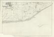
Essex XLVIII (XLVIIIa) - OS Six-Inch Map
1 : 10560 Topographic maps Ordnance Survey Ordnance Survey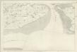
Essex XLVII - OS Six-Inch Map
1 : 10560 Topographic maps Ordnance Survey Ordnance Survey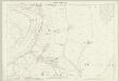
Essex (1st Ed/Rev 1862-96) XXXVIII.13 (includes: Brightlingsea; Great Bentley; St Osyth; Thorrington) - 25 Inch Map
1 : 2500 Topographic maps Ordnance Survey Ordnance Survey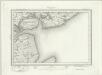
Brightlingsea (Outline) - OS One-Inch Revised New Series
1 : 63360 Topographic maps Ordnance Survey Ordnance Survey
Brightlingsea (Hills) - OS One-Inch Revised New Series
1 : 63360 Topographic maps Ordnance Survey Ordnance Survey
Ipswich
1 : 31680 This drawing of parts of Essex and Suffolk is made up from four conjoined sheets mounted on stiff card. Verron's reputation as a surveyor suffered over the course of the survey. A letter from Survey Superintendent, William Mudge, dated 11 October 1820, reads: "Mr Stanley is going with me ...to Woodbridge to examine what is necessary to be done with Mr Verron's Plans...I apprehend they are much worse than... I expected." Verron
Southend-On-Sea - OS One-Inch Map
1 : 63360 Topographic maps Ordnance Survey Ordnance Survey
Colchester - OS One-Inch Map
1 : 63360 Topographic maps Ordnance Survey Ordnance Survey
Ipswitch - OS One-Inch Map
1 : 63360 Topographic maps Ordnance Survey Ordnance Survey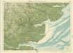
Essex, Sheet 26 - Bartholomew's "Half Inch to the Mile Maps" of England & Wales
1 : 126720 Topographic maps Bartholomew, John George John Bartholomew & Co
Essex
1 : 200000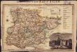
Langley's new map of Essex
1 : 488000
Essex actually surveyed with the several Roads from London &c. ...
1 : 191000
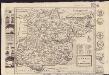
A mapp of ye county of Essex, with its hundreds
1 : 250000