Maps of Hertfordshire
Essex nXLII.SW - OS Six-Inch Map
1 : 10560 Topographic maps Ordnance Survey Ordnance Survey
Essex nXLII.SW - OS Six-Inch Map
1 : 10560 Topographic maps Ordnance Survey Ordnance Survey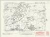
Essex nXLII.SW - OS Six-Inch Map
1 : 10560 Topographic maps Ordnance Survey Ordnance Survey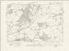
Essex nXLII.SW - OS Six-Inch Map
1 : 10560 Topographic maps Ordnance Survey Ordnance Survey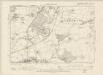
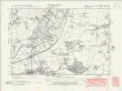
Hertfordshire XXXI.SW - OS Six-Inch Map
1 : 10560 Topographic maps Ordnance Survey Ordnance Survey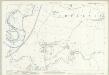
Essex (1st Ed/Rev 1862-96) XLI.3 (includes: Harlow; Sawbridgeworth; Sheering) - 25 Inch Map
1 : 2500 Topographic maps Ordnance Survey Ordnance Survey
Essex (New Series 1913-) n XLII.14 (includes: Harlow; Matching; Sheering) - 25 Inch Map
1 : 2500 Topographic maps Ordnance Survey Ordnance Survey
Essex (New Series 1913-) n XLII.13 (includes: Harlow; Netteswell; Sawbridgeworth) - 25 Inch Map
1 : 2500 Topographic maps Ordnance Survey Ordnance Survey
Hertfordshire XXXI.13 (includes: Harlow; Netteswell; Sawbridgeworth; Sheering) - 25 Inch Map
1 : 2500 Topographic maps Ordnance Survey Ordnance Survey
Essex (New Series 1913-) n XLII.10 (includes: Sheering) - 25 Inch Map
1 : 2500 Topographic maps Ordnance Survey Ordnance Survey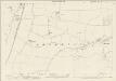
Hertfordshire XXXI.10 (includes: Sawbridgeworth; Sheering) - 25 Inch Map
1 : 2500 Topographic maps Ordnance Survey Ordnance Survey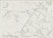
Essex (New Series 1913-) n XLII.9 (includes: High Wych; Sawbridgeworth) - 25 Inch Map
1 : 2500 Topographic maps Ordnance Survey Ordnance Survey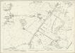
Hertfordshire XXXI.9 (includes: High Wych; Sawbridgeworth; Sheering) - 25 Inch Map
1 : 2500 Topographic maps Ordnance Survey Ordnance Survey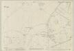
Essex (1st Ed/Rev 1862-96) XLI.2 (includes: Harlow; High Wych; Netteswell; Sawbridgeworth) - 25 Inch Map
1 : 2500 Topographic maps Ordnance Survey Ordnance Survey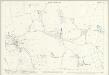
Essex (1st Ed/Rev 1862-96) XLI.7 (includes: Harlow; Matching) - 25 Inch Map
1 : 2500 Topographic maps Ordnance Survey Ordnance Survey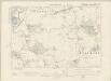
Essex XLI.NE - OS Six-Inch Map
1 : 10560 Topographic maps Ordnance Survey Ordnance Survey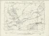
Essex XLI.NW - OS Six-Inch Map
1 : 10560 Topographic maps Ordnance Survey Ordnance Survey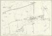
Essex (1st Ed/Rev 1862-96) XLI.6 (includes: Harlow; Netteswell; Sawbridgeworth) - 25 Inch Map
1 : 2500 Topographic maps Ordnance Survey Ordnance Survey
Essex (1st Ed/Rev 1862-96) XXXI.15 (includes: Sawbridgeworth; Sheering) - 25 Inch Map
1 : 2500 Topographic maps Ordnance Survey Ordnance Survey
Essex (1st Ed/Rev 1862-96) XLI.4 (includes: Hatfield Broad Oak; Matching; Sheering) - 25 Inch Map
1 : 2500 Topographic maps Ordnance Survey Ordnance Survey
Essex nXLII - OS Six-Inch Map
1 : 10560 Topographic maps Ordnance Survey Ordnance Survey
Hertfordshire XXXI - OS Six-Inch Map
1 : 10560 Topographic maps Ordnance Survey Ordnance Survey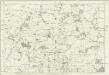
Essex XLI - OS Six-Inch Map
1 : 10560 Topographic maps Ordnance Survey Ordnance Survey
TL41 - OS 1:25,000 Provisional Series Map
1 : 25000 Topographic maps Ordnance Survey Ordnance Survey
Essex XXXI.SE - OS Six-Inch Map
1 : 10560 Topographic maps Ordnance Survey Ordnance Survey
Essex (1st Ed/Rev 1862-96) XLI.8 (includes: Matching) - 25 Inch Map
1 : 2500 Topographic maps Ordnance Survey Ordnance Survey
Essex (1st Ed/Rev 1862-96) XXXI.16 (includes: Hatfield Broad Oak; Little Hallingbury; Sawbridgeworth; Sheering) - 25 Inch Map
1 : 2500 Topographic maps Ordnance Survey Ordnance Survey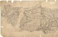
Epping
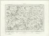
Pencil lines radiating from trigonometrical stations cover this drawing. They show the angles used for measuring distances and plotting topographical features. To the left of the map on Chestnut Common, the word 'flag' denotes the site of such a station. Hoddesden Park Wood and surrounding woodland are shown by individual trees with a line at the base, indicating shadow. This laborious technique was often replaced by a more generalised, stippled representation of treetops. The Lee River, running from Standstead at the top of this drawing, branches to form a canal leading down to the Powder Mills, which manufactured Gun Powder for shipping to London. Locks on the canal are shown in red
Epping (Hills) - OS One-Inch Revised New Series
1 : 63360 Topographic maps Ordnance Survey Ordnance Survey