Maps of Nayland-with-Wissington
Essex nXVIII.SW - OS Six-Inch Map
1 : 10560 Topographic maps Ordnance Survey Ordnance Survey
Essex XVIII.NE - OS Six-Inch Map
1 : 10560 Topographic maps Ordnance Survey Ordnance Survey
Essex XVIII.NE - OS Six-Inch Map
1 : 10560 Topographic maps Ordnance Survey Ordnance Survey
Suffolk LXXXVI.NE - OS Six-Inch Map
1 : 10560 Topographic maps Ordnance Survey Ordnance Survey
Essex (New Series 1913-) n XVIII.14 (includes: Boxted; Great Horkesley; Little Horkesley; Nayland with Wissington) - 25 Inch Map
1 : 2500 Topographic maps Ordnance Survey Ordnance Survey
Essex (New Series 1913-) n XVIII.13 (includes: Little Horkesley; Nayland with Wissington; Wormingford) - 25 Inch Map
1 : 2500 Topographic maps Ordnance Survey Ordnance Survey
Essex (New Series 1913-) n XVIII.10 (includes: Great Horkesley; Nayland with Wissington; Stoke By Nayland) - 25 Inch Map
1 : 2500 Topographic maps Ordnance Survey Ordnance Survey
Essex (New Series 1913-) nXVIII.9 & nXVII.12 (includes: Bures St Mary; Nayland with Wissington) - 25 Inch Map
1 : 2500 Topographic maps Ordnance Survey Ordnance Survey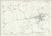
Suffolk LXXXVI.3 (includes: Great Horkesley; Nayland with Wissington; Stoke by Nayland) - 25 Inch Map
1 : 2500 Topographic maps Ordnance Survey Ordnance Survey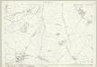
Suffolk LXXXVI.7 (includes: Great Horkesley; Little Horkesley; Nayland with Wissington) - 25 Inch Map
1 : 2500 Topographic maps Ordnance Survey Ordnance Survey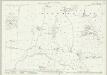
Suffolk LXXXVI.2 (includes: Bures St Mary; Nayland with Wissington; Wormingford) - 25 Inch Map
1 : 2500 Topographic maps Ordnance Survey Ordnance Survey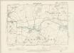
Essex XVIII.NW - OS Six-Inch Map
1 : 10560 Topographic maps Ordnance Survey Ordnance Survey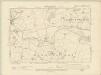
Essex XVIII.NW - OS Six-Inch Map
1 : 10560 Topographic maps Ordnance Survey Ordnance Survey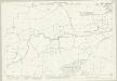
Suffolk LXXXVI.4 (includes: Boxted; Great Horkesley; Nayland with Wissington; Stoke by Nayland) - 25 Inch Map
1 : 2500 Topographic maps Ordnance Survey Ordnance Survey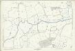
Suffolk LXXXVI.4 (includes: Boxted; Great Horkesley; Nayland with Wissington; Stoke by Nayland) - 25 Inch Map
1 : 2500 Topographic maps Ordnance Survey Ordnance Survey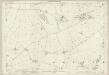
Essex (1st Ed/Rev 1862-96) XVIII.8 (includes: Boxted; Great Horkesley) - 25 Inch Map
1 : 2500 Topographic maps Ordnance Survey Ordnance Survey
TL93 - OS 1:25,000 Provisional Series Map
1 : 25000 Topographic maps Ordnance Survey Ordnance Survey
Essex XVIII - OS Six-Inch Map
1 : 10560 Topographic maps Ordnance Survey Ordnance Survey
Suffolk LXXX.15 (includes: Nayland with Wissington; Stoke by Nayland) - 25 Inch Map
1 : 2500 Topographic maps Ordnance Survey Ordnance Survey
Suffolk LXXX.15 (includes: Nayland with Wissington; Stoke by Nayland) - 25 Inch Map
1 : 2500 Topographic maps Ordnance Survey Ordnance Survey
Suffolk LXXX.14 (includes: Assington; Bures St Mary; Nayland with Wissington; Stoke by Nayland) - 25 Inch Map
1 : 2500 Topographic maps Ordnance Survey Ordnance Survey
Suffolk LXXX.14 (includes: Assington; Bures St Mary; Nayland with Wissington; Stoke by Nayland) - 25 Inch Map
1 : 2500 Topographic maps Ordnance Survey Ordnance Survey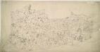
Halstead
1 : 31680 Oval gaps have been left in the forested areas of this unfinished plan to allow place names to be inserted later. The road network is complete, indicating that communication routes were the first aspect of the area to be recorded, a reflection of the military imperative of the Survey. Yeakell, Thomas
Colchester - OS One-Inch Map
1 : 63360 Topographic maps Ordnance Survey Ordnance Survey
Essex, Sheet 26 - Bartholomew's "Half Inch to the Mile Maps" of England & Wales
1 : 126720 Topographic maps Bartholomew, John George John Bartholomew & Co
Essex
1 : 200000
Suffolk, Sheet 20 - Bartholomew's "Half Inch to the Mile Maps" of England & Wales
1 : 126720 Topographic maps Bartholomew, John George John Bartholomew & Co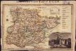
Langley's new map of Essex
1 : 488000
Essex actually surveyed with the several Roads from London &c. ...
1 : 191000