Maps of Babergh
Essex nXVII.SW - OS Six-Inch Map
1 : 10560 Topographic maps Ordnance Survey Ordnance Survey
Essex nXVII.SW - OS Six-Inch Map
1 : 10560 Topographic maps Ordnance Survey Ordnance Survey
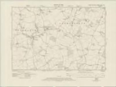
Essex XVII.NE - OS Six-Inch Map
1 : 10560 Topographic maps Ordnance Survey Ordnance Survey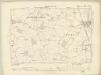
Essex XVII.NE - OS Six-Inch Map
1 : 10560 Topographic maps Ordnance Survey Ordnance Survey
Suffolk LXXXV.NE & LXXXVI.NW - OS Six-Inch Map
1 : 10560 Topographic maps Ordnance Survey Ordnance Survey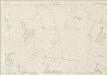
Essex (New Series 1913-) n XVII.14 (includes: Alphamstone; Bures; Pebmarsh; White Colne) - 25 Inch Map
1 : 2500 Topographic maps Ordnance Survey Ordnance Survey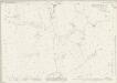
Essex (New Series 1913-) n XVII.13 (includes: Colne Engaine; Pebmarsh) - 25 Inch Map
1 : 2500 Topographic maps Ordnance Survey Ordnance Survey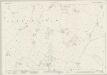
Essex (New Series 1913-) n XVII.10 (includes: Alphamstone; Bures) - 25 Inch Map
1 : 2500 Topographic maps Ordnance Survey Ordnance Survey
Essex (New Series 1913-) n XVII.9 (includes: Alphamstone; Pebmarsh; Twinstead) - 25 Inch Map
1 : 2500 Topographic maps Ordnance Survey Ordnance Survey
Essex (1st Ed/Rev 1862-96) XVII.3 (includes: Alphamstone) - 25 Inch Map
1 : 2500 Topographic maps Ordnance Survey Ordnance Survey
Essex (1st Ed/Rev 1862-96) XVII.7 (includes: Alphamstone; Bures; Colne Engaine; Pebmarsh; White Colne) - 25 Inch Map
1 : 2500 Topographic maps Ordnance Survey Ordnance Survey
Essex (1st Ed/Rev 1862-96) XVII.2 (includes: Little Maplestead; Pebmarsh) - 25 Inch Map
1 : 2500 Topographic maps Ordnance Survey Ordnance Survey
Essex XVII.NW - OS Six-Inch Map
1 : 10560 Topographic maps Ordnance Survey Ordnance Survey
Essex (1st Ed/Rev 1862-96) XVII.6 (includes: Colne Engaine; Pebmarsh) - 25 Inch Map
1 : 2500 Topographic maps Ordnance Survey Ordnance Survey
Suffolk LXXXV.4 (includes: Alphamstone; Bures St Mary; Bures; Lamarsh) - 25 Inch Map
1 : 2500 Topographic maps Ordnance Survey Ordnance Survey
Essex (1st Ed/Rev 1862-96) XVII.8 (includes: Bures; Mount Bures; Wakes Colne; White Colne) - 25 Inch Map
1 : 2500 Topographic maps Ordnance Survey Ordnance Survey
TL83 - OS 1:25,000 Provisional Series Map
1 : 25000 Topographic maps Ordnance Survey Ordnance Survey
Essex XVII - OS Six-Inch Map
1 : 10560 Topographic maps Ordnance Survey Ordnance Survey
Suffolk LXXIX.SE - OS Six-Inch Map
1 : 10560 Topographic maps Ordnance Survey Ordnance Survey
Essex XII.SE - OS Six-Inch Map
1 : 10560 Topographic maps Ordnance Survey Ordnance Survey
Essex XII.SE - OS Six-Inch Map
1 : 10560 Topographic maps Ordnance Survey Ordnance Survey
Suffolk LXXIX.SE - OS Six-Inch Map
1 : 10560 Topographic maps Ordnance Survey Ordnance Survey
Essex (1st Ed/Rev 1862-96) XII.15 (includes: Alphamstone; Twinstead) - 25 Inch Map
1 : 2500 Topographic maps Ordnance Survey Ordnance Survey
Essex (1st Ed/Rev 1862-96) XII.14 (includes: Pebmarsh; Twinstead; Wickham St Paul) - 25 Inch Map
1 : 2500 Topographic maps Ordnance Survey Ordnance Survey
Suffolk LXXIX.16 (includes: Alphamstone; Bures St Mary; Bures; Lamarsh) - 25 Inch Map
1 : 2500 Topographic maps Ordnance Survey Ordnance Survey
Suffolk LXXIX.16 (includes: Alphamstone; Bures St Mary; Bures; Lamarsh) - 25 Inch Map
1 : 2500 Topographic maps Ordnance Survey Ordnance Survey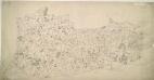
Halstead
1 : 31680 Oval gaps have been left in the forested areas of this unfinished plan to allow place names to be inserted later. The road network is complete, indicating that communication routes were the first aspect of the area to be recorded, a reflection of the military imperative of the Survey. Yeakell, Thomas
Braintree (Hills) - OS One-Inch Revised New Series
1 : 63360 Topographic maps Ordnance Survey Ordnance Survey
Braintree (Outline) - OS One-Inch Revised New Series
1 : 63360 Topographic maps Ordnance Survey Ordnance Survey