Maps of Babergh
Suffolk LXXIX.NW - OS Six-Inch Map
1 : 10560 Topographic maps Ordnance Survey Ordnance Survey
Essex XII.NW - OS Six-Inch Map
1 : 10560 Topographic maps Ordnance Survey Ordnance Survey
Essex (New Series 1913-) n X.16 (includes: Bulmer; Gestingthorpe; Wickham St Paul) - 25 Inch Map
1 : 2500 Topographic maps Ordnance Survey Ordnance Survey
Suffolk LXXIX.7 & 6 (includes: Ballingdon; Bulmer; Great Henny; Little Cornard; Little Henny; Middleton) - 25 Inch Map
1 : 2500 Topographic maps Ordnance Survey Ordnance Survey
Suffolk LXXIX.6 (includes: Ballingdon; Bulmer; Great Henny; Little Henny; Middleton) - 25 Inch Map
1 : 2500 Topographic maps Ordnance Survey Ordnance Survey
Essex (1st Ed/Rev 1862-96) XII.5 (includes: Bulmer; Gestingthorpe; Wickham St Paul) - 25 Inch Map
1 : 2500 Topographic maps Ordnance Survey Ordnance Survey
Suffolk LXXIX.3 & 2 (includes: Ballingdon; Belchamp Walter; Bulmer; Great Cornard; Middleton; Sudbury) - 25 Inch Map
1 : 2500 Topographic maps Ordnance Survey Ordnance Survey
Essex (1st Ed/Rev 1862-96) XII.1 (includes: Belchamp Walter; Bulmer; Gestingthorpe) - 25 Inch Map
1 : 2500 Topographic maps Ordnance Survey Ordnance Survey
Essex (New Series 1913-) n X.12 (includes: Belchamp Walter; Bulmer) - 25 Inch Map
1 : 2500 Topographic maps Ordnance Survey Ordnance Survey
Essex (New Series 1913-) n XI.13 (includes: Ballingdon; Bulmer; Little Henny; Middleton) - 25 Inch Map
1 : 2500 Topographic maps Ordnance Survey Ordnance Survey
Essex nXI.SW - OS Six-Inch Map
1 : 10560 Topographic maps Ordnance Survey Ordnance Survey
Essex (New Series 1913-) n XI.9 (includes: Ballingdon; Bulmer) - 25 Inch Map
1 : 2500 Topographic maps Ordnance Survey Ordnance Survey
Essex (New Series 1913-) n X.15 (includes: Belchamp Walter; Gestingthorpe) - 25 Inch Map
1 : 2500 Topographic maps Ordnance Survey Ordnance Survey
Essex (New Series 1913-) n X.11 (includes: Belchamp Otten; Belchamp Walter; Little Yeldham) - 25 Inch Map
1 : 2500 Topographic maps Ordnance Survey Ordnance Survey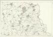
Essex XII - OS Six-Inch Map
1 : 10560 Topographic maps Ordnance Survey Ordnance Survey
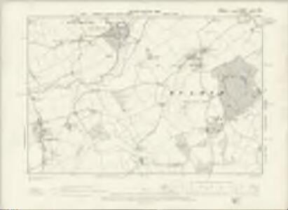
TL83 - OS 1:25,000 Provisional Series Map
1 : 25000 Topographic maps Ordnance Survey Ordnance Survey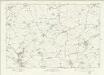
Essex nX - OS Six-Inch Map
1 : 10560 Topographic maps Ordnance Survey Ordnance Survey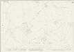
Essex (New Series 1913-) n XVI.4 (includes: Bulmer; Gestingthorpe; Wickham St Paul) - 25 Inch Map
1 : 2500 Topographic maps Ordnance Survey Ordnance Survey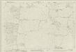
Essex (New Series 1913-) n XVII.1 (includes: Bulmer; Great Henny; Little Henny; Twinstead) - 25 Inch Map
1 : 2500 Topographic maps Ordnance Survey Ordnance Survey
Essex (New Series 1913-) n XVI.3 (includes: Castle Hedingham; Gestingthorpe) - 25 Inch Map
1 : 2500 Topographic maps Ordnance Survey Ordnance Survey
Sudbury (Outline) - OS One-Inch Revised New Series
1 : 63360 Topographic maps Ordnance Survey Ordnance Survey
Sudbury (Hills) - OS One-Inch Revised New Series
1 : 63360 Topographic maps Ordnance Survey Ordnance Survey
Colchester - OS One-Inch Map
1 : 63360 Topographic maps Ordnance Survey Ordnance Survey
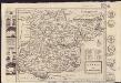
A New and Correct Mapp of Middlesex, Essex and Hertfordshire
Bland, Joseph, Parker, Samuel, Smyth, Payler and Warburton, John
Essex
1 : 200000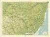
Suffolk, Sheet 20 - Bartholomew's "Half Inch to the Mile Maps" of England & Wales
1 : 126720 Topographic maps Bartholomew, John George John Bartholomew & Co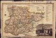
Langley's new map of Essex
1 : 488000
Essex actually surveyed with the several Roads from London &c. ...
1 : 191000
A mapp of ye county of Essex, with its hundreds
1 : 250000