Maps of Hillingdon
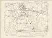
Middlesex XIX.NE - OS Six-Inch Map
1 : 10560 Topographic maps Ordnance Survey Ordnance Survey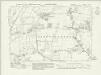
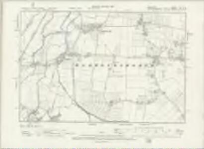
Middlesex XIX.NE - OS Six-Inch Map
1 : 10560 Topographic maps Ordnance Survey Ordnance Survey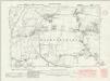
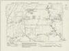
Middlesex XIX.NE - OS Six-Inch Map
1 : 10560 Topographic maps Ordnance Survey Ordnance Survey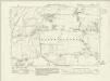
Middlesex XIX.NE - OS Six-Inch Map
1 : 10560 Topographic maps Ordnance Survey Ordnance Survey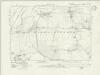
Middlesex XIX.NE - OS Six-Inch Map
1 : 10560 Topographic maps Ordnance Survey Ordnance Survey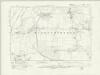
Middlesex XIX.NE - OS Six-Inch Map
1 : 10560 Topographic maps Ordnance Survey Ordnance Survey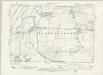
Middlesex XIX.NE - OS Six-Inch Map
1 : 10560 Topographic maps Ordnance Survey Ordnance Survey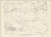
Buckinghamshire LVII.SW - OS Six-Inch Map
1 : 10560 Topographic maps Ordnance Survey Ordnance Survey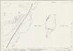
Buckinghamshire LVII.5 & 9 (includes: Iver; Yiewsley and West Drayton) - 25 Inch Map
1 : 2500 Topographic maps Ordnance Survey Ordnance Survey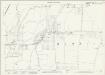
Buckinghamshire LVII.9 (includes: Yiewsley and West Drayton) - 25 Inch Map
1 : 2500 Topographic maps Ordnance Survey Ordnance Survey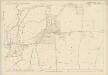
Buckinghamshire LVII.9 (includes: Yiewsley and West Drayton) - 25 Inch Map
1 : 2500 Topographic maps Ordnance Survey Ordnance Survey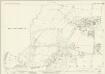
Middlesex XIX.3 (includes: Iver; Yiewsley and West Drayton) - 25 Inch Map
1 : 2500 Topographic maps Ordnance Survey Ordnance Survey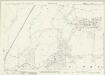
Middlesex XIX.3 (includes: Iver; Yiewsley and West Drayton) - 25 Inch Map
1 : 2500 Topographic maps Ordnance Survey Ordnance Survey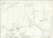
Middlesex XIX.7 (includes: Stanwell; Yiewsley and West Drayton) - 25 Inch Map
1 : 2500 Topographic maps Ordnance Survey Ordnance Survey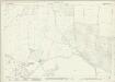
Middlesex XIX.7 (includes: Stanwell; Yiewsley and West Drayton) - 25 Inch Map
1 : 2500 Topographic maps Ordnance Survey Ordnance Survey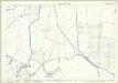
Middlesex XIX.7 (includes: Stanwell; Yiewsley and West Drayton) - 25 Inch Map
1 : 2500 Topographic maps Ordnance Survey Ordnance Survey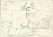
Middlesex XIX.4 (includes: Harlington; Yiewsley and West Drayton) - 25 Inch Map
1 : 2500 Topographic maps Ordnance Survey Ordnance Survey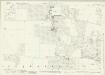
Middlesex XIX.4 (includes: Harlington; Yiewsley and West Drayton) - 25 Inch Map
1 : 2500 Topographic maps Ordnance Survey Ordnance Survey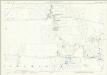
Middlesex XIX.4 (includes: Harlington; Yiewsley and West Drayton) - 25 Inch Map
1 : 2500 Topographic maps Ordnance Survey Ordnance Survey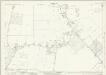
Middlesex XIX.8 (includes: Yiewsley and West Drayton) - 25 Inch Map
1 : 2500 Topographic maps Ordnance Survey Ordnance Survey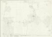
Middlesex XIX.8 (includes: Yiewsley and West Drayton) - 25 Inch Map
1 : 2500 Topographic maps Ordnance Survey Ordnance Survey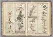
Egham to Binfield, Hounslow to Windsor.
1 : 63360 Cary, John
Plan of Poyle Park Estate, Colnbrook, nr Windsor
Charles E. Barrow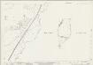
Buckinghamshire LVII.5 & 9 (includes: Iver; Yiewsley and West Drayton) - 25 Inch Map
1 : 2500 Topographic maps Ordnance Survey Ordnance Survey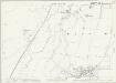
Buckinghamshire LVII.5 (includes: Iver; Yiewsley and West Drayton) - 25 Inch Map
1 : 2500 Topographic maps Ordnance Survey Ordnance Survey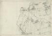
Middlesex XIX - OS Six-Inch Map
1 : 10560 Topographic maps Ordnance Survey Ordnance Survey
TQ07 - OS 1:25,000 Provisional Series Map
1 : 25000 Topographic maps Ordnance Survey Ordnance Survey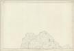
Buckinghamshire LVII - OS Six-Inch Map
1 : 10560 Topographic maps Ordnance Survey Ordnance Survey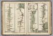
Brentford to Bagshot, Virginia Water to Oakingham.
1 : 63360 Cary, John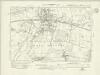
Buckinghamshire LVII.NW - OS Six-Inch Map
1 : 10560 Topographic maps Ordnance Survey Ordnance Survey