Maps of Bristol
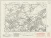
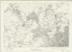
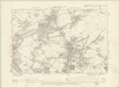
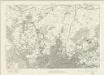
Gloucestershire LXXI.NE - OS Six-Inch Map
1 : 10560 Topographic maps Ordnance Survey Ordnance Survey
Gloucestershire LXXI.NE - OS Six-Inch Map
1 : 10560 Topographic maps Ordnance Survey Ordnance Survey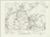
Gloucestershire LXXI.NE - OS Six-Inch Map
1 : 10560 Topographic maps Ordnance Survey Ordnance Survey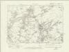
Gloucestershire LXXI.NE - OS Six-Inch Map
1 : 10560 Topographic maps Ordnance Survey Ordnance Survey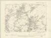
Gloucestershire LXXI.NE - OS Six-Inch Map
1 : 10560 Topographic maps Ordnance Survey Ordnance Survey
Gloucestershire LXXI.NE - OS Six-Inch Map
1 : 10560 Topographic maps Ordnance Survey Ordnance Survey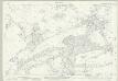
Gloucestershire LXXI.3 (includes: Bristol) - 25 Inch Map
1 : 2500 Topographic maps Ordnance Survey Ordnance Survey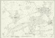
Gloucestershire LXXI.3 (includes: Bristol) - 25 Inch Map
1 : 2500 Topographic maps Ordnance Survey Ordnance Survey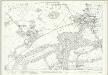
Gloucestershire LXXI.3 (includes: Bristol) - 25 Inch Map
1 : 2500 Topographic maps Ordnance Survey Ordnance Survey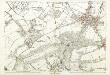
Gloucestershire LXXI.3 (includes: Bristol) - 25 Inch Map
1 : 2500 Topographic maps Ordnance Survey Ordnance Survey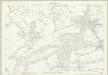
Gloucestershire LXXI.3 (includes: Bristol) - 25 Inch Map
1 : 2500 Topographic maps Ordnance Survey Ordnance Survey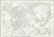
Gloucestershire LXXI.7 (includes: Abbots Leigh; Bristol) - 25 Inch Map
1 : 2500 Topographic maps Ordnance Survey Ordnance Survey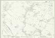
Gloucestershire LXXI.7 (includes: Abbots Leigh; Bristol) - 25 Inch Map
1 : 2500 Topographic maps Ordnance Survey Ordnance Survey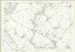
Gloucestershire LXXI.7 (includes: Abbots Leigh; Bristol) - 25 Inch Map
1 : 2500 Topographic maps Ordnance Survey Ordnance Survey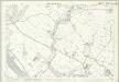
Gloucestershire LXXI.7 (includes: Abbots Leigh; Bristol) - 25 Inch Map
1 : 2500 Topographic maps Ordnance Survey Ordnance Survey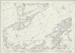
Gloucestershire LXXI.4 (includes: Bristol; Filton) - 25 Inch Map
1 : 2500 Topographic maps Ordnance Survey Ordnance Survey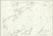
Gloucestershire LXXI.4 (includes: Bristol; Filton) - 25 Inch Map
1 : 2500 Topographic maps Ordnance Survey Ordnance Survey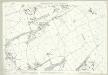
Gloucestershire LXXI.4 (includes: Bristol; Filton) - 25 Inch Map
1 : 2500 Topographic maps Ordnance Survey Ordnance Survey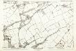
Gloucestershire LXXI.4 (includes: Bristol; Filton) - 25 Inch Map
1 : 2500 Topographic maps Ordnance Survey Ordnance Survey
Gloucestershire LXXI.4 (includes: Bristol; Filton) - 25 Inch Map
1 : 2500 Topographic maps Ordnance Survey Ordnance Survey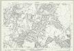
Gloucestershire LXXI.8 (includes: Bristol) - 25 Inch Map
1 : 2500 Topographic maps Ordnance Survey Ordnance Survey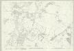
Gloucestershire LXXI.8 (includes: Bristol) - 25 Inch Map
1 : 2500 Topographic maps Ordnance Survey Ordnance Survey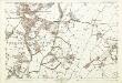
Gloucestershire LXXI.8 (includes: Bristol) - 25 Inch Map
1 : 2500 Topographic maps Ordnance Survey Ordnance Survey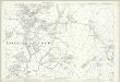
Gloucestershire LXXI.8 (includes: Bristol) - 25 Inch Map
1 : 2500 Topographic maps Ordnance Survey Ordnance Survey
A plan of the great cavern called Pen Park Hole, in the parish of Westbury
Somerset III - OS Six-Inch Map
1 : 10560 Topographic maps Ordnance Survey Ordnance Survey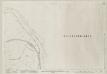
Somerset III.9 (includes: Abbots Leigh; Bristol) - 25 Inch Map
1 : 2500 Topographic maps Ordnance Survey Ordnance Survey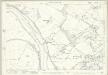
Somerset III.9 (includes: Abbots Leigh; Bristol) - 25 Inch Map
1 : 2500 Topographic maps Ordnance Survey Ordnance Survey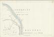
Somerset III.9 (includes: Abbots Leigh; Bristol) - 25 Inch Map
1 : 2500 Topographic maps Ordnance Survey Ordnance Survey