Maps of South Gloucestershire

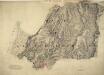
Gloucestershire LXII.NE - OS Six-Inch Map
1 : 10560 Topographic maps Ordnance Survey Ordnance Survey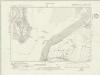
Gloucestershire LXII.NE - OS Six-Inch Map
1 : 10560 Topographic maps Ordnance Survey Ordnance Survey
Gloucestershire LXII.NE - OS Six-Inch Map
1 : 10560 Topographic maps Ordnance Survey Ordnance Survey
Gloucestershire LXII.NE - OS Six-Inch Map
1 : 10560 Topographic maps Ordnance Survey Ordnance Survey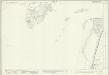
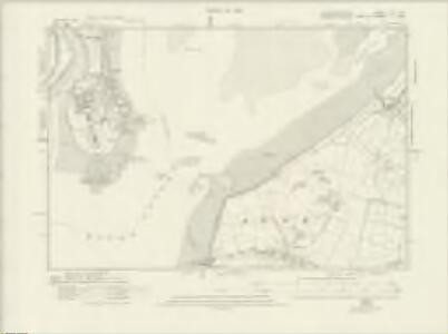
Gloucestershire LXII.7 (includes: Aust; Pilning and Severn Beach; Tidenham) - 25 Inch Map
1 : 2500 Topographic maps Ordnance Survey Ordnance Survey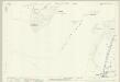
Gloucestershire LXII.7 (includes: Aust; Pilning and Severn Beach; Tidenham) - 25 Inch Map
1 : 2500 Topographic maps Ordnance Survey Ordnance Survey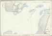
Gloucestershire LXII.7 (includes: Aust; Pilning and Severn Beach; Tidenham) - 25 Inch Map
1 : 2500 Topographic maps Ordnance Survey Ordnance Survey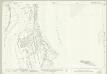
Gloucestershire LXII.3 (includes: Aust; Chepstow; Tidenham) - 25 Inch Map
1 : 2500 Topographic maps Ordnance Survey Ordnance Survey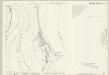
Gloucestershire LXII.3 (includes: Aust; Chepstow; Tidenham) - 25 Inch Map
1 : 2500 Topographic maps Ordnance Survey Ordnance Survey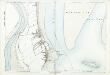
Gloucestershire LXII.3 (includes: Aust; Chepstow; Tidenham) - 25 Inch Map
1 : 2500 Topographic maps Ordnance Survey Ordnance Survey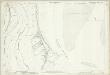
Gloucestershire LXII.3 (includes: Aust; Chepstow; Tidenham) - 25 Inch Map
1 : 2500 Topographic maps Ordnance Survey Ordnance Survey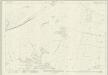
Gloucestershire LXII.8 (includes: Aust) - 25 Inch Map
1 : 2500 Topographic maps Ordnance Survey Ordnance Survey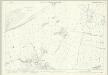
Gloucestershire LXII.8 (includes: Aust) - 25 Inch Map
1 : 2500 Topographic maps Ordnance Survey Ordnance Survey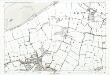
Gloucestershire LXII.8 (includes: Aust) - 25 Inch Map
1 : 2500 Topographic maps Ordnance Survey Ordnance Survey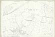
Gloucestershire LXII.8 (includes: Aust) - 25 Inch Map
1 : 2500 Topographic maps Ordnance Survey Ordnance Survey
Gloucestershire LXII.4 (includes: Aust; Oldbury upon Severn) - 25 Inch Map
1 : 2500 Topographic maps Ordnance Survey Ordnance Survey
Gloucestershire LXII.4 (includes: Aust; Oldbury upon Severn) - 25 Inch Map
1 : 2500 Topographic maps Ordnance Survey Ordnance Survey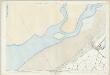
Gloucestershire LXII.4 (includes: Aust; Oldbury upon Severn) - 25 Inch Map
1 : 2500 Topographic maps Ordnance Survey Ordnance Survey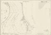
Monmouthshire XXXI.6 & 10 (includes: Aust; Chepstow; Mathern; Pilning and Severn Beach; Tidenham) - 25 Inch Map
1 : 2500 Topographic maps Ordnance Survey Ordnance Survey
Monmouthshire XXXI.6 & 10 (includes: Aust; Chepstow; Mathern; Pilning and Severn Beach; Tidenham) - 25 Inch Map
1 : 2500 Topographic maps Ordnance Survey Ordnance Survey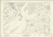
Monmouthshire XXXI - OS Six-Inch Map
1 : 10560 Topographic maps Ordnance Survey Ordnance Survey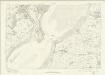
Monmouthshire XXXI - OS Six-Inch Map
1 : 10560 Topographic maps Ordnance Survey Ordnance Survey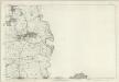
Monmouthshire XXXI - OS Six-Inch Map
1 : 10560 Topographic maps Ordnance Survey Ordnance Survey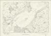
Gloucestershire LXII - OS Six-Inch Map
1 : 10560 Topographic maps Ordnance Survey Ordnance Survey
ST59 - OS 1:25,000 Provisional Series Map
1 : 25000 Topographic maps Ordnance Survey Ordnance Survey
Monmouthshire XXXI.SW - OS Six-Inch Map
1 : 10560 Topographic maps Ordnance Survey Ordnance Survey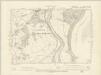
Monmouthshire XXXI.NW - OS Six-Inch Map
1 : 10560 Topographic maps Ordnance Survey Ordnance Survey
Chepstow (Hills) - OS One-Inch Revised New Series
1 : 63360 Topographic maps Ordnance Survey Ordnance Survey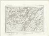
Chepstow (Outline) - OS One-Inch Revised New Series
1 : 63360 Topographic maps Ordnance Survey Ordnance Survey