Maps of South Gloucestershire

Gloucestershire LIV.SE - OS Six-Inch Map
1 : 10560 Topographic maps Ordnance Survey Ordnance Survey
Gloucestershire LIV.SE - OS Six-Inch Map
1 : 10560 Topographic maps Ordnance Survey Ordnance Survey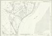
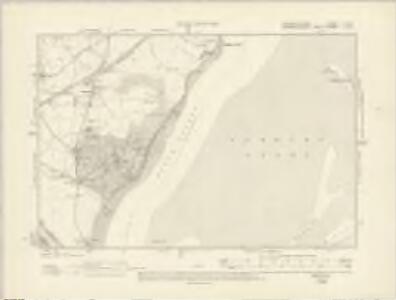
Gloucestershire LIV.15 (includes: Aust; Chepstow; Tidenham) - 25 Inch Map
1 : 2500 Topographic maps Ordnance Survey Ordnance Survey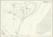
Gloucestershire LIV.15 (includes: Aust; Chepstow; Tidenham) - 25 Inch Map
1 : 2500 Topographic maps Ordnance Survey Ordnance Survey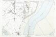
Gloucestershire LIV.15 (includes: Aust; Chepstow; Tidenham) - 25 Inch Map
1 : 2500 Topographic maps Ordnance Survey Ordnance Survey
Gloucestershire LIV.11 (includes: Aust; Oldbury upon Severn; Tidenham) - 25 Inch Map
1 : 2500 Topographic maps Ordnance Survey Ordnance Survey
Gloucestershire LIV.11 (includes: Aust; Oldbury upon Severn; Tidenham) - 25 Inch Map
1 : 2500 Topographic maps Ordnance Survey Ordnance Survey
Gloucestershire LIV.16 (includes: Aust; Oldbury upon Severn) - 25 Inch Map
1 : 2500 Topographic maps Ordnance Survey Ordnance Survey
Gloucestershire LIV.12 (includes: Aust; Oldbury upon Severn; Tidenham) - 25 Inch Map
1 : 2500 Topographic maps Ordnance Survey Ordnance Survey
Gloucestershire LIV.12 (includes: Aust; Oldbury upon Severn; Tidenham) - 25 Inch Map
1 : 2500 Topographic maps Ordnance Survey Ordnance Survey
Gloucestershire LIV.12 (includes: Aust; Oldbury upon Severn; Tidenham) - 25 Inch Map
1 : 2500 Topographic maps Ordnance Survey Ordnance Survey
Monmouthshire XXXI.2 (includes: Aust; Chepstow; Tidenham) - 25 Inch Map
1 : 2500 Topographic maps Ordnance Survey Ordnance Survey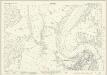
Monmouthshire XXVI.13 & 14 (includes: Aust; Chepstow; St Arvans; Tidenham) - 25 Inch Map
1 : 2500 Topographic maps Ordnance Survey Ordnance Survey
Monmouthshire XXVI.13 & 14 (includes: Aust; Chepstow; St Arvans; Tidenham) - 25 Inch Map
1 : 2500 Topographic maps Ordnance Survey Ordnance Survey
Gloucestershire LIV - OS Six-Inch Map
1 : 10560 Topographic maps Ordnance Survey Ordnance Survey
ST59 - OS 1:25,000 Provisional Series Map
1 : 25000 Topographic maps Ordnance Survey Ordnance Survey
Monmouthshire XXXI - OS Six-Inch Map
1 : 10560 Topographic maps Ordnance Survey Ordnance Survey
Monmouthshire XXXI - OS Six-Inch Map
1 : 10560 Topographic maps Ordnance Survey Ordnance Survey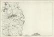
Monmouthshire XXXI - OS Six-Inch Map
1 : 10560 Topographic maps Ordnance Survey Ordnance Survey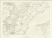
Monmouthshire XXVI - OS Six-Inch Map
1 : 10560 Topographic maps Ordnance Survey Ordnance Survey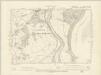
Monmouthshire XXXI.NW - OS Six-Inch Map
1 : 10560 Topographic maps Ordnance Survey Ordnance Survey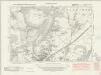
Monmouthshire XXVI.SW - OS Six-Inch Map
1 : 10560 Topographic maps Ordnance Survey Ordnance Survey
Monmouthshire XXVI.SW - OS Six-Inch Map
1 : 10560 Topographic maps Ordnance Survey Ordnance Survey
Monmouthshire XXVI.SW - OS Six-Inch Map
1 : 10560 Topographic maps Ordnance Survey Ordnance Survey
Monmouthshire XXXI.6 & 10 (includes: Aust; Chepstow; Mathern; Pilning and Severn Beach; Tidenham) - 25 Inch Map
1 : 2500 Topographic maps Ordnance Survey Ordnance Survey
Chepstow (Hills) - OS One-Inch Revised New Series
1 : 63360 Topographic maps Ordnance Survey Ordnance Survey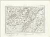
Chepstow (Outline) - OS One-Inch Revised New Series
1 : 63360 Topographic maps Ordnance Survey Ordnance Survey
Chepstow
1 : 31680 Thomas Budgen surveyed the majority of the Welsh plans, and is probably author of this drawing of the Severn Estuary. The plan is a good example of the use of black and red ink to distinguish between wooden and masonry structures. Chepstow Bridge, on the River Wye, is illustrated with red piers and a black roadway. Budgen, Thomas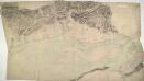
Newport 21
1 : 31680 This drawings depicts the winding course of the River Usk as it flows by the Roman town of Caerleon into the Severn Estuary and the Bristol Channel. Not far from the river mouth lies Newport. The Usk is not navigable except at this point, but the Monmouthshire and Brecon and Abergavenny canals, in part following the valley, carry a small trade up to Brecon. Cardiff, depicted at bottom left, was a town of only 6,000 inhabitants when this plan was produced. Budgen, Charles