Maps of Bedfordshire
Buckinghamshire VI.SW - OS Six-Inch Map
1 : 10560 Topographic maps Ordnance Survey Ordnance Survey
Buckinghamshire VI.SW - OS Six-Inch Map
1 : 10560 Topographic maps Ordnance Survey Ordnance Survey
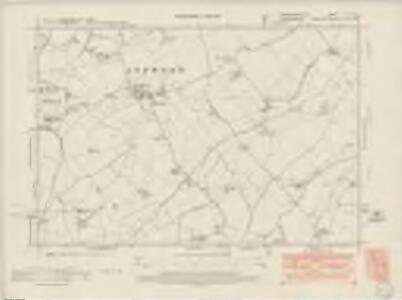
Bedfordshire XV.NE - OS Six-Inch Map
1 : 10560 Topographic maps Ordnance Survey Ordnance Survey
Bedfordshire XV.NE - OS Six-Inch Map
1 : 10560 Topographic maps Ordnance Survey Ordnance Survey
Bedfordshire XV.NE - OS Six-Inch Map
1 : 10560 Topographic maps Ordnance Survey Ordnance Survey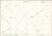
Buckinghamshire VI.14 (includes: Cranfield; Kempston Rural; North Crawley; Stagsden; Wootton) - 25 Inch Map
1 : 2500 Topographic maps Ordnance Survey Ordnance Survey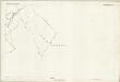
Buckinghamshire VI.14 (includes: Cranfield; Kempston Rural; North Crawley; Stagsden; Wootton) - 25 Inch Map
1 : 2500 Topographic maps Ordnance Survey Ordnance Survey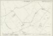
Buckinghamshire VI.10 (includes: Stagsden) - 25 Inch Map
1 : 2500 Topographic maps Ordnance Survey Ordnance Survey
Buckinghamshire VI.10 (includes: Stagsden) - 25 Inch Map
1 : 2500 Topographic maps Ordnance Survey Ordnance Survey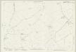
Buckinghamshire VI.13 (includes: Astwood; Hardmead; North Crawley) - 25 Inch Map
1 : 2500 Topographic maps Ordnance Survey Ordnance Survey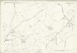
Buckinghamshire VI.13 (includes: Astwood; Hardmead; North Crawley) - 25 Inch Map
1 : 2500 Topographic maps Ordnance Survey Ordnance Survey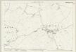
Buckinghamshire VI.9 (includes: Astwood; Hardmead) - 25 Inch Map
1 : 2500 Topographic maps Ordnance Survey Ordnance Survey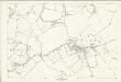
Buckinghamshire VI.9 (includes: Astwood; Hardmead) - 25 Inch Map
1 : 2500 Topographic maps Ordnance Survey Ordnance Survey
Bedfordshire XV.8 (includes: Astwood; Cranfield; Hardmead; Kempston Rural; North Crawley; Stagsden) - 25 Inch Map
1 : 2500 Topographic maps Ordnance Survey Ordnance Survey
Bedfordshire XV.8 (includes: Astwood; Cranfield; Hardmead; Kempston Rural; North Crawley; Stagsden) - 25 Inch Map
1 : 2500 Topographic maps Ordnance Survey Ordnance Survey
Bedfordshire XV.4 (includes: Astwood; Stagsden) - 25 Inch Map
1 : 2500 Topographic maps Ordnance Survey Ordnance Survey
Bedfordshire XV.4 (includes: Astwood; Stagsden) - 25 Inch Map
1 : 2500 Topographic maps Ordnance Survey Ordnance Survey
Bedfordshire XVI.5 (includes: Kempston Rural; North Crawley; Stagsden; Wootton) - 25 Inch Map
1 : 2500 Topographic maps Ordnance Survey Ordnance Survey
Bedfordshire XVI.5 (includes: Kempston Rural; North Crawley; Stagsden; Wootton) - 25 Inch Map
1 : 2500 Topographic maps Ordnance Survey Ordnance Survey
Bedfordshire XVI.5 (includes: Kempston Rural; North Crawley; Stagsden; Wootton) - 25 Inch Map
1 : 2500 Topographic maps Ordnance Survey Ordnance Survey
Bedfordshire XVI.1 (includes: Kempston Rural; Stagsden) - 25 Inch Map
1 : 2500 Topographic maps Ordnance Survey Ordnance Survey
Bedfordshire XVI.1 (includes: Kempston Rural; Stagsden) - 25 Inch Map
1 : 2500 Topographic maps Ordnance Survey Ordnance Survey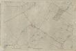
Bedfordshire XVI.1 (includes: Kempston Rural; Stagsden) - 25 Inch Map
1 : 2500 Topographic maps Ordnance Survey Ordnance Survey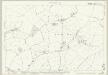
Bedfordshire XV.12 (includes: Cranfield; Kempston Rural; Marston Moretaine; North Crawley) - 25 Inch Map
1 : 2500 Topographic maps Ordnance Survey Ordnance Survey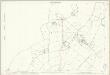
Bedfordshire XV.12 (includes: Cranfield; Kempston Rural; Marston Moretaine; North Crawley) - 25 Inch Map
1 : 2500 Topographic maps Ordnance Survey Ordnance Survey
Buckinghamshire VI (inset XI) - OS Six-Inch Map
1 : 10560 Topographic maps Ordnance Survey Ordnance Survey
SP94 - OS 1:25,000 Provisional Series Map
1 : 25000 Topographic maps Ordnance Survey Ordnance Survey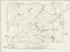
Bedfordshire XVI.NW - OS Six-Inch Map
1 : 10560 Topographic maps Ordnance Survey Ordnance Survey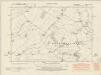
Bedfordshire XVI.NW - OS Six-Inch Map
1 : 10560 Topographic maps Ordnance Survey Ordnance Survey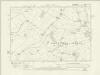
Bedfordshire XVI.NW - OS Six-Inch Map
1 : 10560 Topographic maps Ordnance Survey Ordnance Survey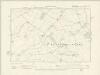
Bedfordshire XVI.NW - OS Six-Inch Map
1 : 10560 Topographic maps Ordnance Survey Ordnance Survey