Maps of Wareham St. Martin
Dorset XLIX.NE - OS Six-Inch Map
1 : 10560 Topographic maps Ordnance Survey Ordnance Survey
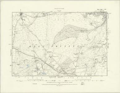
Dorset XLIX.NE - OS Six-Inch Map
1 : 10560 Topographic maps Ordnance Survey Ordnance Survey
Dorset XLIX.NE - OS Six-Inch Map
1 : 10560 Topographic maps Ordnance Survey Ordnance Survey
Dorset XLIX.NE - OS Six-Inch Map
1 : 10560 Topographic maps Ordnance Survey Ordnance Survey
Dorset XLIX.4 (includes: Arne; Wareham Lady St Mary; Wareham St Martin) - 25 Inch Map
1 : 2500 Topographic maps Ordnance Survey Ordnance Survey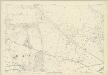
Dorset XLIX.4 (includes: Arne; Wareham Lady St Mary; Wareham St Martin) - 25 Inch Map
1 : 2500 Topographic maps Ordnance Survey Ordnance Survey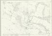
Dorset XLIX.3 (includes: Arne; Bere Regis; East Stoke; Wareham St Martin) - 25 Inch Map
1 : 2500 Topographic maps Ordnance Survey Ordnance Survey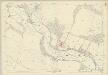
Dorset XLIX.3 (includes: Arne; Bere Regis; East Stoke; Wareham St Martin) - 25 Inch Map
1 : 2500 Topographic maps Ordnance Survey Ordnance Survey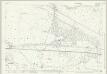
Dorset XLIX.7 (includes: Arne; East Stoke) - 25 Inch Map
1 : 2500 Topographic maps Ordnance Survey Ordnance Survey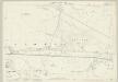
Dorset XLIX.7 (includes: Arne; East Stoke) - 25 Inch Map
1 : 2500 Topographic maps Ordnance Survey Ordnance Survey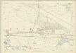
Dorset XLIX.7 (includes: Arne; East Stoke) - 25 Inch Map
1 : 2500 Topographic maps Ordnance Survey Ordnance Survey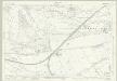
Dorset XLIX.8 (includes: Arne; East Stoke; Wareham Lady St Mary; Wareham St Martin) - 25 Inch Map
1 : 2500 Topographic maps Ordnance Survey Ordnance Survey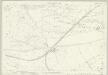
Dorset XLIX.8 (includes: Arne; East Stoke; Wareham Lady St Mary; Wareham St Martin) - 25 Inch Map
1 : 2500 Topographic maps Ordnance Survey Ordnance Survey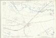
Dorset XLIX.8 (includes: Arne; East Stoke; Wareham Lady St Mary; Wareham St Martin) - 25 Inch Map
1 : 2500 Topographic maps Ordnance Survey Ordnance Survey
SY98 - OS 1:25,000 Provisional Series Map
1 : 25000 Topographic maps Ordnance Survey Ordnance Survey
Dorchester (Hills) - OS One-Inch Revised New Series
1 : 63360 Topographic maps Ordnance Survey Ordnance Survey
Dorchester (Outline) - OS One-Inch Revised New Series
1 : 63360 Topographic maps Ordnance Survey Ordnance Survey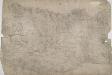
Dorchester
This drawing is very worn with some areas missing. The Ordnance Survey Letter Book notes that Mr Budgen was to be at Dorchester "on a new piece of work on the 29th Day of this Month", allowing us to be fairly certain of the authorship of this drawing. Maiden Castle - at 47 acres the largest iron age hillfort in Europe - is marked in the bottom left. The lines describing it follow the actual shape of the earthworks. Budgen, Charles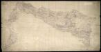
Weymouth
This drawing covers the coast of Weymouth Bay and the Isle of Portland. Lighthouses are marked on the tip of the island. Red lines denote stone walls. Sandsfoot Castle and Portland Castle are shown by blocks of red ink. These were among of a series of castles built by Henry VIII as defence against Spain and France after his divorce from the Catholic Catherine of Aragon and his breaking of ties with Rome. Chalbury Hillfort is indicated above Weymouth Bay. Archaeological sites were of interest to many of the draughtsmen and were often included even before it became obligatory to do so in 1816. The boundary with Purbeck is indicated by a red pecked line. Budgen, Charles
Poole
This drawing covers the coastline of Swanage and Studland. Reflecting the military impetus of the Ordanance Survey, a battery and signal point are marked on opposite sides of Swanage Bay. The islands and sands around Poole are recorded in detail and the various channels marked and named. There is a network of red-ink lines around Swanage. These are probably stone walls delineating field boundaries, but could also be corrections added at a later date. On the right-hand edge of the manuscript, a note records the scale of the drawing, the date of execution and the names of the surveyors. The note is pasted on and may have been trimmed from the margins of the drawing and repositioned. A red pecked line, starting at Allam Chine on North Shore, marks the county boundary between Dorset and Hampshire. Budgen, Charles
Bournemouth - OS One-Inch Map
1 : 63360 Topographic maps Ordnance Survey Ordnance Survey
Dorchester - OS One-Inch Map
1 : 63360 Topographic maps Ordnance Survey Ordnance Survey
Cary's Improved Map of England and Wales
Cary, George, & Cary, John London : G. & J. Cary
Comitatus Dorcestria, sive Dorsettia ; vulgo anglice Dorset Shire
1 : 145000
Comitatus Dorcestria vulgo anglice Dorset Shire
1 : 170000 Amstelodami : apud Joannem Janssonium
An accurate map of Dorset Shire divided into hundreds
1 : 222000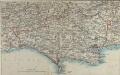
Map of Dorsetshire
This map comes from the Abbott's Illustrated Counties series of county guides: Dorsetshire, its history, antiquities, places of interest, etc a complete, concise and exhaustive story of Dorset from the earliest times to the present day' The Guide Printing & Publishing Co.
Dorset, Sheet 34 - Bartholomew's "Half Inch to the Mile Maps" of England & Wales
1 : 126720 Topographic maps Bartholomew, John George John Bartholomew & Co
COMITATVS | DORCESTRIA, | sive | DORSETTIA; | Vulgo Anglice | DORSET SHIRE.
[Amsterdam : Joan Blaeu]