Maps of Wiltshire

Dorset IX.NE - OS Six-Inch Map
1 : 10560 Topographic maps Ordnance Survey Ordnance Survey
Dorset IX.NE - OS Six-Inch Map
1 : 10560 Topographic maps Ordnance Survey Ordnance Survey
Hampshire & Isle of Wight LIVA.NW - OS Six-Inch Map
1 : 10560 Topographic maps Ordnance Survey Ordnance Survey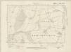
Hampshire & Isle of Wight LIVA.NW - OS Six-Inch Map
1 : 10560 Topographic maps Ordnance Survey Ordnance Survey
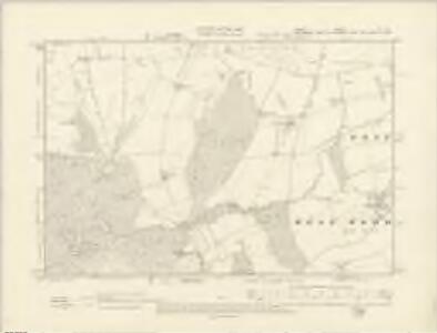
Wiltshire LXXV.NW - OS Six-Inch Map
1 : 10560 Topographic maps Ordnance Survey Ordnance Survey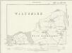
Hampshire & Isle of Wight LIVA.NW - OS Six-Inch Map
1 : 10560 Topographic maps Ordnance Survey Ordnance Survey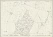
Wiltshire LXXV.1 (includes: Bower Chalke; Ebbesbourne Wake; Pentridge) - 25 Inch Map
1 : 2500 Topographic maps Ordnance Survey Ordnance Survey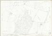
Wiltshire LXXV.1 (includes: Bower Chalke; Ebbesbourne Wake; Pentridge) - 25 Inch Map
1 : 2500 Topographic maps Ordnance Survey Ordnance Survey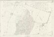
Wiltshire LXXV.1 (includes: Bower Chalke; Ebbesbourne Wake; Pentridge) - 25 Inch Map
1 : 2500 Topographic maps Ordnance Survey Ordnance Survey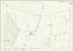
Dorset IX.4 (includes: Bower Chalke; Ebbesbourne Wake; Pentridge) - 25 Inch Map
1 : 2500 Topographic maps Ordnance Survey Ordnance Survey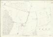
Dorset IX.4 (includes: Bower Chalke; Ebbesbourne Wake; Pentridge) - 25 Inch Map
1 : 2500 Topographic maps Ordnance Survey Ordnance Survey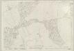
Wiltshire LXXV.5 & LXXV.6 (includes: Bower Chalke; Ebbesbourne Wake; Pentridge; Sixpenny Handley; Wimborne St Giles) - 25 Inch Map
1 : 2500 Topographic maps Ordnance Survey Ordnance Survey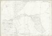
Wiltshire LXXV.5 & LXXV.6 (includes: Bower Chalke; Ebbesbourne Wake; Pentridge; Sixpenny Handley; Wimborne St Giles) - 25 Inch Map
1 : 2500 Topographic maps Ordnance Survey Ordnance Survey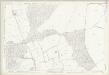
Wiltshire LXXV.5 (includes: Bower Chalke; Ebbesbourne Wake; Pentridge; Sixpenny Handley; Wimborne St Giles) - 25 Inch Map
1 : 2500 Topographic maps Ordnance Survey Ordnance Survey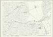
Dorset IX.7 (includes: Berwick St John; Bower Chalke; Ebbesbourne Wake; Sixpenny Handley) - 25 Inch Map
1 : 2500 Topographic maps Ordnance Survey Ordnance Survey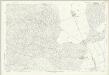
Dorset IX.7 (includes: Berwick St John; Bower Chalke; Ebbesbourne Wake; Sixpenny Handley) - 25 Inch Map
1 : 2500 Topographic maps Ordnance Survey Ordnance Survey
Dorset IX.8 (includes: Bower Chalke; Pentridge; Sixpenny Handley; Wimborne St Giles) - 25 Inch Map
1 : 2500 Topographic maps Ordnance Survey Ordnance Survey
Dorset IX.8 (includes: Bower Chalke; Pentridge; Sixpenny Handley; Wimborne St Giles) - 25 Inch Map
1 : 2500 Topographic maps Ordnance Survey Ordnance Survey
Wiltshire LXXIV.4 (includes: Alvediston; Berwick St John; Ebbesbourne Wake) - 25 Inch Map
1 : 2500 Topographic maps Ordnance Survey Ordnance Survey
Wiltshire LXXIV.4 (includes: Alvediston; Berwick St John; Ebbesbourne Wake) - 25 Inch Map
1 : 2500 Topographic maps Ordnance Survey Ordnance Survey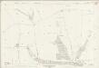
Wiltshire LXXIV.4 (includes: Alvediston; Berwick St John; Ebbesbourne Wake) - 25 Inch Map
1 : 2500 Topographic maps Ordnance Survey Ordnance Survey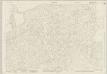
Wiltshire LXXIV.8 (includes: Berwick St John; Ebbesbourne Wake; Sixpenny Handley) - 25 Inch Map
1 : 2500 Topographic maps Ordnance Survey Ordnance Survey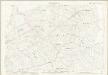
Wiltshire LXXIV.8 (includes: Berwick St John; Ebbesbourne Wake; Sixpenny Handley) - 25 Inch Map
1 : 2500 Topographic maps Ordnance Survey Ordnance Survey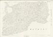
Wiltshire LXXIV.8 (includes: Berwick St John; Ebbesbourne Wake; Sixpenny Handley) - 25 Inch Map
1 : 2500 Topographic maps Ordnance Survey Ordnance Survey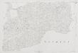
Wiltshire LXXIV.8 (includes: Berwick St John; Ebbesbourne Wake; Sixpenny Handley) - 25 Inch Map
1 : 2500 Topographic maps Ordnance Survey Ordnance Survey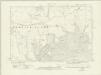
Wiltshire LXXIV.NE - OS Six-Inch Map
1 : 10560 Topographic maps Ordnance Survey Ordnance Survey
Wiltshire LXXIV.NE - OS Six-Inch Map
1 : 10560 Topographic maps Ordnance Survey Ordnance Survey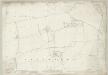
Wiltshire LXXV.2 (includes: Bower Chalke; Broad Chalke; Martin; Pentridge) - 25 Inch Map
1 : 2500 Topographic maps Ordnance Survey Ordnance Survey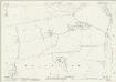
Hampshire and Isle of Wight LIVA.2 (includes: Bower Chalke; Broad Chalke; Martin; Pentridge) - 25 Inch Map
1 : 2500 Topographic maps Ordnance Survey Ordnance Survey
Wiltshire LXXV.2 (includes: Bower Chalke; Broad Chalke; Martin; Pentridge) - 25 Inch Map
1 : 2500 Topographic maps Ordnance Survey Ordnance Survey
Wiltshire LXXV.2 (includes: Bower Chalke; Broad Chalke; Martin; Pentridge) - 25 Inch Map
1 : 2500 Topographic maps Ordnance Survey Ordnance Survey
Wiltshire LXXV.2 (includes: Bower Chalke; Broad Chalke; Martin; Pentridge) - 25 Inch Map
1 : 2500 Topographic maps Ordnance Survey Ordnance Survey