Mapa catalogado
Dorset IV.SW - OS Six-Inch Map

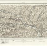
Título completo:Dorset IV.SW - OS Six-Inch Map
Año de ilustración:1938
Fecha de publicación:1948
Editorial:Ordnance Survey
Tamaño físico:20 x 30 cm
Escala del mapa:1:10 560
An improved map of Wilt Shire
1755
Bowen; Tinney
Wiltonia sive comitatvs Wiltoniensis; anglis Wil Shire
1646
Blaeu
n/a
1742
Salisbury - OS One-Inch Map
1956
Ordnance Survey
1:63k
Swindon - OS One-Inch Map
1961
Ordnance Survey
1:63k
Marlborough (Hills) - OS One-Inch Revised New Series
1902
Ordnance Survey
1:63k
Marlborough (Outline) - OS One-Inch Revised New Series
1896
Ordnance Survey
1:63k
Devizes (Outline) - OS One-Inch Revised New Series
1896
Ordnance Survey
1:63k
Devizes (Hills) - OS One-Inch Revised New Series
1896
Ordnance Survey
1:63k
Salisbury (Outline) - OS One-Inch Revised New Series
1897
Ordnance Survey
1:63k
Salisbury (Hills) - OS One-Inch Revised New Series
1897
Ordnance Survey
1:63k