Maps of Tetcott
Devonshire LXXIV.NW - OS Six-Inch Map
1 : 10560 Topographic maps Ordnance Survey Ordnance Survey
Devonshire LXXIV.NW - OS Six-Inch Map
1 : 10560 Topographic maps Ordnance Survey Ordnance Survey
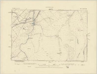
Devon LXXIV.2 (includes: Luffincott; Tetcott) - 25 Inch Map
1 : 2500 Topographic maps Ordnance Survey Ordnance Survey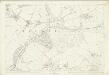
Devon LXXIV.2 (includes: Luffincott; Tetcott) - 25 Inch Map
1 : 2500 Topographic maps Ordnance Survey Ordnance Survey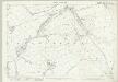
Devon LXXIV.6 (includes: Luffincott; Northcott; St Giles On The Heath; Tetcott) - 25 Inch Map
1 : 2500 Topographic maps Ordnance Survey Ordnance Survey
Devon LXXIV.6 (includes: Luffincott; Northcott; St Giles On The Heath; Tetcott) - 25 Inch Map
1 : 2500 Topographic maps Ordnance Survey Ordnance Survey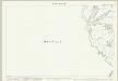
Devon LXXIV.5 (includes: Boyton; Luffincott; North Tamerton; Tetcott) - 25 Inch Map
1 : 2500 Topographic maps Ordnance Survey Ordnance Survey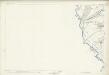
Devon LXXIV.5 (includes: Boyton; Luffincott; North Tamerton; Tetcott) - 25 Inch Map
1 : 2500 Topographic maps Ordnance Survey Ordnance Survey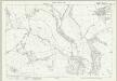
Devon LXXIV.1 (includes: Clawton; North Tamerton; Tetcott) - 25 Inch Map
1 : 2500 Topographic maps Ordnance Survey Ordnance Survey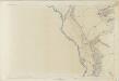
Devon LXXIV.1 (includes: Clawton; North Tamerton; Tetcott) - 25 Inch Map
1 : 2500 Topographic maps Ordnance Survey Ordnance Survey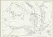
Cornwall IX.12 (includes: Luffincott; North Tamerton; Tetcott) - 25 Inch Map
1 : 2500 Topographic maps Ordnance Survey Ordnance Survey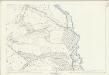
Cornwall IX.12 (includes: Luffincott; North Tamerton; Tetcott) - 25 Inch Map
1 : 2500 Topographic maps Ordnance Survey Ordnance Survey
Cornwall IX.16 & IXA.13 (includes: Boyton; Luffincott; North Tamerton; Northcott; St Giles On The Heath; Tetcott) - 25 Inch Map
1 : 2500 Topographic maps Ordnance Survey Ordnance Survey
Cornwall IX.16 (includes: Boyton; Luffincott; North Tamerton; Northcott; Tetcott) - 25 Inch Map
1 : 2500 Topographic maps Ordnance Survey Ordnance Survey
Cornwall IX.16 & IXA.13 (includes: Boyton; Luffincott; North Tamerton; Northcott; St Giles On The Heath; Tetcott) - 25 Inch Map
1 : 2500 Topographic maps Ordnance Survey Ordnance Survey
Cornwall IXA.13 (includes: Luffincott; Northcott; St Giles On The Heath) - 25 Inch Map
1 : 2500 Topographic maps Ordnance Survey Ordnance Survey
Cornwall IX.SE & IXA.SW - OS Six-Inch Map
1 : 10560 Topographic maps Ordnance Survey Ordnance Survey
Cornwall IX.SE - OS Six-Inch Map
1 : 10560 Topographic maps Ordnance Survey Ordnance Survey
Cornwall IX.8 (includes: Clawton; North Tamerton; Tetcott) - 25 Inch Map
1 : 2500 Topographic maps Ordnance Survey Ordnance Survey
Cornwall IX.8 (includes: Clawton; North Tamerton; Tetcott) - 25 Inch Map
1 : 2500 Topographic maps Ordnance Survey Ordnance Survey
SX39 - OS 1:25,000 Provisional Series Map
1 : 25000 Topographic maps Ordnance Survey Ordnance Survey
Cornwall IX.NE - OS Six-Inch Map
1 : 10560 Topographic maps Ordnance Survey Ordnance Survey
Cornwall IX.NE - OS Six-Inch Map
1 : 10560 Topographic maps Ordnance Survey Ordnance Survey
Holsworthy (Outline) - OS One-Inch Revised New Series
1 : 63360 Topographic maps Ordnance Survey Ordnance Survey
Holsworthy (Hills) - OS One-Inch Revised New Series
1 : 63360 Topographic maps Ordnance Survey Ordnance Survey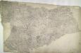
Holsworthy, Devon
Pencil annotations on the bottom right of the map give the surveyors name and the drawing's date and scale. A red dashed line denotes the border of Devon and Cornwall, running partly along the course of the River Tamer. Pencil rays intersect across the plan, evidence of triangulation measurements taken by the surveyor. Although it did not become obligatory to include archaeological details until 1816, prehistoric defensive earthworks are noted at Warbstow Barrow . A windmill is shown in elevation at Holsworthy. Budgen, Charles
Bude - OS One-Inch Map
1 : 63360 Topographic maps Ordnance Survey Ordnance Survey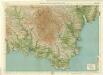
South Devon, Sheet 36 - Bartholomew's "Half Inch to the Mile Maps" of England & Wales
1 : 126720 Topographic maps Bartholomew, John George John Bartholomew & Co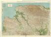
North Devon, Sheet 35 - Bartholomew's "Half Inch to the Mile Maps" of England & Wales
1 : 126720 Topographic maps Bartholomew, John George John Bartholomew & Co