Maps of Torridge
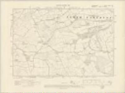
Devonshire LXXIII.NE - OS Six-Inch Map
1 : 10560 Topographic maps Ordnance Survey Ordnance Survey
Devonshire LXXIII.NE - OS Six-Inch Map
1 : 10560 Topographic maps Ordnance Survey Ordnance Survey
Devon LXXIII.7 (includes: Boyton; North Petherwin; North Tamerton; Week St Mary) - 25 Inch Map
1 : 2500 Topographic maps Ordnance Survey Ordnance Survey
Devon LXXIII.7 (includes: Boyton; North Petherwin; North Tamerton; Week St Mary) - 25 Inch Map
1 : 2500 Topographic maps Ordnance Survey Ordnance Survey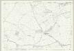
Cornwall IX.10 (includes: Boyton; North Tamerton; Week St Mary; Whitstone) - 25 Inch Map
1 : 2500 Topographic maps Ordnance Survey Ordnance Survey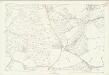
Cornwall IX.10 (includes: Boyton; North Tamerton; Week St Mary; Whitstone) - 25 Inch Map
1 : 2500 Topographic maps Ordnance Survey Ordnance Survey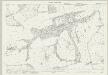
Cornwall IX.11 (includes: Boyton; North Tamerton) - 25 Inch Map
1 : 2500 Topographic maps Ordnance Survey Ordnance Survey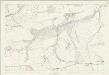
Cornwall IX.11 (includes: Boyton; North Tamerton) - 25 Inch Map
1 : 2500 Topographic maps Ordnance Survey Ordnance Survey
Cornwall IX.14 (includes: Boyton; North Petherwin; North Tamerton; Week St Mary) - 25 Inch Map
1 : 2500 Topographic maps Ordnance Survey Ordnance Survey
Cornwall IX.14 (includes: Boyton; North Petherwin; North Tamerton; Week St Mary) - 25 Inch Map
1 : 2500 Topographic maps Ordnance Survey Ordnance Survey
Cornwall IX.15 (includes: Boyton; North Tamerton) - 25 Inch Map
1 : 2500 Topographic maps Ordnance Survey Ordnance Survey
Cornwall IX.15 (includes: Boyton; North Tamerton) - 25 Inch Map
1 : 2500 Topographic maps Ordnance Survey Ordnance Survey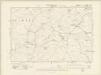
Cornwall IX.SW - OS Six-Inch Map
1 : 10560 Topographic maps Ordnance Survey Ordnance Survey
Cornwall IX.SW - OS Six-Inch Map
1 : 10560 Topographic maps Ordnance Survey Ordnance Survey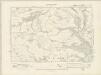
Cornwall IX.SE & IXA.SW - OS Six-Inch Map
1 : 10560 Topographic maps Ordnance Survey Ordnance Survey
Cornwall IX.SE - OS Six-Inch Map
1 : 10560 Topographic maps Ordnance Survey Ordnance Survey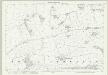
Cornwall IX.7 (includes: North Tamerton) - 25 Inch Map
1 : 2500 Topographic maps Ordnance Survey Ordnance Survey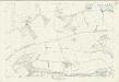
Cornwall IX.7 (includes: North Tamerton) - 25 Inch Map
1 : 2500 Topographic maps Ordnance Survey Ordnance Survey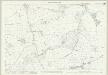
Cornwall IX.6 (includes: North Tamerton; Whitstone) - 25 Inch Map
1 : 2500 Topographic maps Ordnance Survey Ordnance Survey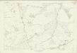
Cornwall IX.6 (includes: North Tamerton; Whitstone) - 25 Inch Map
1 : 2500 Topographic maps Ordnance Survey Ordnance Survey
SX29 - OS 1:25,000 Provisional Series Map
1 : 25000 Topographic maps Ordnance Survey Ordnance Survey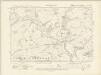
Cornwall IX.NE - OS Six-Inch Map
1 : 10560 Topographic maps Ordnance Survey Ordnance Survey
Cornwall IX.NE - OS Six-Inch Map
1 : 10560 Topographic maps Ordnance Survey Ordnance Survey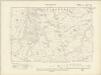
Cornwall IX.NW - OS Six-Inch Map
1 : 10560 Topographic maps Ordnance Survey Ordnance Survey
Cornwall IX.NW - OS Six-Inch Map
1 : 10560 Topographic maps Ordnance Survey Ordnance Survey
Holsworthy (Outline) - OS One-Inch Revised New Series
1 : 63360 Topographic maps Ordnance Survey Ordnance Survey
Holsworthy (Hills) - OS One-Inch Revised New Series
1 : 63360 Topographic maps Ordnance Survey Ordnance Survey
Camelford, Cornwall (002OSD000000001U00009000)
Royal Military Draughtsmen and Surveyors were listed as first-class or second-class by the Tower of London Drawing Room according to the quality of their work. Robert Dawson, the draughtsman of this map, was an influential teacher at the Tower and rated first-class, while Henry Stevens, the surveyor, was rated only second-class.The orientation of this map does not have north at the top. Hence, the coastal boundary from Widemouth Bay south to Tintagel Castle runs from left to right along the bottom of the drawing. A faded blue-green wash indicates water. Brown Willy, the highest point in Cornwall, is shown on the northern edge of Bodmin Moor to the top right of the inland boundary. A turnpike road, coloured ochre yellow, runs from Launceston to Camelford. One side of the road is thickened and miles appear alongside in figures. The close attention given to communication routes highlights the military intent of these studies. At the same time, archaeological features and antiquities are also noted, reflecting the particular interests of individual surveyors or draughtsmen. In this instance, manganese mines are marked. Stevens, Henry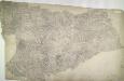
Holsworthy, Devon
Pencil annotations on the bottom right of the map give the surveyors name and the drawing's date and scale. A red dashed line denotes the border of Devon and Cornwall, running partly along the course of the River Tamer. Pencil rays intersect across the plan, evidence of triangulation measurements taken by the surveyor. Although it did not become obligatory to include archaeological details until 1816, prehistoric defensive earthworks are noted at Warbstow Barrow . A windmill is shown in elevation at Holsworthy. Budgen, Charles