Maps of Lyme Regis
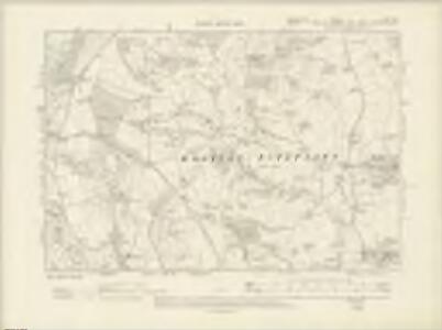
Devonshire LXXII.SE - OS Six-Inch Map
1 : 10560 Topographic maps Ordnance Survey Ordnance Survey
Devonshire LXXII.SE - OS Six-Inch Map
1 : 10560 Topographic maps Ordnance Survey Ordnance Survey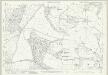
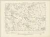
Devon LXXII.11 (includes: Axminster Hamlets; Uplyme; Wootton Fitzpaine) - 25 Inch Map
1 : 2500 Topographic maps Ordnance Survey Ordnance Survey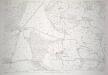
Devon LXXII.11 (includes: Axminster Hamlets; Uplyme; Wootton Fitzpaine) - 25 Inch Map
1 : 2500 Topographic maps Ordnance Survey Ordnance Survey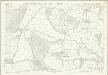
Devon LXXII.11 (includes: Axminster Hamlets; Uplyme; Wootton Fitzpaine) - 25 Inch Map
1 : 2500 Topographic maps Ordnance Survey Ordnance Survey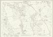
Devon LXXII.15 (includes: Lyme Regis; Uplyme; Wootton Fitzpaine) - 25 Inch Map
1 : 2500 Topographic maps Ordnance Survey Ordnance Survey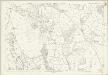
Devon LXXII.15 (includes: Lyme Regis; Uplyme; Wootton Fitzpaine) - 25 Inch Map
1 : 2500 Topographic maps Ordnance Survey Ordnance Survey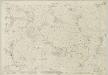
Dorset XXXVII.1 (includes: Wootton Fitzpaine) - 25 Inch Map
1 : 2500 Topographic maps Ordnance Survey Ordnance Survey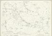
Dorset XXXVII.1 (includes: Wootton Fitzpaine) - 25 Inch Map
1 : 2500 Topographic maps Ordnance Survey Ordnance Survey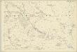
Dorset XXXVII.1 (includes: Wootton Fitzpaine) - 25 Inch Map
1 : 2500 Topographic maps Ordnance Survey Ordnance Survey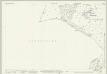
Dorset XXXVI.4 (includes: Axminster Hamlets; Lyme Regis; Uplyme; Wootton Fitzpaine) - 25 Inch Map
1 : 2500 Topographic maps Ordnance Survey Ordnance Survey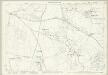
Dorset XXXVI.4 (includes: Axminster Hamlets; Lyme Regis; Uplyme; Wootton Fitzpaine) - 25 Inch Map
1 : 2500 Topographic maps Ordnance Survey Ordnance Survey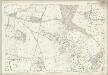
Dorset XXXVI.4 (includes: Axminster Hamlets; Lyme Regis; Uplyme; Wootton Fitzpaine) - 25 Inch Map
1 : 2500 Topographic maps Ordnance Survey Ordnance Survey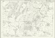
Dorset XXVIII.13 (includes: Hawkchurch; Whitechurch Canonicorum; Wootton Fitzpaine) - 25 Inch Map
1 : 2500 Topographic maps Ordnance Survey Ordnance Survey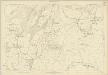
Dorset XXVIII.13 (includes: Hawkchurch; Whitechurch Canonicorum; Wootton Fitzpaine) - 25 Inch Map
1 : 2500 Topographic maps Ordnance Survey Ordnance Survey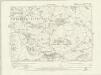
Dorset XXXVII.NW - OS Six-Inch Map
1 : 10560 Topographic maps Ordnance Survey Ordnance Survey
Dorset XXXVII.NW - OS Six-Inch Map
1 : 10560 Topographic maps Ordnance Survey Ordnance Survey
Dorset XXXVII.NW - OS Six-Inch Map
1 : 10560 Topographic maps Ordnance Survey Ordnance Survey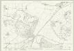
Dorset XXVII.16 (includes: Axminster Hamlets; Hawkchurch; Wootton Fitzpaine) - 25 Inch Map
1 : 2500 Topographic maps Ordnance Survey Ordnance Survey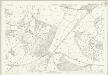
Dorset XXVII.16 (includes: Axminster Hamlets; Hawkchurch; Wootton Fitzpaine) - 25 Inch Map
1 : 2500 Topographic maps Ordnance Survey Ordnance Survey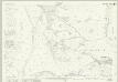
Dorset XXXVII.5 (includes: Catherston Leweston; Charmouth; Lyme Regis; Wootton Fitzpaine) - 25 Inch Map
1 : 2500 Topographic maps Ordnance Survey Ordnance Survey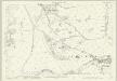
Dorset XXXVII.5 (includes: Catherston Leweston; Charmouth; Lyme Regis; Wootton Fitzpaine) - 25 Inch Map
1 : 2500 Topographic maps Ordnance Survey Ordnance Survey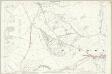
Dorset XXXVII.5 (includes: Catherston Leweston; Charmouth; Lyme Regis; Wootton Fitzpaine) - 25 Inch Map
1 : 2500 Topographic maps Ordnance Survey Ordnance Survey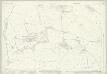
Dorset XXXVII.2 (includes: Whitechurch Canonicorum; Wootton Fitzpaine) - 25 Inch Map
1 : 2500 Topographic maps Ordnance Survey Ordnance Survey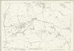
Dorset XXXVII.2 (includes: Whitechurch Canonicorum; Wootton Fitzpaine) - 25 Inch Map
1 : 2500 Topographic maps Ordnance Survey Ordnance Survey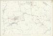
Dorset XXXVII.2 (includes: Whitechurch Canonicorum; Wootton Fitzpaine) - 25 Inch Map
1 : 2500 Topographic maps Ordnance Survey Ordnance Survey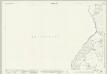
Dorset XXXVI.8 (includes: Lyme Regis; Uplyme; Wootton Fitzpaine) - 25 Inch Map
1 : 2500 Topographic maps Ordnance Survey Ordnance Survey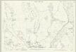
Dorset XXXVI.8 (includes: Lyme Regis; Uplyme; Wootton Fitzpaine) - 25 Inch Map
1 : 2500 Topographic maps Ordnance Survey Ordnance Survey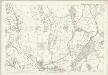
Dorset XXXVI.8 (includes: Lyme Regis; Uplyme; Wootton Fitzpaine) - 25 Inch Map
1 : 2500 Topographic maps Ordnance Survey Ordnance Survey