Maps of Bideford
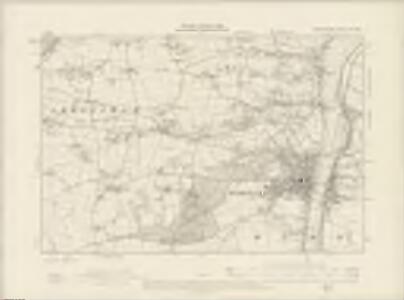
Devonshire XIX.NW - OS Six-Inch Map
1 : 10560 Topographic maps Ordnance Survey Ordnance Survey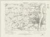
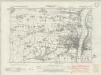
Devonshire XIX.NW - OS Six-Inch Map
1 : 10560 Topographic maps Ordnance Survey Ordnance Survey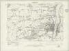
Devonshire XIX.NW - OS Six-Inch Map
1 : 10560 Topographic maps Ordnance Survey Ordnance Survey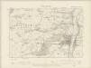
Devonshire XIX.NW - OS Six-Inch Map
1 : 10560 Topographic maps Ordnance Survey Ordnance Survey
Devonshire XIX.NW - OS Six-Inch Map
1 : 10560 Topographic maps Ordnance Survey Ordnance Survey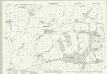
Devon XIX.5 (includes: Abbotsham; Alwington; Bideford) - 25 Inch Map
1 : 2500 Topographic maps Ordnance Survey Ordnance Survey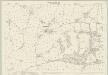
Devon XIX.5 (includes: Abbotsham; Alwington; Bideford) - 25 Inch Map
1 : 2500 Topographic maps Ordnance Survey Ordnance Survey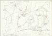
Devon XIX.5 (includes: Abbotsham; Alwington; Bideford) - 25 Inch Map
1 : 2500 Topographic maps Ordnance Survey Ordnance Survey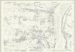
Devon XIX.2 (includes: Bideford; Northam; Westleigh) - 25 Inch Map
1 : 2500 Topographic maps Ordnance Survey Ordnance Survey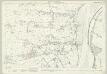
Devon XIX.2 (includes: Bideford; Northam; Westleigh) - 25 Inch Map
1 : 2500 Topographic maps Ordnance Survey Ordnance Survey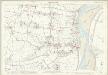
Devon XIX.2 (includes: Bideford; Northam; Westleigh) - 25 Inch Map
1 : 2500 Topographic maps Ordnance Survey Ordnance Survey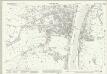
Devon XIX.6 (includes: Bideford) - 25 Inch Map
1 : 2500 Topographic maps Ordnance Survey Ordnance Survey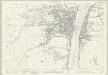
Devon XIX.6 (includes: Bideford) - 25 Inch Map
1 : 2500 Topographic maps Ordnance Survey Ordnance Survey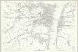
Devon XIX.6 (includes: Bideford) - 25 Inch Map
1 : 2500 Topographic maps Ordnance Survey Ordnance Survey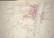
Devon XIX.6 (includes: Bideford) - 25 Inch Map
1 : 2500 Topographic maps Ordnance Survey Ordnance Survey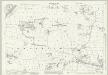
Devon XIX.1 (includes: Abbotsham; Bideford; Northam) - 25 Inch Map
1 : 2500 Topographic maps Ordnance Survey Ordnance Survey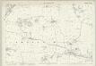
Devon XIX.1 (includes: Abbotsham; Bideford; Northam) - 25 Inch Map
1 : 2500 Topographic maps Ordnance Survey Ordnance Survey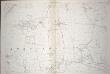
Devon XIX.1 (includes: Abbotsham; Bideford; Northam) - 25 Inch Map
1 : 2500 Topographic maps Ordnance Survey Ordnance Survey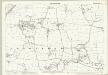
Devon XIX.1 (includes: Abbotsham; Bideford; Northam) - 25 Inch Map
1 : 2500 Topographic maps Ordnance Survey Ordnance Survey
SS42 - OS 1:25,000 Provisional Series Map
1 : 25000 Topographic maps Ordnance Survey Ordnance Survey
Bideford (Hills) - OS One-Inch Revised New Series
1 : 63360 Topographic maps Ordnance Survey Ordnance Survey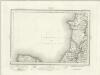
Bideford (Outline) - OS One-Inch Revised New Series
1 : 63360 Topographic maps Ordnance Survey Ordnance Survey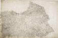
Hartland, Devon
A dashed red line marks the county boundary between Cornwall and Devon at the bottom left of the manuscript. Depicted throughout the area, Devon's mills provided the East India Company with woven serges by the ton until the early 19th century. Coarse woollen cloths, blankets and fine lace were also woven throughout the county. Budgen, Charles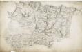
Barnstaple, Devon
The indication of land relief and attention to communication routes on this plan conform to the military and cartographic standards employed by the West Country survey. The south of England was the area most vulnerable to invasion, especially during the Napoleonic conflicts between 1793 and 1815. Accurate mapping of the Devonshire coastline was, therefore, of great military significance. Towards the left of the plan, the sand dunes of Braunton Burrows stretch southwards from the sea at Barnstaple Bay towards Appledore and Bideford.
Barnstaple - OS One-Inch Map
1 : 63360 Topographic maps Ordnance Survey Ordnance Survey
North Devon, Sheet 35 - Bartholomew's "Half Inch to the Mile Maps" of England & Wales
1 : 126720 Topographic maps Bartholomew, John George John Bartholomew & Co
Sheets 11-12. (Cary's England, Wales, and Scotland).
1 : 360000 Cary, John, ca. 1754-1835
Devonshire
1 : 640000 Devon (Anglie) Hall, Sid. by Chapman & Hall
Devoniae descriptio = The description of Devon-Shire
1 : 180000 Amstelodami : apud Joannem Janssonium