Maps of Somerset
Devonshire XI.SE - OS Six-Inch Map
1 : 10560 Topographic maps Ordnance Survey Ordnance Survey
Devonshire XI.SE - OS Six-Inch Map
1 : 10560 Topographic maps Ordnance Survey Ordnance Survey
Somerset XLV.13 (includes: Exmoor) - 25 Inch Map
1 : 2500 Topographic maps Ordnance Survey Ordnance Survey
Somerset XLV.13 (includes: Exmoor) - 25 Inch Map
1 : 2500 Topographic maps Ordnance Survey Ordnance Survey
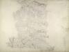
Devon XI.15 (includes: Exmoor; North Molton) - 25 Inch Map
1 : 2500 Topographic maps Ordnance Survey Ordnance Survey
Devon XI.15 (includes: Exmoor; North Molton) - 25 Inch Map
1 : 2500 Topographic maps Ordnance Survey Ordnance Survey
Somerset LVI.1 (includes: Exmoor; North Molton) - 25 Inch Map
1 : 2500 Topographic maps Ordnance Survey Ordnance Survey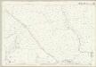
Somerset LVI.1 (includes: Exmoor; North Molton) - 25 Inch Map
1 : 2500 Topographic maps Ordnance Survey Ordnance Survey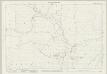
Somerset XLV.14 (includes: Exmoor; Withypool) - 25 Inch Map
1 : 2500 Topographic maps Ordnance Survey Ordnance Survey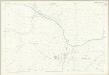
Somerset XLV.14 (includes: Exmoor; Withypool) - 25 Inch Map
1 : 2500 Topographic maps Ordnance Survey Ordnance Survey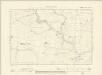
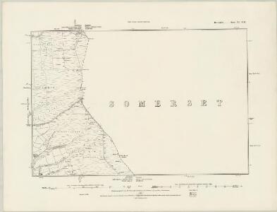
Somerset XLV.SW - OS Six-Inch Map
1 : 10560 Topographic maps Ordnance Survey Ordnance Survey
Somerset XLV.SW - OS Six-Inch Map
1 : 10560 Topographic maps Ordnance Survey Ordnance Survey
Somerset LVI.NW - OS Six-Inch Map
1 : 10560 Topographic maps Ordnance Survey Ordnance Survey
Somerset LVI.NW - OS Six-Inch Map
1 : 10560 Topographic maps Ordnance Survey Ordnance Survey
Somerset LVI.2 (includes: Exmoor; Withypool) - 25 Inch Map
1 : 2500 Topographic maps Ordnance Survey Ordnance Survey
Somerset LVI.2 (includes: Exmoor; Withypool) - 25 Inch Map
1 : 2500 Topographic maps Ordnance Survey Ordnance Survey
Somerset XLIV.16 & LIVA.4 (includes: Exmoor; North Molton) - 25 Inch Map
1 : 2500 Topographic maps Ordnance Survey Ordnance Survey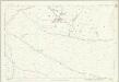
Somerset XLIV.16 (includes: Exmoor; North Molton) - 25 Inch Map
1 : 2500 Topographic maps Ordnance Survey Ordnance Survey
Somerset XLIV.16 & LIVA.4 (includes: Exmoor; North Molton) - 25 Inch Map
1 : 2500 Topographic maps Ordnance Survey Ordnance Survey
SS73 - OS 1:25,000 Provisional Series Map
1 : 25000 Topographic maps Ordnance Survey Ordnance Survey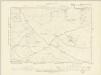
Somerset XLIV.SE & LVIa.NE - OS Six-Inch Map
1 : 10560 Topographic maps Ordnance Survey Ordnance Survey
Somerset XLIV.SE - OS Six-Inch Map
1 : 10560 Topographic maps Ordnance Survey Ordnance Survey
Somerset LVIA.NE - OS Six-Inch Map
1 : 10560 Topographic maps Ordnance Survey Ordnance Survey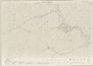
Somerset XLV.9 (includes: Exmoor) - 25 Inch Map
1 : 2500 Topographic maps Ordnance Survey Ordnance Survey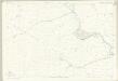
Somerset XLV.9 (includes: Exmoor) - 25 Inch Map
1 : 2500 Topographic maps Ordnance Survey Ordnance Survey
Somerset XLV.10 (includes: Exford; Exmoor; Withypool) - 25 Inch Map
1 : 2500 Topographic maps Ordnance Survey Ordnance Survey
Somerset XLV.10 (includes: Exford; Exmoor; Withypool) - 25 Inch Map
1 : 2500 Topographic maps Ordnance Survey Ordnance Survey
Somerset XLIV.12 (includes: Exmoor) - 25 Inch Map
1 : 2500 Topographic maps Ordnance Survey Ordnance Survey
Somerset XLIV.12 (includes: Exmoor) - 25 Inch Map
1 : 2500 Topographic maps Ordnance Survey Ordnance Survey