Maps of Swanmore
Hampshire & Isle of Wight LXVII.NW - OS Six-Inch Map
1 : 10560 Topographic maps Ordnance Survey Ordnance Survey
Hampshire & Isle of Wight LXVII.NW - OS Six-Inch Map
1 : 10560 Topographic maps Ordnance Survey Ordnance Survey
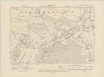
Hampshire and Isle of Wight LXVII.2 (includes: Droxford; Soberton; Swanmore) - 25 Inch Map
1 : 2500 Topographic maps Ordnance Survey Ordnance Survey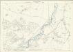
Hampshire and Isle of Wight LXVII.2 (includes: Droxford; Soberton; Swanmore) - 25 Inch Map
1 : 2500 Topographic maps Ordnance Survey Ordnance Survey
Hampshire and Isle of Wight LXVII.2 (with inset LXVII.6) (includes: Droxford; Soberton; Swanmore) - 25 Inch Map
1 : 2500 Topographic maps Ordnance Survey Ordnance Survey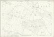
Hampshire and Isle of Wight LXVII.1 (includes: Bishops Waltham; Shedfield; Swanmore) - 25 Inch Map
1 : 2500 Topographic maps Ordnance Survey Ordnance Survey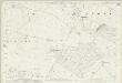
Hampshire and Isle of Wight LXVII.1 (includes: Bishops Waltham; Shedfield; Swanmore) - 25 Inch Map
1 : 2500 Topographic maps Ordnance Survey Ordnance Survey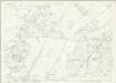
Hampshire and Isle of Wight LXVII.5 (includes: Shedfield; Soberton; Swanmore; Wickham) - 25 Inch Map
1 : 2500 Topographic maps Ordnance Survey Ordnance Survey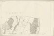
Hampshire and Isle of Wight LXVII.5 (includes: Shedfield; Soberton; Swanmore; Wickham) - 25 Inch Map
1 : 2500 Topographic maps Ordnance Survey Ordnance Survey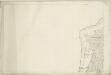
Hampshire and Isle of Wight LXVII.5 (includes: Shedfield; Soberton; Swanmore; Wickham) - 25 Inch Map
1 : 2500 Topographic maps Ordnance Survey Ordnance Survey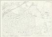
Hampshire and Isle of Wight LXVII.6 (includes: Soberton; Swanmore) - 25 Inch Map
1 : 2500 Topographic maps Ordnance Survey Ordnance Survey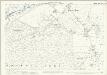
Hampshire and Isle of Wight LXVII.6 (includes: Soberton; Swanmore) - 25 Inch Map
1 : 2500 Topographic maps Ordnance Survey Ordnance Survey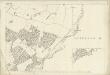
Hampshire and Isle of Wight LXVII.2 (with inset LXVII.6) (includes: Droxford; Soberton; Swanmore) - 25 Inch Map
1 : 2500 Topographic maps Ordnance Survey Ordnance Survey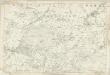
Hampshire & Isle of Wight LXVII - OS Six-Inch Map
1 : 10560 Topographic maps Ordnance Survey Ordnance Survey
SU51 - OS 1:25,000 Provisional Series Map
1 : 25000 Topographic maps Ordnance Survey Ordnance Survey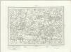
Fareham (Outline) - OS One-Inch Revised New Series
1 : 63360 Topographic maps Ordnance Survey Ordnance Survey
Fareham (Hills) - OS One-Inch Revised New Series
1 : 63360 Topographic maps Ordnance Survey Ordnance Survey

Map of Hampshire, including the Isle of Wight, 4
1 Blatt : 53 x 69 cm s.n.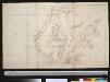
Het eiland Wight met de rede van Portsmouth en Southampton Water
England Gerard van Keulen
The Solent - OS One-Inch Map
1 : 63360 Topographic maps Ordnance Survey Ordnance Survey
Winchester - OS One-Inch Map
1 : 63360 Topographic maps Ordnance Survey Ordnance Survey
To the right honorable the master, wardens & elder brethren of the Trinity House, this chart of Spithead is ... dedicated
1 : 110000 Heather, W. (William) Heather and Williams
New Forrest & Isle of Wight, Sheet 33 - Bartholomew's "Half Inch to the Mile Maps" of England & Wales
1 : 126720 Topographic maps Bartholomew, John George John Bartholomew & Co
Hantonia sive Sovthantonensis comitatvs vulgo Hant-shire
1 Karte : Kupferdruck ; 40 x 48 cm Blaeu Joan Blaeu
Sheets 15-16. (Cary's England, Wales, and Scotland).
1 : 360000 Cary, John, ca. 1754-1835
A new improved map of Hampshire
1 Karte : Kupferdruck ; 51 x 67 cm Kitchin; Hinton sold by I. Hinton at the Kings Arms in St. Pauls Church Yard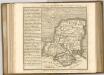

Bacon's twentieth century map of Hampshire
1 : 125000 titelvariant: Bacon's new map of Hampshire; Annotatie: Omslagtitel: Bacon's new map of Hampshire; Met plaatsnamenregister en afstandentabel London : Bacon