Maps of Vernhams Dean
Hampshire & Isle of Wight VII.SE - OS Six-Inch Map
1 : 10560 Topographic maps Ordnance Survey Ordnance Survey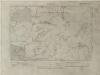
Hampshire & Isle of Wight VII.SE - OS Six-Inch Map
1 : 10560 Topographic maps Ordnance Survey Ordnance Survey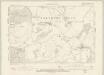
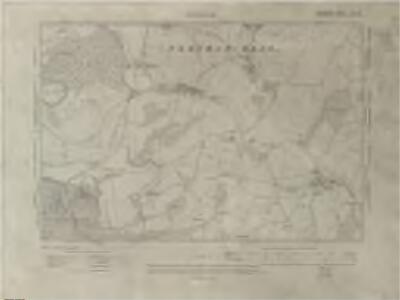
Wiltshire XLIII.SE - OS Six-Inch Map
1 : 10560 Topographic maps Ordnance Survey Ordnance Survey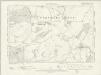
Hampshire & Isle of Wight VII.SE - OS Six-Inch Map
1 : 10560 Topographic maps Ordnance Survey Ordnance Survey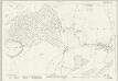
Wiltshire XLIII.11 (includes: Chute; Tidcombe and Fosbury; Vernhams Dean) - 25 Inch Map
1 : 2500 Topographic maps Ordnance Survey Ordnance Survey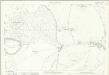
Wiltshire XLIII.11 (includes: Chute; Tidcombe and Fosbury; Vernhams Dean) - 25 Inch Map
1 : 2500 Topographic maps Ordnance Survey Ordnance Survey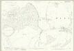
Wiltshire XLIII.11 (includes: Chute; Tidcombe and Fosbury; Vernhams Dean) - 25 Inch Map
1 : 2500 Topographic maps Ordnance Survey Ordnance Survey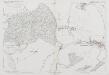
Wiltshire XLIII.11 (includes: Chute; Tidcombe and Fosbury; Vernhams Dean) - 25 Inch Map
1 : 2500 Topographic maps Ordnance Survey Ordnance Survey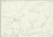
Wiltshire XLIII.15 (includes: Chute; Tangley; Tidcombe and Fosbury; Vernhams Dean) - 25 Inch Map
1 : 2500 Topographic maps Ordnance Survey Ordnance Survey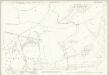
Wiltshire XLIII.15 (includes: Chute; Tangley; Tidcombe and Fosbury; Vernhams Dean) - 25 Inch Map
1 : 2500 Topographic maps Ordnance Survey Ordnance Survey
Wiltshire XLIII.15 (includes: Chute; Tangley; Tidcombe and Fosbury; Vernhams Dean) - 25 Inch Map
1 : 2500 Topographic maps Ordnance Survey Ordnance Survey
Wiltshire XLIII.15 (includes: Chute; Tangley; Tidcombe and Fosbury; Vernhams Dean) - 25 Inch Map
1 : 2500 Topographic maps Ordnance Survey Ordnance Survey
Wiltshire XLIII.15 (includes: Chute; Tangley; Tidcombe and Fosbury; Vernhams Dean) - 25 Inch Map
1 : 2500 Topographic maps Ordnance Survey Ordnance Survey
Hampshire and Isle of Wight VII.12 (includes: Hurstbourne Tarrant; Linkenholt; Vernhams Dean) - 25 Inch Map
1 : 2500 Topographic maps Ordnance Survey Ordnance Survey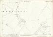
Hampshire and Isle of Wight VII.12 (includes: Hurstbourne Tarrant; Linkenholt; Vernhams Dean) - 25 Inch Map
1 : 2500 Topographic maps Ordnance Survey Ordnance Survey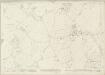
Hampshire and Isle of Wight VII.16 (includes: Hurstbourne Tarrant; Vernhams Dean) - 25 Inch Map
1 : 2500 Topographic maps Ordnance Survey Ordnance Survey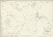
Hampshire and Isle of Wight VII.16 (includes: Hurstbourne Tarrant; Vernhams Dean) - 25 Inch Map
1 : 2500 Topographic maps Ordnance Survey Ordnance Survey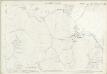
Hampshire and Isle of Wight VII.16 (includes: Hurstbourne Tarrant; Vernhams Dean) - 25 Inch Map
1 : 2500 Topographic maps Ordnance Survey Ordnance Survey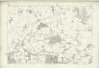
Wiltshire XLIII - OS Six-Inch Map
1 : 10560 Topographic maps Ordnance Survey Ordnance Survey
SU35 - OS 1:25,000 Provisional Series Map
1 : 25000 Topographic maps Ordnance Survey Ordnance Survey
Andover (Hills) - OS One-Inch Revised New Series
1 : 63360 Topographic maps Ordnance Survey Ordnance Survey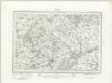
Andover (Outline) - OS One-Inch Revised New Series
1 : 63360 Topographic maps Ordnance Survey Ordnance Survey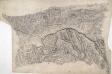
Hungerford
This drawing describes the borders of the counties of Berkshire, Hampshire and Wiltshire. Their boundaries are marked by red pecked lines, as a note at the base of the drawing explains. The draughtsman has detailed the star-shaped path formation of Savernake Forest, a great royal hunting forest, and recorded the Roman road between Marton and Titcombe. Chisbury, an iron-age hillfort, is marked by concentric rings to the right of Savernake Forest, although the recording of archaeological features did not become obligatory until 1816. To the left of Shalbourne, a windmill is shown in elevation.
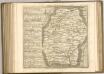
Map of Hampshire, including the Isle of Wight, 1
1 Blatt : 55 x 68 cm s.n.
Winchester - OS One-Inch Map
1 : 63360 Topographic maps Ordnance Survey Ordnance Survey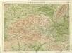
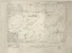
Berkshire, Sheet 29 - Bartholomew's "Half Inch to the Mile Maps" of England & Wales
1 : 126720 Topographic maps Bartholomew, John George John Bartholomew & Co
BERCHERIA | Vernacule | BARK SHIRE.
[Amsterdam : Joan Blaeu]
Wiltonia sive Comitatus Wiltoniensis anglis Wil Shire
1 : 210000 Amstelodami : apud Joannem Janssonium