Maps of Torridge
Cornwall XII.NW - OS Six-Inch Map
1 : 10560 Topographic maps Ordnance Survey Ordnance Survey
Cornwall XII.NW - OS Six-Inch Map
1 : 10560 Topographic maps Ordnance Survey Ordnance Survey
Devon LXXIII.14 (includes: North Petherwin; Tremaine) - 25 Inch Map
1 : 2500 Topographic maps Ordnance Survey Ordnance Survey
Devon LXXIII.14 (includes: North Petherwin; Tremaine) - 25 Inch Map
1 : 2500 Topographic maps Ordnance Survey Ordnance Survey
Cornwall XII.7 & 2 & 5 (includes: Boyton; North Petherwin; Tremaine; Werrington) - 25 Inch Map
1 : 2500 Topographic maps Ordnance Survey Ordnance Survey
Cornwall XII.2 (includes: Boyton; North Petherwin) - 25 Inch Map
1 : 2500 Topographic maps Ordnance Survey Ordnance Survey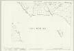
Cornwall XII.7 & 2 & 5 (includes: Boyton; North Petherwin; Tremaine; Werrington) - 25 Inch Map
1 : 2500 Topographic maps Ordnance Survey Ordnance Survey
Cornwall XII.5 (includes: North Petherwin; Tremaine) - 25 Inch Map
1 : 2500 Topographic maps Ordnance Survey Ordnance Survey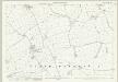
Devon LXXIII.15 (includes: North Petherwin) - 25 Inch Map
1 : 2500 Topographic maps Ordnance Survey Ordnance Survey
Devon LXXIII.15 (includes: North Petherwin) - 25 Inch Map
1 : 2500 Topographic maps Ordnance Survey Ordnance Survey
Devon LXXIII.10 (includes: North Petherwin) - 25 Inch Map
1 : 2500 Topographic maps Ordnance Survey Ordnance Survey
Devon LXXIII.10 (includes: North Petherwin) - 25 Inch Map
1 : 2500 Topographic maps Ordnance Survey Ordnance Survey
Devon LXXIII.11 (includes: Boyton; North Petherwin) - 25 Inch Map
1 : 2500 Topographic maps Ordnance Survey Ordnance Survey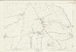
Devon LXXIII.11 (includes: Boyton; North Petherwin) - 25 Inch Map
1 : 2500 Topographic maps Ordnance Survey Ordnance Survey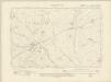
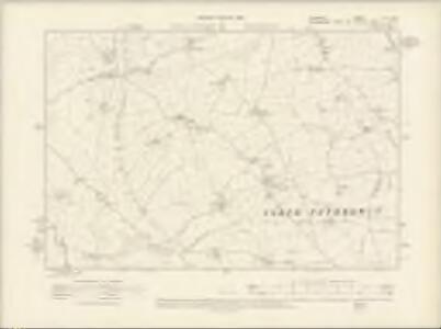
Devonshire LXXIII.SW - OS Six-Inch Map
1 : 10560 Topographic maps Ordnance Survey Ordnance Survey
Devonshire LXXIII.SW - OS Six-Inch Map
1 : 10560 Topographic maps Ordnance Survey Ordnance Survey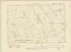
Devonshire LXXIII.SE - OS Six-Inch Map
1 : 10560 Topographic maps Ordnance Survey Ordnance Survey
Devonshire LXXIII.SE - OS Six-Inch Map
1 : 10560 Topographic maps Ordnance Survey Ordnance Survey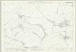
Devon LXXXV.3 (includes: Egloskerry; North Petherwin) - 25 Inch Map
1 : 2500 Topographic maps Ordnance Survey Ordnance Survey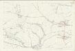
Devon LXXXV.3 (includes: Egloskerry; North Petherwin) - 25 Inch Map
1 : 2500 Topographic maps Ordnance Survey Ordnance Survey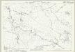
Devon LXXXV.2 (includes: Egloskerry; North Petherwin; Tremaine; Tresmeer) - 25 Inch Map
1 : 2500 Topographic maps Ordnance Survey Ordnance Survey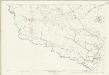
Devon LXXXV.2 (includes: Egloskerry; North Petherwin; Tremaine; Tresmeer) - 25 Inch Map
1 : 2500 Topographic maps Ordnance Survey Ordnance Survey
SX29 - OS 1:25,000 Provisional Series Map
1 : 25000 Topographic maps Ordnance Survey Ordnance Survey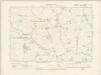
Devonshire LXXXV.NE - OS Six-Inch Map
1 : 10560 Topographic maps Ordnance Survey Ordnance Survey
Devonshire LXXXV.NE - OS Six-Inch Map
1 : 10560 Topographic maps Ordnance Survey Ordnance Survey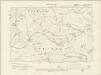
Devonshire LXXXV.NW - OS Six-Inch Map
1 : 10560 Topographic maps Ordnance Survey Ordnance Survey
Devonshire LXXXV.NW - OS Six-Inch Map
1 : 10560 Topographic maps Ordnance Survey Ordnance Survey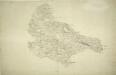
Launceston, Cornwall 1
Once the capital of Cornwall, Launceston is represented here by red blocks, each indicating a stone building., The castle dates from Norman times and was one of the greatest strongholds of the Earls of Cornwall, controlling the main entry route into the county., The road leading to Trevadlack Cross is physically,marked on the map,by a series of pin-holes., This means the draughtsman used measuring dividers to plot the exact course of the road., Recording archaeological sites did not become obligatory until 1816, but,many draughtsmen included them before then,out of personal interest., Here,,a set of concentric circles at the top of the map represents such a site, called,'Giant's Grave'., Hewitt, John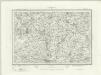
Holsworthy (Outline) - OS One-Inch Revised New Series
1 : 63360 Topographic maps Ordnance Survey Ordnance Survey