Maps of Bridgerule
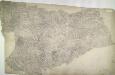
Cornwall VI.NW - OS Six-Inch Map
1 : 10560 Topographic maps Ordnance Survey Ordnance Survey
Cornwall VI.NW - OS Six-Inch Map
1 : 10560 Topographic maps Ordnance Survey Ordnance Survey
Devon XLIX.15 (includes: Bridgerule; Launcells; Pancrasweek) - 25 Inch Map
1 : 2500 Topographic maps Ordnance Survey Ordnance Survey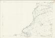
Devon XLIX.15 (includes: Bridgerule; Launcells; Pancrasweek) - 25 Inch Map
1 : 2500 Topographic maps Ordnance Survey Ordnance Survey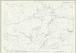
Cornwall VI.2 (includes: Bridgerule; Launcells; Pancrasweek) - 25 Inch Map
1 : 2500 Topographic maps Ordnance Survey Ordnance Survey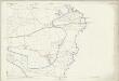
Cornwall VI.2 (includes: Bridgerule; Launcells; Pancrasweek) - 25 Inch Map
1 : 2500 Topographic maps Ordnance Survey Ordnance Survey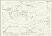
Cornwall VI.1 (includes: Bude Stratton; Launcells) - 25 Inch Map
1 : 2500 Topographic maps Ordnance Survey Ordnance Survey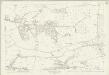
Cornwall VI.1 (includes: Bude Stratton; Launcells) - 25 Inch Map
1 : 2500 Topographic maps Ordnance Survey Ordnance Survey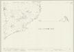
Cornwall VI.6 & 10 (includes: Bridgerule; Launcells; Pancrasweek; Pyworthy; Whitstone) - 25 Inch Map
1 : 2500 Topographic maps Ordnance Survey Ordnance Survey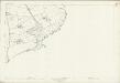
Cornwall VI.6 (includes: Bridgerule; Launcells; Pancrasweek) - 25 Inch Map
1 : 2500 Topographic maps Ordnance Survey Ordnance Survey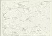
Cornwall VI.5 (includes: Bridgerule; Launcells; Marhamchurch) - 25 Inch Map
1 : 2500 Topographic maps Ordnance Survey Ordnance Survey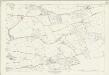
Cornwall VI.5 (includes: Bridgerule; Launcells; Marhamchurch) - 25 Inch Map
1 : 2500 Topographic maps Ordnance Survey Ordnance Survey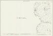
Devon XLIX.11 (includes: Launcells; Pancrasweek) - 25 Inch Map
1 : 2500 Topographic maps Ordnance Survey Ordnance Survey
Devon XLIX.11 (includes: Launcells; Pancrasweek) - 25 Inch Map
1 : 2500 Topographic maps Ordnance Survey Ordnance Survey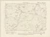
Devonshire XLIX.SE - OS Six-Inch Map
1 : 10560 Topographic maps Ordnance Survey Ordnance Survey
Devonshire XLIX.SE - OS Six-Inch Map
1 : 10560 Topographic maps Ordnance Survey Ordnance Survey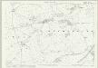
Devon LXI.3 (includes: Bridgerule; Launcells; Pyworthy) - 25 Inch Map
1 : 2500 Topographic maps Ordnance Survey Ordnance Survey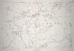
Devon LXI.3 (includes: Bridgerule; Launcells; Pyworthy) - 25 Inch Map
1 : 2500 Topographic maps Ordnance Survey Ordnance Survey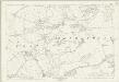
Devon LXI.3 (includes: Bridgerule; Launcells; Pyworthy) - 25 Inch Map
1 : 2500 Topographic maps Ordnance Survey Ordnance Survey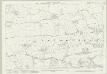
Devon LXI.2 (includes: Bridgerule; Launcells; Marhamchurch) - 25 Inch Map
1 : 2500 Topographic maps Ordnance Survey Ordnance Survey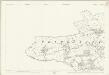
Devon LXI.2 (includes: Bridgerule; Launcells; Marhamchurch) - 25 Inch Map
1 : 2500 Topographic maps Ordnance Survey Ordnance Survey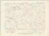
Devonshire LXI.NE - OS Six-Inch Map
1 : 10560 Topographic maps Ordnance Survey Ordnance Survey
Devonshire LXI.NE - OS Six-Inch Map
1 : 10560 Topographic maps Ordnance Survey Ordnance Survey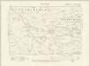
Devonshire LXI.NW - OS Six-Inch Map
1 : 10560 Topographic maps Ordnance Survey Ordnance Survey
Devonshire LXI.NW - OS Six-Inch Map
1 : 10560 Topographic maps Ordnance Survey Ordnance Survey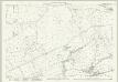
Devon XLIX.16 (includes: Bridgerule; Pancrasweek; Pyworthy) - 25 Inch Map
1 : 2500 Topographic maps Ordnance Survey Ordnance Survey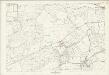
Devon XLIX.16 (includes: Bridgerule; Pancrasweek; Pyworthy) - 25 Inch Map
1 : 2500 Topographic maps Ordnance Survey Ordnance Survey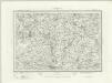
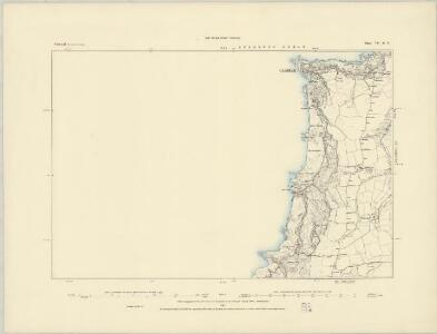
Holsworthy (Outline) - OS One-Inch Revised New Series
1 : 63360 Topographic maps Ordnance Survey Ordnance Survey
Holsworthy (Hills) - OS One-Inch Revised New Series
1 : 63360 Topographic maps Ordnance Survey Ordnance Survey