Maps of Bradworthy
Cornwall II.NW - OS Six-Inch Map
1 : 10560 Topographic maps Ordnance Survey Ordnance Survey
Cornwall II.NW - OS Six-Inch Map
1 : 10560 Topographic maps Ordnance Survey Ordnance Survey
Devon XXVII.15 (includes: Bradworthy; Hartland; Morwenstow) - 25 Inch Map
1 : 2500 Topographic maps Ordnance Survey Ordnance Survey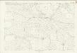
Devon XXVII.15 (includes: Bradworthy; Hartland; Morwenstow) - 25 Inch Map
1 : 2500 Topographic maps Ordnance Survey Ordnance Survey
Cornwall II.2 (includes: Bradworthy; Hartland; Morwenstow) - 25 Inch Map
1 : 2500 Topographic maps Ordnance Survey Ordnance Survey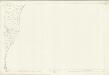
Cornwall II.6 (includes: Bradworthy; Hartland; Morwenstow) - 25 Inch Map
1 : 2500 Topographic maps Ordnance Survey Ordnance Survey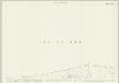
Cornwall II.1 (includes: Hartland; Morwenstow; Welcombe) - 25 Inch Map
1 : 2500 Topographic maps Ordnance Survey Ordnance Survey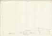
Cornwall II.1 (includes: Hartland; Morwenstow; Welcombe) - 25 Inch Map
1 : 2500 Topographic maps Ordnance Survey Ordnance Survey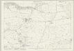
Cornwall II.5 (includes: Morwenstow) - 25 Inch Map
1 : 2500 Topographic maps Ordnance Survey Ordnance Survey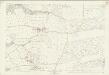
Cornwall II.5 (includes: Morwenstow) - 25 Inch Map
1 : 2500 Topographic maps Ordnance Survey Ordnance Survey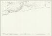
Devon XXVII.14 (includes: Hartland; Morwenstow; Welcombe) - 25 Inch Map
1 : 2500 Topographic maps Ordnance Survey Ordnance Survey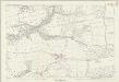
Devon XXVII.14 (includes: Hartland; Morwenstow; Welcombe) - 25 Inch Map
1 : 2500 Topographic maps Ordnance Survey Ordnance Survey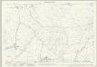
Devon XXVII.11 (includes: Bradworthy; Hartland) - 25 Inch Map
1 : 2500 Topographic maps Ordnance Survey Ordnance Survey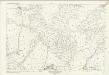
Devon XXVII.11 (includes: Bradworthy; Hartland) - 25 Inch Map
1 : 2500 Topographic maps Ordnance Survey Ordnance Survey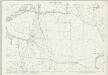
Devon XXVII.10 (includes: Hartland; Welcombe) - 25 Inch Map
1 : 2500 Topographic maps Ordnance Survey Ordnance Survey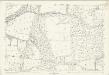
Devon XXVII.10 (includes: Hartland; Welcombe) - 25 Inch Map
1 : 2500 Topographic maps Ordnance Survey Ordnance Survey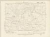
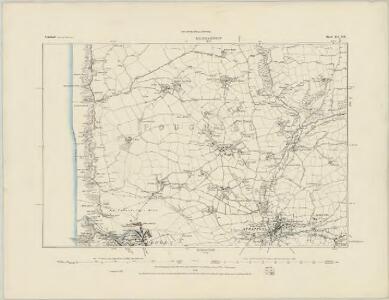
Devonshire XXVII.SE - OS Six-Inch Map
1 : 10560 Topographic maps Ordnance Survey Ordnance Survey
Devonshire XXVII.SE - OS Six-Inch Map
1 : 10560 Topographic maps Ordnance Survey Ordnance Survey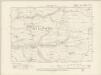
Devonshire XXVII.SW - OS Six-Inch Map
1 : 10560 Topographic maps Ordnance Survey Ordnance Survey
Devonshire XXVII.SW - OS Six-Inch Map
1 : 10560 Topographic maps Ordnance Survey Ordnance Survey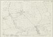
Devon XXXVIII.3 (includes: Bradworthy; Kilkhampton; Morwenstow) - 25 Inch Map
1 : 2500 Topographic maps Ordnance Survey Ordnance Survey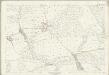
Devon XXXVIII.3 (includes: Bradworthy; Kilkhampton; Morwenstow) - 25 Inch Map
1 : 2500 Topographic maps Ordnance Survey Ordnance Survey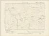
Devonshire XXXVIII.NE - OS Six-Inch Map
1 : 10560 Topographic maps Ordnance Survey Ordnance Survey
Devonshire XXXVIII.NE - OS Six-Inch Map
1 : 10560 Topographic maps Ordnance Survey Ordnance Survey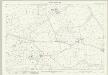
Devon XXVII.16 (includes: Bradworthy) - 25 Inch Map
1 : 2500 Topographic maps Ordnance Survey Ordnance Survey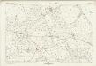
Devon XXVII.16 (includes: Bradworthy) - 25 Inch Map
1 : 2500 Topographic maps Ordnance Survey Ordnance Survey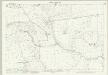
Devon XXVII.12 (includes: Bradworthy; Hartland; Woolfardisworthy) - 25 Inch Map
1 : 2500 Topographic maps Ordnance Survey Ordnance Survey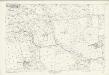
Devon XXVII.12 (includes: Bradworthy; Hartland; Woolfardisworthy) - 25 Inch Map
1 : 2500 Topographic maps Ordnance Survey Ordnance Survey
Bude (Hills) - OS One-Inch Revised New Series
1 : 63360 Topographic maps Ordnance Survey Ordnance Survey