Maps of Guildford
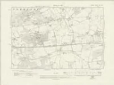
Surrey XXIII.SW - OS Six-Inch Map
1 : 10560 Topographic maps Ordnance Survey Ordnance Survey
Surrey XXIII.SW - OS Six-Inch Map
1 : 10560 Topographic maps Ordnance Survey Ordnance Survey
Surrey XXIII.SW - OS Six-Inch Map
1 : 10560 Topographic maps Ordnance Survey Ordnance Survey
Surrey XXIII.9 (includes: Ash and Normandy) - 25 Inch Map
1 : 2500 Topographic maps Ordnance Survey Ordnance Survey
Surrey XXIII.9 (includes: Ash and Normandy) - 25 Inch Map
1 : 2500 Topographic maps Ordnance Survey Ordnance Survey
Surrey XXIII.13 (includes: Ash and Normandy; Wanborough) - 25 Inch Map
1 : 2500 Topographic maps Ordnance Survey Ordnance Survey
Surrey XXIII.13 (includes: Ash and Normandy; Wanborough) - 25 Inch Map
1 : 2500 Topographic maps Ordnance Survey Ordnance Survey
Surrey XXIII.13 (includes: Ash and Normandy; Wanborough) - 25 Inch Map
1 : 2500 Topographic maps Ordnance Survey Ordnance Survey
Surrey XXIII.10 (includes: Ash and Normandy; Worplesdon) - 25 Inch Map
1 : 2500 Topographic maps Ordnance Survey Ordnance Survey
Surrey XXIII.10 (includes: Ash and Normandy; Worplesdon) - 25 Inch Map
1 : 2500 Topographic maps Ordnance Survey Ordnance Survey
Surrey XXIII.10 (includes: Ash and Normandy; Worplesdon) - 25 Inch Map
1 : 2500 Topographic maps Ordnance Survey Ordnance Survey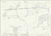
Surrey XXIII.14 (includes: Ash and Normandy; Compton; Wanborough; Worplesdon) - 25 Inch Map
1 : 2500 Topographic maps Ordnance Survey Ordnance Survey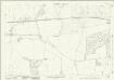
Surrey XXIII.14 (includes: Ash and Normandy; Compton; Wanborough; Worplesdon) - 25 Inch Map
1 : 2500 Topographic maps Ordnance Survey Ordnance Survey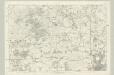
Surrey XXIII - OS Six-Inch Map
1 : 10560 Topographic maps Ordnance Survey Ordnance Survey
Map of Henly Parke
Maps of Henley Park from "A Description of the Honour of Windesor", John Norden's survey of Windsor. The title page states that the survey was "taken and performed by the perambulation view and delineation of John Norden In Anno 1607". The plans are the result of a survey conducted on foot by Norden. The maps in this volume show communication routes, individual buildings, field boundaries and parkland along with details of wildlife and human activity, such as stags in Windsor Park and people boating on the Thames. The scale at which the maps are presented varies throughout the volume, with feet, perches and miles being the units of measurement recorded by a scale bar.John Norden is best known for his work "Speculum Britainiae", literally a "Mirror of Britain", which in its attempt to include the road names and town plans, lacking on many county maps of the period, was a direct ancestor of the modern A-Z. As well as producing several county maps in the 1590s, Norden worked as a land surveyor producing surveys for landowners and was the author of a work which outlines principles of surveying, known as the "Surveyor's Dialogue". Norden, John

SU95 - OS 1:25,000 Provisional Series Map
1 : 25000 Topographic maps Ordnance Survey Ordnance Survey
Godalming
1 : 31680 .This map is in excellent condition and has retained its colour through two centuries. The turquoise wash, used to indicate water, remains particularly bright and vibrant. Commonland is the most prominent topographical feature in the drawing, denoted by open dotting. Large commons are shown at Frensham, Fernham, Thursley, Witley and Hinkley. Commons were carefully detailed by the surveyors, with a view to their possible use as military encampments. Although illustrating archaeological features did not become obligatory until 1816, this map notes a Bronze Age structure called the Devil's Jump, near Elstead at the centre of the map. Budgen, Thomas
Aldershot (Hills) - OS One-Inch Revised New Series
1 : 63360 Topographic maps Ordnance Survey Ordnance Survey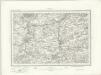
Aldershot (Outline) - OS One-Inch Revised New Series
1 : 63360 Topographic maps Ordnance Survey Ordnance Survey
Chobham
1 : 31680 .This map is in poor repair. Its edges are dirty and damaged, and a join is visible where the drawing has been torn. Triangulation points can be seen at the map's boundaries, along with a series of stitch holes. Silk tape was wound through these holes to protect the map in the field. .The drawing details a large number of commons, including Pirbright, Ham Haw and Ockham. These are depicted by patterns of open dotting. Basingstoke Canal also features. It was completed in 1794, only a few years before this map was drawn. Blue washes, used to depict water, have faded. The town of Chertsey appears towards the top right, along with the ruins of Chertsey Abbey. The abbey was founded in AD666, as a house for the Benedictine Order, and dissolved in 1537. Budgen, Thomas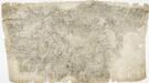
Odiham
1 : 31680 The most striking feature of this drawing is the triangulation web covering a large area around the East Hampstead Plain. According to manuscript sources, the different ground levels in this region made it an ideal case study for assistant engineers training for the Ordnance Survey under the tuition of Robert Dawson, the surveyor of this plan. Two circles on the main road through Hartford Bridge Flats represent triangulation points. Dawson, Robert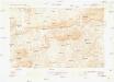
Guildford
1 : 63360 Ordnance Survey Office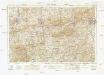
Guildford
1 : 63360 Ordnance Survey Office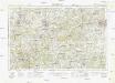
Guildford
1 : 63360 Ordnance Survey Office
London passenger transport map
Ordnance Survey
Aldershot - OS One-Inch Map
1 : 63360 Topographic maps Ordnance Survey Ordnance Survey
Map of Forests around Windsor
Map of the forests around Windsor from "A Description of the Honour of Windesor", John Norden's survey of Windsor. The title page states that the survey was "taken and performed by the perambulation view and delineation of John Norden In Anno 1607". The plans are the result of a survey conducted on foot by Norden. The maps in this volume show communication routes, individual buildings, field boundaries and parkland along with details of wildlife and human activity, such as stags in Windsor Park and people boating on the Thames. The scale at which the maps are presented varies throughout the volume, with feet, perches and miles being the units of measurement recorded by a scale bar. John Norden is best known for his work "Speculum Britainiae", literally a "Mirror of Britain", which in its attempt to include the road names and town plans, lacking on many county maps of the period, was a direct ancestor of the modern A-Z. As well as producing several county maps in the 1590s, Norden worked as a land surveyor producing surveys for landowners and was the author of a work which outlines principles of surveying, known as the "Surveyor's Dialogue". Norden, John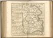
Provincia di Surrey
1 Karte : Kupferdruck ; 18 x 29 cm Zatta presso Antonio Zatta
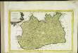
An accurate map of the county of Surrey
1 Karte : Kupferdruck ; 51 x 69 cm Bowen; Hinton sold by I. Hinton at the Kings Arms in St Pauls Church Yard