Maps of Runnymede
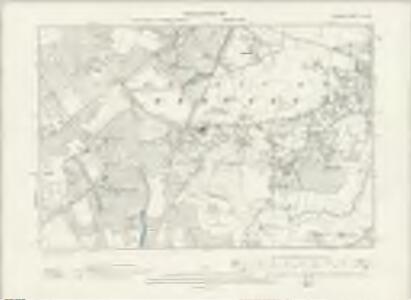
Surrey XI.SW - OS Six-Inch Map
1 : 10560 Topographic maps Ordnance Survey Ordnance Survey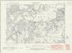
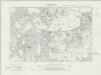
Surrey XI.SW - OS Six-Inch Map
1 : 10560 Topographic maps Ordnance Survey Ordnance Survey
Surrey XI.SW - OS Six-Inch Map
1 : 10560 Topographic maps Ordnance Survey Ordnance Survey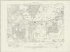
Surrey XI.SW - OS Six-Inch Map
1 : 10560 Topographic maps Ordnance Survey Ordnance Survey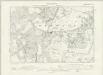
Surrey XI.SW - OS Six-Inch Map
1 : 10560 Topographic maps Ordnance Survey Ordnance Survey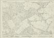
Surrey XI.9 (includes: Chertsey) - 25 Inch Map
1 : 2500 Topographic maps Ordnance Survey Ordnance Survey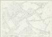
Surrey XI.9 (includes: Chertsey) - 25 Inch Map
1 : 2500 Topographic maps Ordnance Survey Ordnance Survey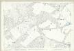
Surrey XI.9 (includes: Chertsey) - 25 Inch Map
1 : 2500 Topographic maps Ordnance Survey Ordnance Survey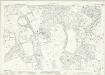
Surrey XI.13 (includes: Chertsey; Chobham) - 25 Inch Map
1 : 2500 Topographic maps Ordnance Survey Ordnance Survey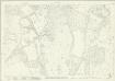
Surrey XI.13 (includes: Chertsey; Chobham) - 25 Inch Map
1 : 2500 Topographic maps Ordnance Survey Ordnance Survey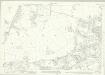
Surrey XI.10 (includes: Chertsey) - 25 Inch Map
1 : 2500 Topographic maps Ordnance Survey Ordnance Survey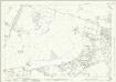
Surrey XI.10 (includes: Chertsey) - 25 Inch Map
1 : 2500 Topographic maps Ordnance Survey Ordnance Survey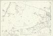
Surrey XI.10 (includes: Chertsey) - 25 Inch Map
1 : 2500 Topographic maps Ordnance Survey Ordnance Survey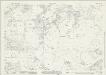
Surrey XI.14 (includes: Chertsey) - 25 Inch Map
1 : 2500 Topographic maps Ordnance Survey Ordnance Survey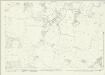
Surrey XI.14 (includes: Chertsey) - 25 Inch Map
1 : 2500 Topographic maps Ordnance Survey Ordnance Survey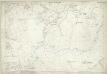
Surrey XI.14 (includes: Chertsey) - 25 Inch Map
1 : 2500 Topographic maps Ordnance Survey Ordnance Survey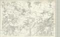
Surrey XI - OS Six-Inch Map
1 : 10560 Topographic maps Ordnance Survey Ordnance Survey
TQ06 - OS 1:25,000 Provisional Series Map
1 : 25000 Topographic maps Ordnance Survey Ordnance Survey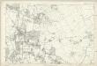
Berkshire XLVIII - OS Six-Inch Map
1 : 10560 Topographic maps Ordnance Survey Ordnance Survey
The first sheet of an actual survey of Berkshire
1 Blatt : 68 x 52 cm publish'd according to act of parliament by John Rocque chorographer to their royal Highnesses the late and present Prince of Wales etc. in the Strand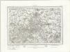
Windsor (Outline) - OS One-Inch Revised New Series
1 : 63360 Topographic maps Ordnance Survey Ordnance Survey
Windsor (Hills) - OS One-Inch Revised New Series
1 : 63360 Topographic maps Ordnance Survey Ordnance Survey
Chobham
1 : 31680 .This map is in poor repair. Its edges are dirty and damaged, and a join is visible where the drawing has been torn. Triangulation points can be seen at the map's boundaries, along with a series of stitch holes. Silk tape was wound through these holes to protect the map in the field. .The drawing details a large number of commons, including Pirbright, Ham Haw and Ockham. These are depicted by patterns of open dotting. Basingstoke Canal also features. It was completed in 1794, only a few years before this map was drawn. Blue washes, used to depict water, have faded. The town of Chertsey appears towards the top right, along with the ruins of Chertsey Abbey. The abbey was founded in AD666, as a house for the Benedictine Order, and dissolved in 1537. Budgen, Thomas
London passenger transport map
Ordnance Survey
Estates at Windsor, Berkshire
This is a manuscript map of the area surrounding Windsor in Berkshire. It forms part of an atlas that belonged to William Cecil Lord Burghley, Elizabeth I’s Secretary of State. Burghley used this atlas to illustrate domestic matters. Burghley was in charge of administration for the Royal Estate of Windsor. The Royal Estates were notoriously slackly administered, a flaw that no official involved was keen to remedy as there were considerable personal advantages to be gained from inadequacies in the system. The map is drawn to scale with a scale bar of 5.5 - 6 miles. The many parks are shown by enclosure symbols, an important feature of any landscape for military purposes as it was in parks that troops could rest and horses graze. Communication routes such as roads and pathways are indicated by double or single broken lines and the rivers and the points at which they are bridged are also shown. The waterways were a vital communication route at the time, especially in this area where the Thames provides direct access to the centre of London.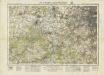
England and Wales [OS of]
Ordnance Survey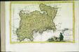
Provincia di Middlesex
1 Karte : Kupferdruck ; 19 x 29 cm Zatta; Zuliani; Pitteri presso Antonio Zatta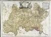
A map of the county of Middlesex
1 Karte : Kupferdruck ; 50 x 68 cm Rocque publish'd according to act of parliament by J. Rocque in the Strand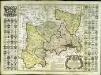
Map of the county of Middlesex
1 Karte : Kupferdruck ; 50 x 50 cm, Bildgrösse 52 x 73 cm Seale s.n.