Maps of Adur
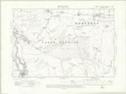
Sussex LII.SW - OS Six-Inch Map
1 : 10560 Topographic maps Ordnance Survey Ordnance Survey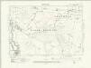
Sussex LII.SW - OS Six-Inch Map
1 : 10560 Topographic maps Ordnance Survey Ordnance Survey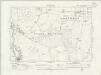
Sussex LII.SW - OS Six-Inch Map
1 : 10560 Topographic maps Ordnance Survey Ordnance Survey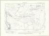
Sussex LII.SW - OS Six-Inch Map
1 : 10560 Topographic maps Ordnance Survey Ordnance Survey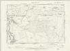
Sussex LII.SW - OS Six-Inch Map
1 : 10560 Topographic maps Ordnance Survey Ordnance Survey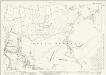
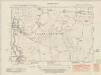
Sussex LII.9 (includes: Upper Beeding) - 25 Inch Map
1 : 2500 Topographic maps Ordnance Survey Ordnance Survey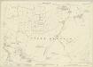
Sussex LII.9 (includes: Upper Beeding) - 25 Inch Map
1 : 2500 Topographic maps Ordnance Survey Ordnance Survey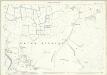
Sussex LII.9 (includes: Upper Beeding) - 25 Inch Map
1 : 2500 Topographic maps Ordnance Survey Ordnance Survey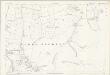
Sussex LII.9 (includes: Upper Beeding) - 25 Inch Map
1 : 2500 Topographic maps Ordnance Survey Ordnance Survey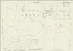
Sussex LII.10 (includes: Fulking; Upper Beeding) - 25 Inch Map
1 : 2500 Topographic maps Ordnance Survey Ordnance Survey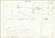
Sussex LII.10 (includes: Fulking; Upper Beeding) - 25 Inch Map
1 : 2500 Topographic maps Ordnance Survey Ordnance Survey
Sussex LII.13 (includes: Bramber; Old Shoreham; Upper Beeding) - 25 Inch Map
1 : 2500 Topographic maps Ordnance Survey Ordnance Survey
Sussex LII.14 (includes: Fulking; Old Shoreham; Upper Beeding) - 25 Inch Map
1 : 2500 Topographic maps Ordnance Survey Ordnance Survey
Sussex LII.14 (includes: Fulking; Old Shoreham; Upper Beeding) - 25 Inch Map
1 : 2500 Topographic maps Ordnance Survey Ordnance Survey
Sussex LII - OS Six-Inch Map
1 : 10560 Topographic maps Ordnance Survey Ordnance Survey
TQ21 - OS 1:25,000 Provisional Series Map
1 : 25000 Topographic maps Ordnance Survey Ordnance Survey
TQ20 - OS 1:25,000 Provisional Series Map
1 : 25000 Topographic maps Ordnance Survey Ordnance Survey
Brighton (Hills) - OS One-Inch Revised New Series
1 : 63360 Topographic maps Ordnance Survey Ordnance Survey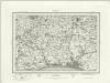
Brighton (Outline) - OS One-Inch Revised New Series
1 : 63360 Topographic maps Ordnance Survey Ordnance Survey
Brighton and Worthing - OS One-Inch Map
1 : 63360 Topographic maps Ordnance Survey Ordnance Survey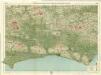
Sussex, Sheet 32 - Bartholomew's "Half Inch to the Mile Maps" of England & Wales
1 : 126720 Topographic maps Bartholomew, John George John Bartholomew & Co
Suthsexia vernacule Sussex
1 Karte : Kupferdruck ; 36 x 49 cm Valck; Schenk apud Gerardum Valk et Petrum Schenk
Svthsexia; vernacule Svssex
1 Karte : Kupferdruck ; 37 x 51 cm Blaeu Joan Blaeu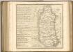
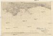
Der Kanal
1 : 150000 Lamanšský průliv Reichs-Marine-Amt
Sheets 15-16. (Cary's England, Wales, and Scotland).
1 : 360000 Cary, John, ca. 1754-1835
Surria vernacule Surrey
1 : 220000 [Amstelodami] : [apud Joannem Janssonium]
SVTHSEXIA, | Vernacule | SUSSEX.
[Amsterdam : Joan Blaeu]
Suthsexia vernacule Sussex
1 : 240000 Amstelodami : apud Joannem Janssonium