Maps of Kent
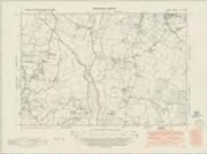
Kent LXII.NW - OS Six-Inch Map
1 : 10560 Topographic maps Ordnance Survey Ordnance Survey
Kent LXII.NW - OS Six-Inch Map
1 : 10560 Topographic maps Ordnance Survey Ordnance Survey
Kent LXII.NW - OS Six-Inch Map
1 : 10560 Topographic maps Ordnance Survey Ordnance Survey
Kent LXII.1 (includes: Horsmonden; Marden; Yalding) - 25 Inch Map
1 : 2500 Topographic maps Ordnance Survey Ordnance Survey
Kent LXII.1 (includes: Horsmonden; Marden; Yalding) - 25 Inch Map
1 : 2500 Topographic maps Ordnance Survey Ordnance Survey
Kent LXII.1 (includes: Horsmonden; Marden; Yalding) - 25 Inch Map
1 : 2500 Topographic maps Ordnance Survey Ordnance Survey
Kent LXII.5 (includes: Horsmonden) - 25 Inch Map
1 : 2500 Topographic maps Ordnance Survey Ordnance Survey
Kent LXII.5 (includes: Horsmonden) - 25 Inch Map
1 : 2500 Topographic maps Ordnance Survey Ordnance Survey
Kent LXII.2 (includes: Marden) - 25 Inch Map
1 : 2500 Topographic maps Ordnance Survey Ordnance Survey
Kent LXII.2 (includes: Marden) - 25 Inch Map
1 : 2500 Topographic maps Ordnance Survey Ordnance Survey
Kent LXII.6 (includes: Goudhurst; Marden; Staplehurst) - 25 Inch Map
1 : 2500 Topographic maps Ordnance Survey Ordnance Survey
Kent LXII.6 (includes: Goudhurst; Marden; Staplehurst) - 25 Inch Map
1 : 2500 Topographic maps Ordnance Survey Ordnance Survey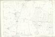
Kent LXII.6 (includes: Goudhurst; Marden; Staplehurst) - 25 Inch Map
1 : 2500 Topographic maps Ordnance Survey Ordnance Survey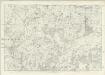
Kent LXII - OS Six-Inch Map
1 : 10560 Topographic maps Ordnance Survey Ordnance Survey
TQ74 - OS 1:25,000 Provisional Series Map
1 : 25000 Topographic maps Ordnance Survey Ordnance Survey
Goudhurst, Kent 16
1 : 21120 This laminated outline drawing of the Kentish Weald is dominated by regular field boundaries and unproductive enclosed land, depicted by open dotting. Buildings are infilled and blocked together in the main settlements of Goudhurst and Broadford. Yellow ochre and blue washes distinguish roads and waterways, respectively.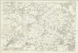
Sussex VIII - OS Six-Inch Map
1 : 10560 Topographic maps Ordnance Survey Ordnance Survey
A topographical-map, of the county of Kent, 12
1 Blatt : 54 x 71 cm A. Dury, W. Herbert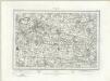
Maidstone (Outline) - OS One-Inch Revised New Series
1 : 63360 Topographic maps Ordnance Survey Ordnance Survey
Maidstone (Hills) - OS One-Inch Revised New Series
1 : 63360 Topographic maps Ordnance Survey Ordnance Survey
Chatham and Maidstone - OS One-Inch Map
1 : 63360 Topographic maps Ordnance Survey Ordnance Survey
London SE - OS One-Inch Map
1 : 63360 Topographic maps Ordnance Survey Ordnance Survey
Hastings - OS One-Inch Map
1 : 63360 Topographic maps Ordnance Survey Ordnance Survey
Kent, Sheet 31 - Bartholomew's "Half Inch to the Mile Maps" of England & Wales
1 : 126720 Topographic maps Bartholomew, John George John Bartholomew & Co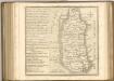
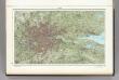
60. London. The World Atlas.
1 : 250000 USSR (Union of Soviet Socialist Republics).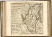
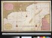
Een gedeelte van het Kanaal van de Hoofden tot den hoek van Bevesier als meede een gedeelte van de cust van Vrankrijk
English Channel Gerard van Keulen
Cantium vernacule Kent
1 : 130000 Amstelodami : apud Joannem Janssonium