Maps of Tonbridge and Malling
Kent LI.NE - OS Six-Inch Map
1 : 10560 Topographic maps Ordnance Survey Ordnance Survey
Kent LI.NE - OS Six-Inch Map
1 : 10560 Topographic maps Ordnance Survey Ordnance Survey
Kent LI.NE - OS Six-Inch Map
1 : 10560 Topographic maps Ordnance Survey Ordnance Survey
Kent LI.3 (includes: East Peckham; Nettlestead) - 25 Inch Map
1 : 2500 Topographic maps Ordnance Survey Ordnance Survey
Kent LI.3 (includes: East Peckham; Nettlestead) - 25 Inch Map
1 : 2500 Topographic maps Ordnance Survey Ordnance Survey
Kent LI.3 (includes: East Peckham; Nettlestead) - 25 Inch Map
1 : 2500 Topographic maps Ordnance Survey Ordnance Survey
Kent LI.7 (includes: East Peckham; Yalding) - 25 Inch Map
1 : 2500 Topographic maps Ordnance Survey Ordnance Survey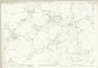
Kent LI.7 (includes: East Peckham; Yalding) - 25 Inch Map
1 : 2500 Topographic maps Ordnance Survey Ordnance Survey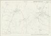
Kent LI.4 (includes: Nettlestead; Yalding) - 25 Inch Map
1 : 2500 Topographic maps Ordnance Survey Ordnance Survey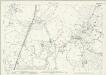
Kent LI.4 (includes: Nettlestead; Yalding) - 25 Inch Map
1 : 2500 Topographic maps Ordnance Survey Ordnance Survey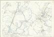
Kent LI.4 (includes: Nettlestead; Yalding) - 25 Inch Map
1 : 2500 Topographic maps Ordnance Survey Ordnance Survey
Kent LI.8 (includes: Yalding) - 25 Inch Map
1 : 2500 Topographic maps Ordnance Survey Ordnance Survey
Kent LI.8 (includes: Yalding) - 25 Inch Map
1 : 2500 Topographic maps Ordnance Survey Ordnance Survey
Kent LI.8 (includes: Yalding) - 25 Inch Map
1 : 2500 Topographic maps Ordnance Survey Ordnance Survey
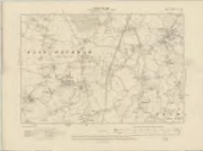
Kent LI - OS Six-Inch Map
1 : 10560 Topographic maps Ordnance Survey Ordnance Survey
TQ64 - OS 1:25,000 Provisional Series Map
1 : 25000 Topographic maps Ordnance Survey Ordnance Survey
Mereworth, Kent
1 : 10560 Irregular field boundaries enclosing agricultural land dominate the Medway Valley in Kent, around the main settlements of Hadlow, Mereworth and Yalding. Rays in red ink intersect the map, evidence of measurements taken by the surveyor between fixed triangulation points. The ruled black-sheet lines indicate the edges of the area that was copied for plans 100 and 119.
A topographical-map, of the county of Kent, 12
1 Blatt : 54 x 71 cm A. Dury, W. Herbert
A sketch of the roads within fourteen miles of Tunbridge Wells
1 : 100000 Brackett, William Clifford, J J. Clifford
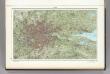
London SE - OS One-Inch Map
1 : 63360 Topographic maps Ordnance Survey Ordnance Survey
Hastings - OS One-Inch Map
1 : 63360 Topographic maps Ordnance Survey Ordnance Survey
A TOPGRAPHICAL MAP OF THE COUNTRY TWENTY MILES ROUND LONDON
In the second half of the18th century, the introduction of turnpike roads and the increased coach-traffic in and out of London contributed to the popularity of the maps of the countryside around the capital. The title of this circular map runs along the top, with points on the compass marked on the border. A list of main roads to and from London is provided at bottom left, with a key at bottom right and scale bar below the plan. Faden, William
Environs of London.
1 : 93000 Colton, G.W.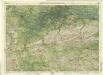
Surrey, Sheet 30 - Bartholomew's "Half Inch to the Mile Maps" of England & Wales
1 : 126720 Topographic maps Bartholomew, John George John Bartholomew & Co
Kent, Sheet 31 - Bartholomew's "Half Inch to the Mile Maps" of England & Wales
1 : 126720 Topographic maps Bartholomew, John George John Bartholomew & Co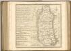
60. London. The World Atlas.
1 : 250000 USSR (Union of Soviet Socialist Republics).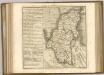

Cantium vernacule Kent
1 : 130000 Amstelodami : apud Joannem Janssonium