Maps of Sevenoaks
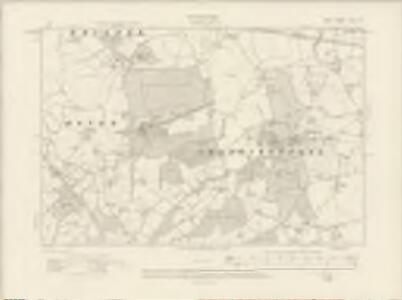
Kent XLIX.SE - OS Six-Inch Map
1 : 10560 Topographic maps Ordnance Survey Ordnance Survey
Kent XLIX.SE - OS Six-Inch Map
1 : 10560 Topographic maps Ordnance Survey Ordnance Survey
Kent XLIX.SE - OS Six-Inch Map
1 : 10560 Topographic maps Ordnance Survey Ordnance Survey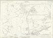
Kent XLIX.11 (includes: Edenbridge; Hever) - 25 Inch Map
1 : 2500 Topographic maps Ordnance Survey Ordnance Survey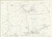
Kent XLIX.11 (includes: Edenbridge; Hever) - 25 Inch Map
1 : 2500 Topographic maps Ordnance Survey Ordnance Survey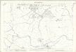
Kent XLIX.11 (includes: Edenbridge; Hever) - 25 Inch Map
1 : 2500 Topographic maps Ordnance Survey Ordnance Survey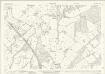
Kent XLIX.15 (includes: Hever) - 25 Inch Map
1 : 2500 Topographic maps Ordnance Survey Ordnance Survey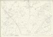
Kent XLIX.15 (includes: Hever) - 25 Inch Map
1 : 2500 Topographic maps Ordnance Survey Ordnance Survey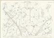
Kent XLIX.15 (includes: Hever) - 25 Inch Map
1 : 2500 Topographic maps Ordnance Survey Ordnance Survey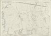
Kent XLIX.12 (includes: Chiddingstone; Penshurst) - 25 Inch Map
1 : 2500 Topographic maps Ordnance Survey Ordnance Survey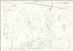
Kent XLIX.12 (includes: Chiddingstone; Penshurst) - 25 Inch Map
1 : 2500 Topographic maps Ordnance Survey Ordnance Survey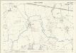
Kent XLIX.12 (includes: Chiddingstone; Penshurst) - 25 Inch Map
1 : 2500 Topographic maps Ordnance Survey Ordnance Survey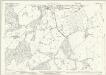
Kent XLIX.16 (includes: Chiddingstone; Penshurst) - 25 Inch Map
1 : 2500 Topographic maps Ordnance Survey Ordnance Survey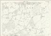
Kent XLIX.16 (includes: Chiddingstone; Penshurst) - 25 Inch Map
1 : 2500 Topographic maps Ordnance Survey Ordnance Survey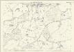
Kent XLIX.16 (includes: Chiddingstone; Penshurst) - 25 Inch Map
1 : 2500 Topographic maps Ordnance Survey Ordnance Survey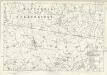
Kent XLIX - OS Six-Inch Map
1 : 10560 Topographic maps Ordnance Survey Ordnance Survey
Penshurst (Kent)
1 : 21120 Drawing showing the area to the west of Penshurst in Kent. The lack of hill sketching suggests this is an intermediate version rather than a completed drawing. Woodland is indicated by meticulous renderings of individual trees. Stone walls, indicated in red ink, mark field boundaries. A pest house ("Pest Ho") is noted to the left of Sevenoaks Common. The pest house provided shelter for people afflicted by plague and other infectious diseases at a safe distance from the densely populated town.
TQ44 - OS 1:25,000 Provisional Series Map
1 : 25000 Topographic maps Ordnance Survey Ordnance Survey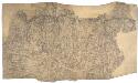
Sevenoaks (Kent)
1 : 21120 Drawing showing the area to the southwest of Sevenoaks. A note in the bottom right corner confirms that this is a field sketch. The loose drawing style contrasts greatly with the later, more finished drawings.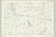
Surrey XXXVI - OS Six-Inch Map
1 : 10560 Topographic maps Ordnance Survey Ordnance Survey
A topographical-map, of the county of Kent, 11
1 Blatt : 54 x 69 cm A. Dury, W. Herbert
Sevenoaks (Hills) - OS One-Inch Revised New Series
1 : 63360 Topographic maps Ordnance Survey Ordnance Survey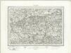
Sevenoaks (Outline) - OS One-Inch Revised New Series
1 : 63360 Topographic maps Ordnance Survey Ordnance Survey
A sketch of the roads within fourteen miles of Tunbridge Wells
1 : 100000 Brackett, William Clifford, J J. Clifford
London passenger transport map
Ordnance Survey
London SE - OS One-Inch Map
1 : 63360 Topographic maps Ordnance Survey Ordnance Survey
SVRRIA | Vernacule | SVRREY.
[Amsterdam : Joan Blaeu]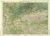
Surrey, Sheet 30 - Bartholomew's "Half Inch to the Mile Maps" of England & Wales
1 : 126720 Topographic maps Bartholomew, John George John Bartholomew & Co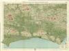
Sussex, Sheet 32 - Bartholomew's "Half Inch to the Mile Maps" of England & Wales
1 : 126720 Topographic maps Bartholomew, John George John Bartholomew & Co