Maps of Swale
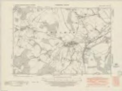
Kent XLV.SE - OS Six-Inch Map
1 : 10560 Topographic maps Ordnance Survey Ordnance Survey
Kent XLV.SE - OS Six-Inch Map
1 : 10560 Topographic maps Ordnance Survey Ordnance Survey
Kent XLV.SE - OS Six-Inch Map
1 : 10560 Topographic maps Ordnance Survey Ordnance Survey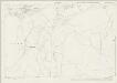
Kent XLV.16 (includes: Chilham) - 25 Inch Map
1 : 2500 Topographic maps Ordnance Survey Ordnance Survey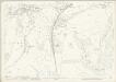
Kent XLV.16 (includes: Chilham) - 25 Inch Map
1 : 2500 Topographic maps Ordnance Survey Ordnance Survey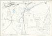
Kent XLV.16 (includes: Chilham) - 25 Inch Map
1 : 2500 Topographic maps Ordnance Survey Ordnance Survey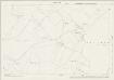
Kent XLV.15 (includes: Chilham) - 25 Inch Map
1 : 2500 Topographic maps Ordnance Survey Ordnance Survey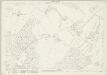
Kent XLV.15 (includes: Chilham) - 25 Inch Map
1 : 2500 Topographic maps Ordnance Survey Ordnance Survey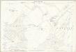
Kent XLV.15 (includes: Chilham) - 25 Inch Map
1 : 2500 Topographic maps Ordnance Survey Ordnance Survey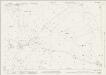
Kent XLV.11 (includes: Chilham; Selling) - 25 Inch Map
1 : 2500 Topographic maps Ordnance Survey Ordnance Survey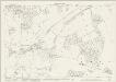
Kent XLV.11 (includes: Chilham; Selling) - 25 Inch Map
1 : 2500 Topographic maps Ordnance Survey Ordnance Survey
Kent XLV.11 (includes: Chilham; Selling) - 25 Inch Map
1 : 2500 Topographic maps Ordnance Survey Ordnance Survey
Kent XLV.12 (includes: Chilham) - 25 Inch Map
1 : 2500 Topographic maps Ordnance Survey Ordnance Survey
Kent XLV.12 (includes: Chilham) - 25 Inch Map
1 : 2500 Topographic maps Ordnance Survey Ordnance Survey
Kent XLV.12 (includes: Chilham) - 25 Inch Map
1 : 2500 Topographic maps Ordnance Survey Ordnance Survey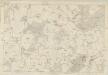
Kent XLV - OS Six-Inch Map
1 : 10560 Topographic maps Ordnance Survey Ordnance Survey
TR05 - OS 1:25,000 Provisional Series Map
1 : 25000 Topographic maps Ordnance Survey Ordnance Survey
Chilham, Kent 6
Drawing showing the area between Challock and Chilham in Kent. To plot the landscape of England, individual parts of the countryside were divided into triangular sections., Two black lines visible on this map represent sides of,one such,triangle., The drawing is covered in red lines., Radiating from fixed points, these indicate the positions from which the surveyor took angular measurements to plot the location of topographical features. Pink, George
Charing, Kent(002OSD000000017U00377000)
This rough sketch was produced in the field. Crosshatching indicates relief, and generalised representations of treetops describe woodland.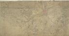
Canterbury, Kent
1 : 21120 The Cathedral City of Canterbury is the large settlement featured at the centre of this drawing. Barracks are recorded nearby. Attention to communications routes conform well to the military and cartographic standards employed by the Survey. The map has been folded, making it hard to read in some places. The top portion of the plan appears to have been torn off.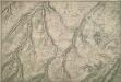
Eastling, Kent 27A
1 : 10560 This plan of the east Kent lowlands shows a region characterised by irregularly shaped field boundaries. The drawing is made on rectangular sheet lines, enclosed by a black border. Fields are coloured brown where cultivated, and green or blank if untilled. Stonework buildings or structures are drawn in red ink at the settlements of Eastling and Moldash. Infilled or blocked areas of black or sepia ink denote structures or buildings made from less permanent materials such as wood.
A topographical-map, of the county of Kent, 14
1 Blatt : 54 x 71 cm A. Dury, W. Herbert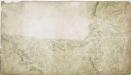
Charing, Kent(002OSD000000017U00375000)
The dominant feature of this drawing is the use of different shades of green to distinguish fields and woods. The draughtsman has depicted individual trees and recorded the position of clearings in Chilham Park. Such detail is testimony to the meticulousness of the Survey. The Stone Street Causeway, a Roman road, is shown to the left of the plan. Connecting Lympne to Canterbury, it is likely to have been the route taken by Henry II's men on their way to murder Archbishop Thomas Becket in Canterbury Cathedral on 29 December 1170.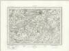
Canterbury (Outline) - OS One-Inch Revised New Series
1 : 63360 Topographic maps Ordnance Survey Ordnance Survey
Canterbury (Hills) - OS One-Inch Revised New Series
1 : 63360 Topographic maps Ordnance Survey Ordnance Survey
Partie de l'Angleterre
1 : 110000 Anglie jižní Fricx, Eugene Henry Harrewyn, Jacques chez Eugene Henry Fricx
Chatham and Maidstone - OS One-Inch Map
1 : 63360 Topographic maps Ordnance Survey Ordnance Survey
Hastings - OS One-Inch Map
1 : 63360 Topographic maps Ordnance Survey Ordnance Survey
East Kent - OS One-Inch Map
1 : 63360 Topographic maps Ordnance Survey Ordnance Survey