Maps of Tonbridge and Malling
Kent XL.SE - OS Six-Inch Map
1 : 10560 Topographic maps Ordnance Survey Ordnance Survey
Kent XL.SE - OS Six-Inch Map
1 : 10560 Topographic maps Ordnance Survey Ordnance Survey
Kent XL.SE - OS Six-Inch Map
1 : 10560 Topographic maps Ordnance Survey Ordnance Survey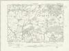
Kent XL.SE - OS Six-Inch Map
1 : 10560 Topographic maps Ordnance Survey Ordnance Survey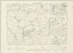
Kent XL.SE - OS Six-Inch Map
1 : 10560 Topographic maps Ordnance Survey Ordnance Survey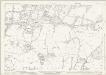
Kent XL.11 (includes: Seal; Shipbourne) - 25 Inch Map
1 : 2500 Topographic maps Ordnance Survey Ordnance Survey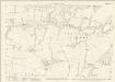
Kent XL.11 (includes: Seal; Shipbourne) - 25 Inch Map
1 : 2500 Topographic maps Ordnance Survey Ordnance Survey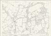
Kent XL.15 (includes: Hildenborough; Seal; Shipbourne) - 25 Inch Map
1 : 2500 Topographic maps Ordnance Survey Ordnance Survey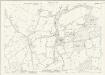
Kent XL.15 (includes: Hildenborough; Seal; Shipbourne) - 25 Inch Map
1 : 2500 Topographic maps Ordnance Survey Ordnance Survey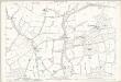
Kent XL.15 (includes: Hildenborough; Seal; Shipbourne) - 25 Inch Map
1 : 2500 Topographic maps Ordnance Survey Ordnance Survey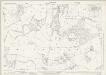
Kent XL.12 (includes: Ightham; Plaxtol; Shipbourne) - 25 Inch Map
1 : 2500 Topographic maps Ordnance Survey Ordnance Survey
Kent XL.12 (includes: Ightham; Plaxtol; Shipbourne) - 25 Inch Map
1 : 2500 Topographic maps Ordnance Survey Ordnance Survey
Kent XL.12 (includes: Ightham; Plaxtol; Shipbourne) - 25 Inch Map
1 : 2500 Topographic maps Ordnance Survey Ordnance Survey
Kent XL.16 (includes: Hadlow; Hildenborough; Shipbourne) - 25 Inch Map
1 : 2500 Topographic maps Ordnance Survey Ordnance Survey
Kent XL.16 (includes: Hadlow; Hildenborough; Shipbourne) - 25 Inch Map
1 : 2500 Topographic maps Ordnance Survey Ordnance Survey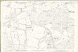
Kent XL.16 (includes: Hadlow; Hildenborough; Shipbourne) - 25 Inch Map
1 : 2500 Topographic maps Ordnance Survey Ordnance Survey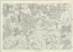
Kent XL - OS Six-Inch Map
1 : 10560 Topographic maps Ordnance Survey Ordnance Survey
Tonbridge (Kent)(002OSD000000005U00354000)
1 : 21120 Drawing showing the area around Tonbridge in Kent. The lack of hill sketching on this drawing suggests an intermediate rather than a finished plan. Field boundaries, woodland and buildings are intricately presented. Individual trees are meticulously drawn along the avenue in Knowle Park. Measurements in ink are given in the bottom left of this drawing. A triangulation diagram appears on the reverse of the manuscript. This was used by the draughtsman to plot topographical features.
Tonbridge (Kent)(002OSD000000005U00352000)
1 : 21120 Drawing showing the area around Tonbridge in Kent. Annotations in ink confirm these drawings as being field sketches. The loose nature of the hill sketching contrasts with that of later, finished drawings. A cross marked Bluborough indicates an observation station from which angular measurements were taken during the surveying.
TQ55 - OS 1:25,000 Provisional Series Map
1 : 25000 Topographic maps Ordnance Survey Ordnance Survey
Knole Park ,amp; Whitely Row, near Sevenoaks, Kent
1 : 21120 Two drawings of areas near Sevenoaks in Kent. The top drawing shows the area around Knole Park, to the southeast of Sevenoaks. Although this field sketch appears loosely drawn, closer inspection reveals it to be meticulously observed. Individual trees with tiny shadows are depicted in Knole Park. The drawing underneath is of the area around Whitley Row, which is slightly southwest of Sevenoaks.
A topographical-map, of the county of Kent, 12
1 Blatt : 54 x 71 cm A. Dury, W. Herbert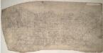
Sevenoaks (Kent) 16
This drawing records the field boundaries and woodland surrounding the towns of Sevenoaks and Kingsdown in Kent. Cultivated land is indicated by a striped pattern, purposely aping the furrows of actual tilled land. Precise instructions for the arrangement of these lines were given in the military manuals. For example, adjacent fields could not have stripes running in the same direction. An 'Old Roman Camp' is recorded on Ightham Common. Pink, George
Sevenoaks (Hills) - OS One-Inch Revised New Series
1 : 63360 Topographic maps Ordnance Survey Ordnance Survey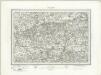
Sevenoaks (Outline) - OS One-Inch Revised New Series
1 : 63360 Topographic maps Ordnance Survey Ordnance Survey
A sketch of the roads within fourteen miles of Tunbridge Wells
1 : 100000 Brackett, William Clifford, J J. Clifford
[Kaart], uit: S.E. London & Sevenoaks
1 : 64000 titelvariant: Ordnance Survey contoured road map of S.E. London and Sevenoaks; Annotatie: Omslagtitel: Ordnance Survey contoured road map of S.E. London and Sevenoaks Ordnance Survey Southampton : The Director General, at the Ordnance Survey Office
London SE - OS One-Inch Map
1 : 63360 Topographic maps Ordnance Survey Ordnance Survey
A NEW and CORRECT MAP of the COUNTRIES TWENTY MILES Round LONDON.
In the second half of the18th century, the introduction of turnpike roads and the increased coach-traffic in and out of London contributed to the popularity of the maps of the countryside around the capital. This map was published in Henry Chamberlain's 1770 'A New and Compleat History and Survey of the Cities of London and Westminster.' The map's title features along the top, with a scale bar and explanatory note below the plan, and border divided in degrees of latitude and longitude. Churches, hills and other architectural or geographical landmarks are indicated by symbols. Market towns are marked by stars. Bowen, Thomas