Maps of East Malling and Larkfield
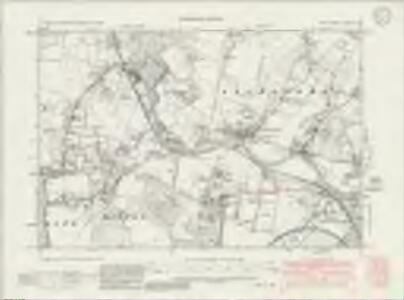
Kent XXXI.SW - OS Six-Inch Map
1 : 10560 Topographic maps Ordnance Survey Ordnance Survey
Kent XXXI.SW - OS Six-Inch Map
1 : 10560 Topographic maps Ordnance Survey Ordnance Survey
Kent XXXI.SW - OS Six-Inch Map
1 : 10560 Topographic maps Ordnance Survey Ordnance Survey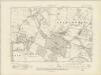
Kent XXXI.SW - OS Six-Inch Map
1 : 10560 Topographic maps Ordnance Survey Ordnance Survey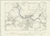
Kent XXXI.SW - OS Six-Inch Map
1 : 10560 Topographic maps Ordnance Survey Ordnance Survey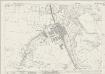
Kent XXXI.9 (includes: Aylesford; Ditton; East Malling and Larkfield) - 25 Inch Map
1 : 2500 Topographic maps Ordnance Survey Ordnance Survey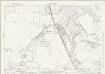
Kent XXXI.9 (includes: Aylesford; Ditton; East Malling and Larkfield) - 25 Inch Map
1 : 2500 Topographic maps Ordnance Survey Ordnance Survey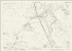
Kent XXXI.9 (includes: Aylesford; Ditton; East Malling and Larkfield) - 25 Inch Map
1 : 2500 Topographic maps Ordnance Survey Ordnance Survey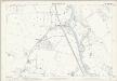
Kent XXXI.9 (includes: Aylesford; Ditton; East Malling and Larkfield) - 25 Inch Map
1 : 2500 Topographic maps Ordnance Survey Ordnance Survey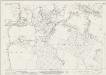
Kent XXXI.13 (includes: Aylesford; Ditton; East Malling and Larkfield) - 25 Inch Map
1 : 2500 Topographic maps Ordnance Survey Ordnance Survey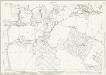
Kent XXXI.13 (includes: Aylesford; Ditton; East Malling and Larkfield) - 25 Inch Map
1 : 2500 Topographic maps Ordnance Survey Ordnance Survey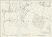
Kent XXXI.13 (includes: Aylesford; Ditton; East Malling and Larkfield) - 25 Inch Map
1 : 2500 Topographic maps Ordnance Survey Ordnance Survey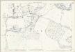
Kent XXXI.13 (includes: Aylesford; Ditton; East Malling and Larkfield) - 25 Inch Map
1 : 2500 Topographic maps Ordnance Survey Ordnance Survey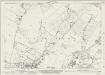
Kent XXXI.10 (includes: Aylesford; Boxley) - 25 Inch Map
1 : 2500 Topographic maps Ordnance Survey Ordnance Survey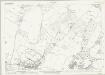
Kent XXXI.10 (includes: Aylesford; Boxley) - 25 Inch Map
1 : 2500 Topographic maps Ordnance Survey Ordnance Survey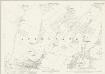
Kent XXXI.10 (includes: Aylesford; Boxley) - 25 Inch Map
1 : 2500 Topographic maps Ordnance Survey Ordnance Survey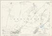
Kent XXXI.10 (includes: Aylesford; Boxley) - 25 Inch Map
1 : 2500 Topographic maps Ordnance Survey Ordnance Survey
Kent XXXI.14 (includes: Aylesford; Boxley; Maidstone) - 25 Inch Map
1 : 2500 Topographic maps Ordnance Survey Ordnance Survey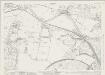
Kent XXXI.14 (includes: Aylesford; Boxley; Maidstone) - 25 Inch Map
1 : 2500 Topographic maps Ordnance Survey Ordnance Survey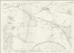
Kent XXXI.14 (includes: Aylesford; Boxley; Maidstone) - 25 Inch Map
1 : 2500 Topographic maps Ordnance Survey Ordnance Survey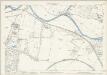
Kent XXXI.14 (includes: Aylesford; Boxley; Maidstone) - 25 Inch Map
1 : 2500 Topographic maps Ordnance Survey Ordnance Survey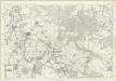
Kent XXXI - OS Six-Inch Map
1 : 10560 Topographic maps Ordnance Survey Ordnance Survey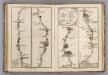
Lewisham to Tunbridge Wells.
1 : 63360 Cary, John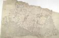
Hadlow, Kent
1 : 31680 This plan of the North Downs in Kent extends from Addington and Ryarsh, on the left, to Barming Heath, on the bottom right. Rays in red ink intersect across the map, evidence of angular measurements taken by the surveyor between fixed triangulation points. The ruled black sheet lines indicate the edges of the area that will be copied for the finished drawing OSD 120. Pink, George
TQ75 - OS 1:25,000 Provisional Series Map
1 : 25000 Topographic maps Ordnance Survey Ordnance Survey
Snodland (Kent)
1 : 10560 Drawing showing the area around Snodland in Kent. This map is drawn on rectangular sheet lines, enclosed by a black border. Fields are coloured brown where cultivated, and green if untilled. Stonework buildings or structures are drawn in red ink. Those made from less permanent materials, such as wood, appear in black or sepia. Corrections have been made on this plan and it is likely that the altitudes ('spot heights') of individual sites of eminence, noted in red-ink figures, are measured rather than merely estimated or sketched.
A topographical-map, of the county of Kent, 7
1 Blatt : 54 x 71 cm A. Dury, W. Herbert
Maidstone (Outline) - OS One-Inch Revised New Series
1 : 63360 Topographic maps Ordnance Survey Ordnance Survey
Maidstone (Hills) - OS One-Inch Revised New Series
1 : 63360 Topographic maps Ordnance Survey Ordnance Survey